Jan 17(Thurs) min max avg
Bitt 2nw valley 22.3 27.5 24.9
Garrett College 23.1 29.3 26.2
Can-Heights 21.0 28.3 24.6
CRN-Canaan
Cabin Mt. x x. x
Cabin Mt north 19.2 26.8 23.0
Spruce Knob 17.4 x x
Snowshoe 17.8 26.2 22.0
Can-Valley Floor 21.2 32.4 26.8
Can-Valley Floor N 22.1 29.7 25.9
7Springs 21.3 25.7 23.5
Cloudy, brief dimmed sun, very brief. First sun in days. Afternoon period of snow. Light SE winds.
Temp profile this afternoon
Radar
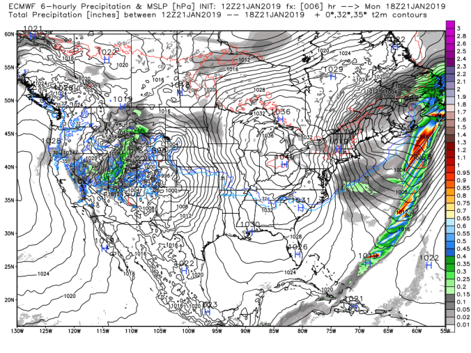
Snowfall- .1 at Bittinger 2nw Valley from 3pm yesterday through the overnight by 8am. 40.0″ on the season This afternoon snow will be included in the morning tally since it began shortly before evening with more to come.
Satellite
Flow
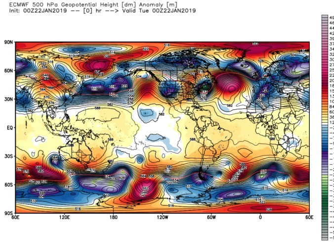
Surface features and 500mb height anomalies and flow
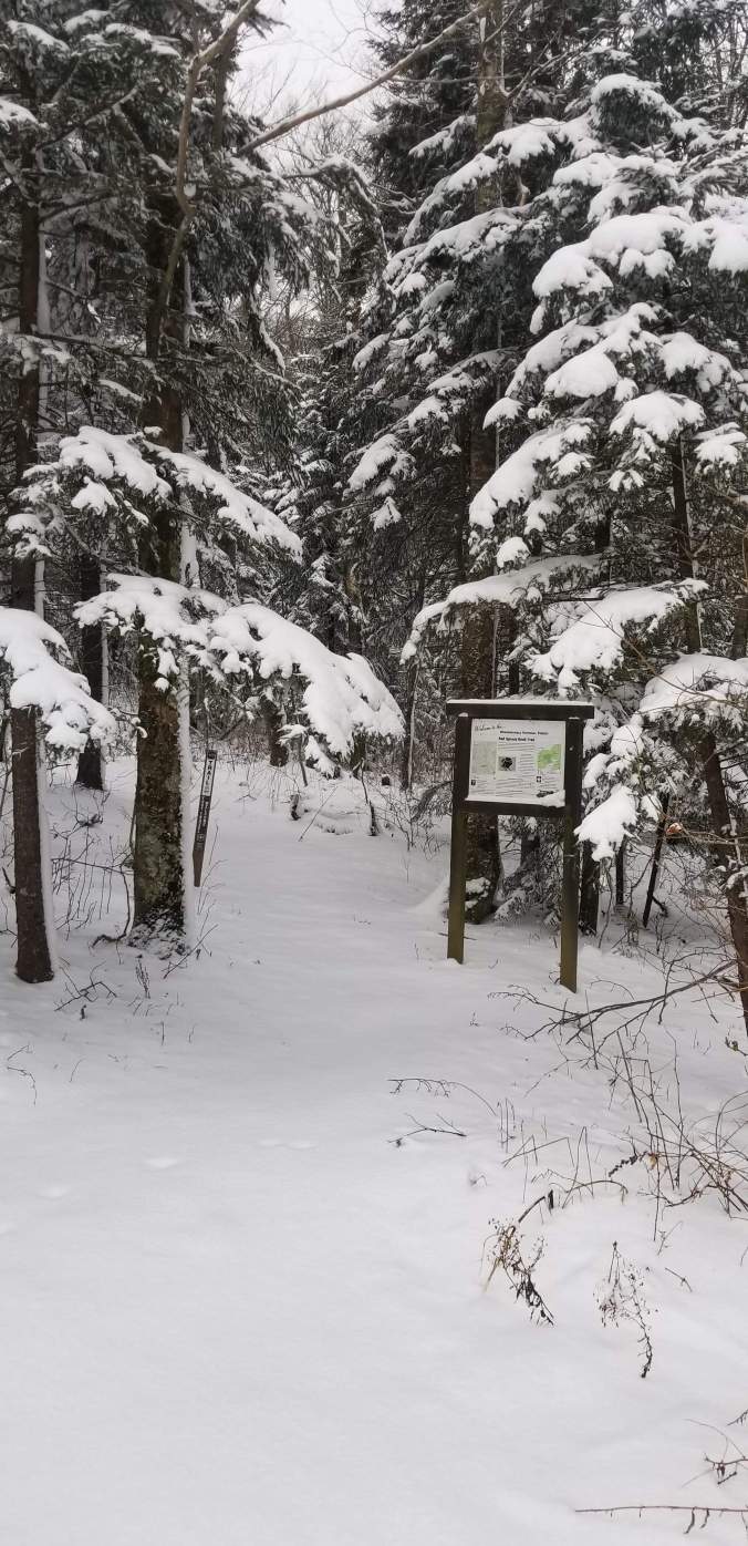
Pics today:
From the gut….
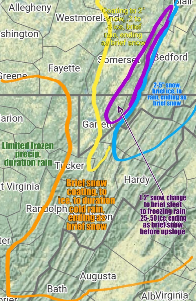
Speaking from the gut:. System moves in Saturday afternoon-Evening…I think the NWS snow map is high. Climatologically speaking, rare that these type of setup produce that much front end snow giving the warmth coming in aloft. Rare….. Do I hope I’m wrong, yes. Gladly would take their snow map….But, speaking from the gut, and it is still early, tweaks may be made, and may not. These systems often have boundaries that are so repetitive over and over. So, this may hold unless we get a big track shift south.— Snow lovers be praying. “As you may me down to sleep, when I awake please make the snow deep, amen.”
Right now, warm zone, west of the orange line. Primarily rain.
Orange zone, brief wintry precip at the onset .2-6 hours worth before plain cold miserable rain. That changes back to snow Sunday. Light accumulations. Coatings to 2″.
Yellow Zone- Brief quick snow thump, brief sleet, and a quick change then to freezing rain. Higher elevations in this zone .2-.4″ ice. Temps may creep above freezing 33-36° range before the rapid rumble Sunday. That’s a blessing if it occurs. As winds increase Sunday and Monday and if the ice remains on the trees, power issues possible. Rapid temp drop Sunday, coating to 2″ more.
Purple zone- Brief quick thump of snow, to sleet, to freezing rain. This is an area that stands a chance that it never goes +32°. Meadow Mt to Savage Mt. Elevation in this setup helps in this location helps, not hinders. Rapid temp drop Sunday and ends as brief snow coating to 2″ more.
Blue zone, Cold air at all level for longer here. Snow, a quick 2-5″ thump, brief icing, to some plain rain, I don’t think the cold stays locked in the low valleys with the Low location on this, then rapid temp drop Sunday, little if any accumulation.
Sunday night- Upslope zones. Western Alleghenies. Some upslope should form, a very high ratio, windblown snow. Maybe 30-50 to 1 ratios as temps fall -5 to +5. Maybe 1-3″/2-4″ of fluff in these areas and speaking of this seperate from the main storm. This 1-3″/2-4″ is not included in anything mentioned above. Temps from +5 to -10 Monday a.m. Coldest above 4000′ in Wv. Windchills -10 to -25 for most, -30 to -40 windchills above exposed 4000′ areas in Wv.
Be prepared….take steps to minimize issues that may occur with loss of electric, frozen water lines , etc.
Long range, the Euro weeklies are looking about as good as they can look… Really expect last several days of Jan, early Feb to go to the extreme in terms of cold and storm track is always a question.