Dec 11, 1992

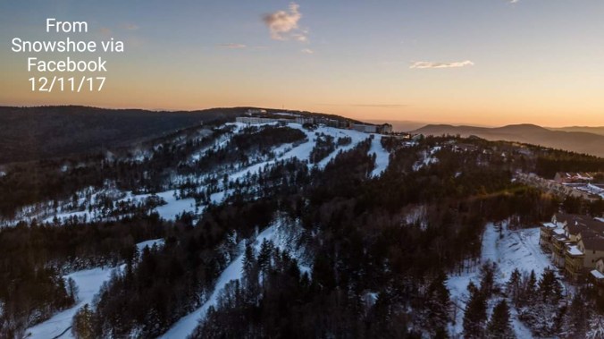
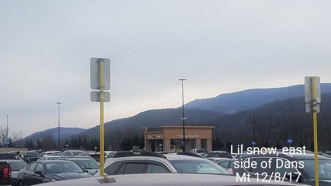
December 11, 12 1992. (pics a few days after)

Large Nor’Easter up the coast, dumping lots of snow from the northern Alleghenies. into the New England mountains.

This storm was my first real big snow that I can recall by date. While I remember others, I do not remember details like with this one. From the day before, day of and days after. From Willard Scott mentioning Garrett County on the brief weather segment of snow in the mts,  to wading through the deep snow…

https://wikivisually.com/wiki/December_1992_nor%27easter

https://en.m.wikipedia.org/wiki/December_1992_nor%27easter

2017-12-11-19-42-52

December 11.         min.        max.      avg

Bitt 2NW valley    25.8        35.5      30.6

Garrett College    26         37.9        32

Can-Heights       22         37.4          29.7

CRN-Canaan     23.9        32.7        30.8

Cabin Mt           19.6        35.6        27.5

Cabin Mt north 20.5      35.6        28

Spruce Knob     17.6       34.7       26.2

Snowshoe/S.C   19.8        37.4      28.5

Can-Valley Floor

Cresaptown      30.4         49.8     40.1

Green Bank Obs 25.4       41.2     33.2

7Springs           26.5         35.4      31

Clouds giving way to sun. Light Sw breezes. A ho hum day before some big changes.

hires_wchill_wv_55.png

6z 3km nam putting out for windchills Wednesday a.m. ecmwf_tsnow_KU_washdc_41.png

This for fun… 12zecmwf snowfall amounts next 10 days.


December 10     min          max.        avg

Bitt 2NW valley 21.7        27.5        24.6

Garrett College 21.6         27.7        24.7

Can-Heights     16.7          24.4        20.5

CRN-Canaan    17.7          27.0       22.3

Cabin Mt           14           21.6        17.8

Cabin Mt north 15.1       22.8       19

Spruce Knob     12.4       21.4       16.9

Snowshoe/S.C   13.3       23.5       18.4

Can-Valley Floor

Cresaptown     29.7       38.7        34.2

Green Bank Obs 21.6    32.7       27

7Springs            23.1      28.1       25.6

Cloudy, snowshowers about through the a.m. Lingering early afternoon north before some clearing. Rime across Wv high ground.

Max temps after dark across Wv high ground.

Snowfall with this event and season:

Bitt 2NW valley .5 —  6.5″ on the season

Can-Heights      1.2 —-  12.6″ on the season

Snowshoe         2.0- —-  8″ on the season

Terra Alta           .4 —–  12.1″ on the season

7Springs             2.0″* —-  7″ on the season


December 9.            min.          max.     avg

Bitt 2NW valley    20.2          30.6      25.4

Garrett College    21.3          30.7       26

Can-Heights         18            26.4       22.2

CRN-Canaan       19.2         28.0       23.6

Cabin Mt             15.1         23.7       19.3

Cabin Mt north 16.2        25.5        20.7

Spruce Knob     14.5        24.1        19.3

Snowshoe/S.C  15.3         25.5        20.2

Can-Valley Floor

Cresaptown    25.9        38.9         32.4

Green Bank Obs 24.1   31.6        27.9

7Springs       21.3          32.3        26.8


Overcast, some light morning snow back to the high WV ground. Very dry air limiting it.. Radar was mainly virga in northern areas. Nothing in Garrett


Snow from the south yesterday and into this a.m… Highest amounts well over a foot in GA, N.C… will post.. Todays main accumulating snow remained east.

2017-12-08-17-36-16

December 8.        min.         max.        avg

Bitt 2NW valley   18.6        25.4        22

Garrett College     18.4       23.8       21.1

Can-Heights        16.7        22.9      19.8

CRN-Canaan       18.1        23.8       21.0

Cabin Mt.           14.2        20.5       17.4

Cabin Mt north 14.9       21.7       18.2

Spruce Knob    14.4        21.6        18

Snowshoe/S.C   15.6       21.9        18.8

Can-Valley Floor

Cresaptown      29.9       38.9        34.4

Green Bank Obs 22.8     29.7        26.2

7Springs           19.5        24.9       22.2

Overall overcast, cloudy, breezy, cold..sums up the day..some dim sun.

Bigger story on the day would be the southern snow. 4-8″ of snow in many areas across the south.

December 7.        min.        max.        avg

Bitt 2NW valley  21.6        35.2*     28.4

Garrett College 21.9          32.9       27.3

Can-Heights      19.8         29.6       24.7

CRN-Canaan     21.8         30.4       26.1

Cabin Mt         17.2         25.5        21.4

Cabin Mt north 18.3      26.6       22.5

Spruce Knob   16.5       28        22.2

Snowshoe/S.C  18.9     26.2      22.5

Can-Valley Floor.

Cresaptown     30.4      48.6     39.2

Green Bank Obs 27.7   38.8    33.2

7Springs         22.7       34.4      28.5

Mix of clouds and sun to start…giving way to widely scattered snowshowers that increased in the afternoon in pockets. It was enough to create ice covered roadways after nightfall.

Winds also up through the day


December 6.          min.      max.       avg

Bitt 2NW valley   23.5      34.1       28.8

Garrett College   23.8       33.3      28.5

Can-Heights       19.3       28.8      24

CRN-Canaan      21.3       29.6     25.4

Cabin Mt          16.2       27         21.6

Cabin Mt north 17.8     26.1     22

Spruce Knob     15.4     29.8     22.6

Snowshoe/S.C    17.2     30.6     23.9

Can-Valley Floor

Cresaptown     28.4      47       37.6

Green Bank Obs 26.2    40.3     33.2

7Springs       25.7        36.7       31.2

precip clearing out pre midnight, reports of  flakes mixed in. Cold air rushing in around midnight. Bitt 2NW valley did not fall below freezing until 12:10am and that put yesterdays min at 32.4 which ended the 20 day stretch of mins below freezing.

Windy conditions persisted through today, times of clouds of peaks of sun. More cloudiness south of Garrett. Temps across Wv high ground remained colder. GFS did not do well on afternoon max temps.

December 5.           min.         max.      avg

Bitt 2NW valley   32.4       48.8      40.6

Garrett College   33.2      50.6       41.9

Can-Heights       30.2       50         40.1

CRN-Canaan     30.0        49.3      39.6

Cabin Mt          28.2        47.3      37.8

Cabin Mt north 28.9     47.5       38.2

Spruce Knob     30.2      45.5      37.8

Snowshoe/S.C   30.4      46        38.2

Can-Valley Floor

Cresaptown      36.3     51.8       44

Green Bank Obs 32.6   50.4     41.5

7Springs        31.3        50.6       40.9

Mainly cloudy day with rain at varying rates a good portion of the day.


December 4.         min.      max.      avg

Bitt 2NW valley  21.1        48.0        34.5

Garrett College    24.7      53.8         39.2

Can-Heights        27          52.8         39.9

CRN-Canaan      24.3        54.1         39.2

Cabin Mt           32.9         50.9        41.9

Cabin Mt north 34          50.9        42.5

Spruce Knob    33.3        46           39.7

Snowshoe/S.C  33.3       42.4         37.8

Can-Valley Floor 11.9

Cresaptown      27.3       55.4        41.3

Green Bank Obs 18.5     51.1       34.8

7Springs           33.6        52.6        43


Clear overnight, light SE breezes up high, calm valleys. A large temp variation. Pics added of that. Mix of clouds and sun with clouds increasing at nightfall. SE breezes dominated the daylight hours and created a temp setup that is typical of the situation and one the 3km nam excels at.

December 3.          min.       max.       avg

Bitt 2NW valley   22.5        45.7        34.1

Garrett College   26.7        48.1        37.4

Can-Heights        27.7        43.5       35.6

CRN-Canaan     26.8         45.8       36.3

Cabin Mt           29.8          42.4      36.1

Cabin Mt north 33.4        41.4       37.3

Spruce Knob     30          42.8       36.4

Snowshoe/S.C   32.7       42.4       37.6

Can-Valley Floor 14.1   47.9       31

Cresaptown       29.7     60.8       44.9

Green Bank Obs 21.9   55          38.5

7Springs            33.5      47.1      40.2

Pretty well a clear start to clear finish. A period of cloud cover and widely scattered light shower occured last night. Temps in the valleys spiked up, then fell again at daybreak.

Supermoon…nice viewing for that. 3rd image is edited, by combining 2 pics.