Euro weeklies are in and they are looking cold. Beginning mid to late next week, we begin our progression into a winter pattern. While these 7 day intervals are all locked into cold, I expect 1-2 day hiccups at random with milder shots in a overall cold pattern. Those run into January
CFSV2, mid to late next week into January. Its looking very similiar to the Euro weeklies in the overall setup.
0z Euro ensembles off todays run. Afternoon to Afternoon mid next week on.. Next week likely the step 1 in a 2-3 step to some very cold weather.
Ensemble means off the Canadian. Very much in line with other modeling..
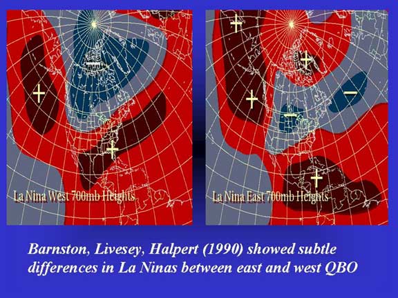
6z GFS ensembles…much in line with other modeling. I think the gfs is most interesting of the bunch in terms of snow potential. Its more classic east based La Nina, negative qbo look. Hints of a SE ridge thats much further south than what exist with a west based La Nina and west QBO…like last year, not to mention, cooler water vs last year off SE coast.

Very much what modeling is going to.
Teleconnections off the Euro ensembles. NAO weakens, as its doing so I think thats one shot at a coastal storm and likely a coastal storm thats moving along at a good clip. Entirely way too early to go into any type of detail in any way shape or form. The biggest teleconnection factor in my opinion near term will be the + PNA, -EPO, -WPO…a product of the Pacific SST. . Cool pool east of dateline, 30-40N, and warmth along west coast. This evolved within the past month to a more favorable look. The pattern becomes more amplified. With a negative QBO, which tends to favor a -AO, it sort of goes hand in hand. SE ridge much further SE, we have no SW flow aloft, and the cold can come, and hold, unlike last winter of quick hits and retreats..
My least favorite aspect of the models is snowfall….Why? Simply because the models will not hit where a low pressure is going a week to 14 days out.
Having said that, it does give looks of potential, and what makes the most sense in the overall setup.
For what this aspect is worth, in the next 10-20 days. I think the pattern favors 2 events riding up the coast. First one is a wave that forms on the cold front mid next week. Overall I think its rapid through and not much of a snowmaker when the cold comes. Like always, needs watched. Only opinion on what fits the current look that can change. I think the pattern favors some diving clippers, with situations where we are very cold and temps jump to the 30s as the low is coming into the Ohio valley, and snow breaks out and a sharp drop occurs. These setups usually have good ratio snows and windy conditions that follow. The overall setup is not unlike the cold of 13/14, 14/15. I currently do not think it goes to those levels yet.
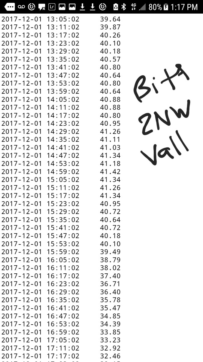
A look at the Euro products for Garrett County area, and Elkins.. This will adjust, and in time with a snowcover present, I do think below 0 valley nights will occur in this pattern. At times high ground struggles 10-15 for max temps, -5 to 0 for lows. I think in the next 10-20 days once the cold comes those will be occurences we see. With hiccups. Should a storm cut west, that can always usher in a day or so warmup in a cold pattern. That is something to watch, but overall it appears the cold pattern is dominant when it comes and quite contrary to last winter where 2 cold days were followed with 5 mild, we may reverse that and then some…stay tuned…


