


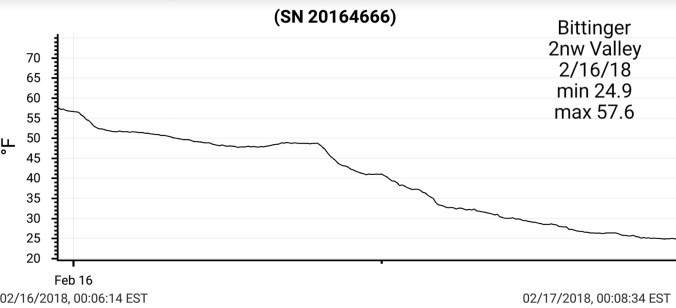
Feb 16. min. max. avg
Bitt 2NW valley 24.9 57.6 41.2
Garrett College 24.6 57.6 41.1
Can-Heights 22.7 57.8 40.2
CRN-Canaan 24.8 60.0 42.4
Cabin Mt 20.8 55.0 37.9
Cabin Mt north 21.2 56.5 38.8
Spruce Knob 22.6 53.8 38.2
Snowshoe/S.C 24.4 54.7 39.5
Can-Valley Floor
Cresaptown 33.8 65.9 49.8
Green Bank Obs 32.4 64.7 48.5
7Springs 23.7 57.9 40.8
A LOT to go over for today. From heavy rain, to a afternoon change to snow, fog, falling temps. Rainfall amounts in the 1-3″ range with the system across the area, isolated higher amounts. Over 4″ around Terra Alta. Rain began to taper, mix with snow midday and changeover early afternoon.
Bitt 2NW valley snowfall – .1″ on the day, partially melted. 83.5″ on the season
Canaaan Heights .8″ with 97.0″ on the season
Will do this a little different today. Starting off with National temp profile last night through 5pm. Cabin Mt 4350 and will add Bittinger 2nw Valley later.


Bittinger 2nw Valley at near 2″ of rain(pulled it before froze) 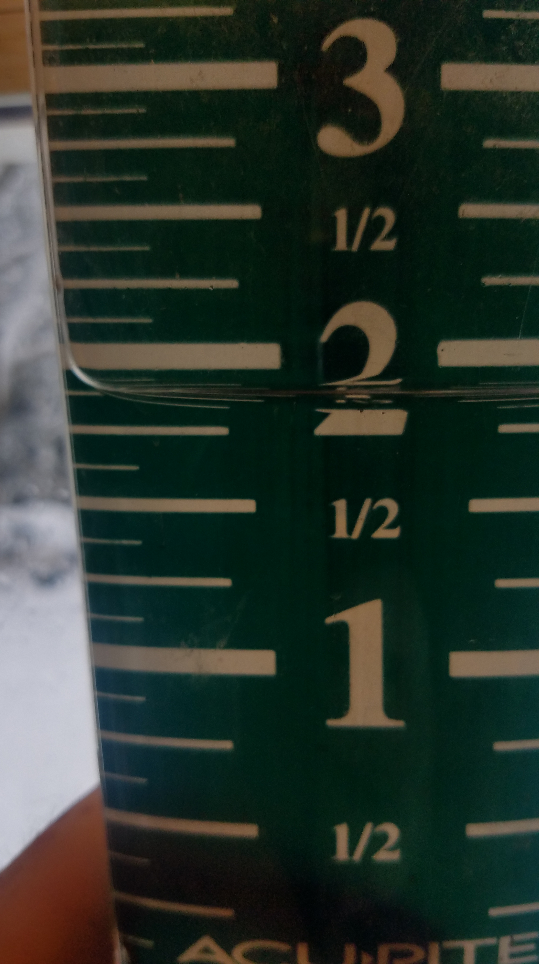
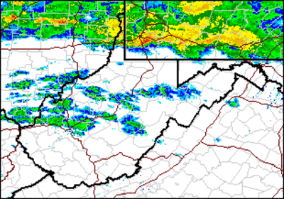
Radar loop
Pics by Jeremy Brenneman, Cassleman Valley south of Grantsville and Mosser Rd east of Mchenry. Water was still on the rise at the time of the pics and Md 495 was closed shortly after


Pics by Erik Peterson in Oakland today


Pic by Garrett County Public Safety 
Garrett County “The Republican” story


Some water data, that I may update again further below


Pics today at resorts, webcams, Snowshoe, Canaan, North Fork Mt, Deep Creek, Keysers Ridge


Pic below by Bill Buckel, at Bittinger 2nw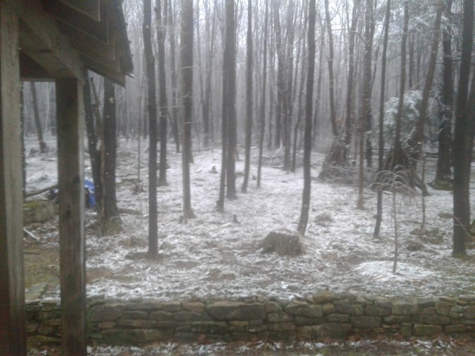
Pic below by Renee Morris this afternoon at Timberline at Canaan
Social media pic at Davis
Snowshoes changeover
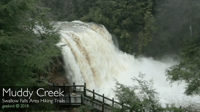
Muddy Creek Falls, posted by Swallow Falls area hiking Facebook page
Ohiopyle today, maxed out at 26500cfs
Radar images of the system


Storm was confirmed a ef-1 in Uniontown last night by the NWS, pics by Sam Hall WTAE


