


Feb 19. min. max. avg
Bitt 2NW valley 24.9 46.2 35.5
Garrett College 32.9 60.6 46.8
Can-Heights 33.7 60.3 47.0
CRN-Canaan 35.9 60.2 48.1
Cabin Mt 33.6 55.8 44.7
Cabin Mt north 30.9 59.5 45.2
Spruce Knob 29.8 51.3 40.5
Snowshoe/S.C 30.7 52.2 41.5
Can-Valley Floor
Cresaptown 28.4 57.2 42.7
Green Bank Obs 26.1 52.8. 39.5
7Springs 31.0 61.2 46.1
Cloudy start, some fog, drizzle, patches of freezing in valleys..sky cover improved today..A huge difference in temps due to snow cover, light winds. Sheltered valleys refridgerated.
One ex at 6pm
I will be blogging in much more detail later about the time and temp differences from today.
And now is later… Bittinger 2nw Valley vs Garrett College. Also added one image of “Greenscapes” in Mchenry by the police barracks.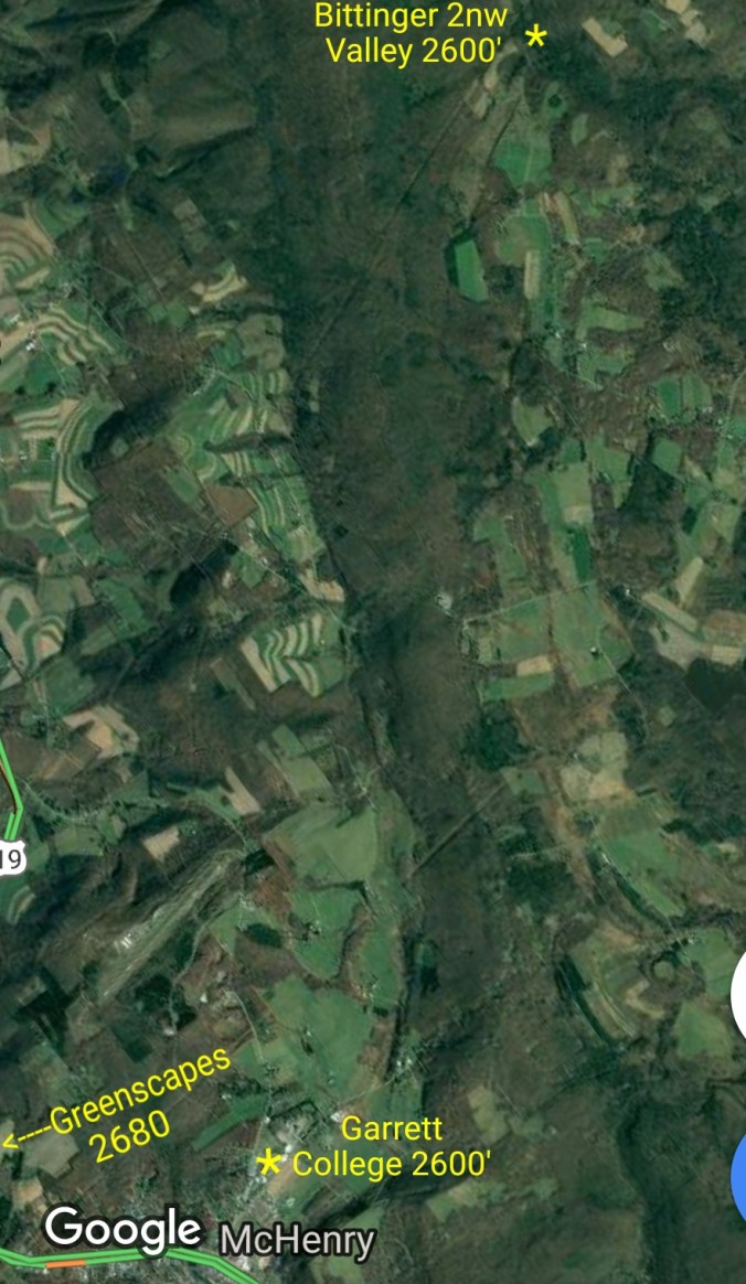


 Bittinger 2nw Valley experimental spot
Other pics on the day


Temps at Cabin Mt, (will add Bittinger 2nw Valley) and National temp profile this afternoon, and in closer view. This will not pick up on the valley/high ground difference.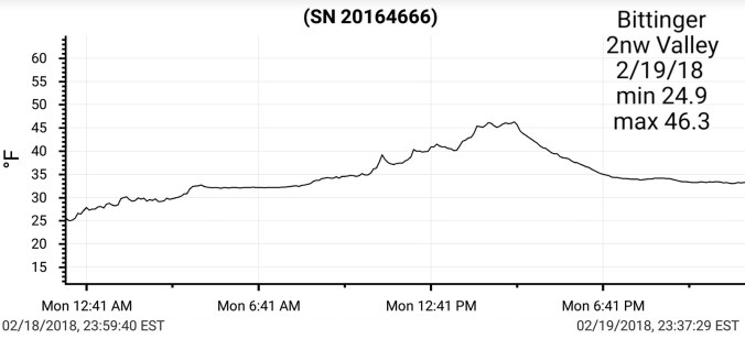


The Big Picture… Our current mild overall pattern shows signs of a breakdown late month, and more so take affect into March. There is some contradictory factors. The cooling off the west coast may help a negative PNA hold and prevent the severe cold from returning this wintet, but allow a pattern to go back into a consistent cold period week 1-3 in March. Lots of details to be worked out and will reveal themselves in time. As of now, plenty of hope for a wintry stretch yet.


