


Feb 23. min. max. avg
Bitt 2NW valley 34.1 57.2 45.6
Garrett College 34.3 61.4 47.8
Can-Heights. 47.6 63.1 55.3
CRN-Canaan 42.3 63.8 53.1
Cabin Mt 50.0 59.4 54.7
Cabin Mt north 43.9 60.8 52.3
Spruce Knob 48.9 57.2 53.1
Snowshoe/S.C. 51.3 60.8 56.0
Can-Valley Floor
Cresaptown 41.0 48.6 44.8
Green Bank Obs 46.9 68.3 57.6
7Springs 35.7 61.1 48.4
Major temp gradient through the morning/midday hours, then the mild intrusion made it across the cool areas except eastern Garrett and valleys east of Garrett. Early morning some spotty light freezing in trees across the highest, east facing slopes. Minimal but impressve with the warmth nearby. Dense fog and showers in the morning. To mainly cloudy and few shower afternoon.
Temps today at Bittinger 2nw Valley, Cabin Mt 4350 and national profile midday and later. To note my(Bittinger 2nw Valley) 7am to 7am reading as most co-ops go by, remained in the 30s. I record here midnight to midnight for the date.


Data today from Mt. Storm, Bittinger 2nw Valley, Piney Run -Finzel, Canaan Heights. Will add Savage Mt data later on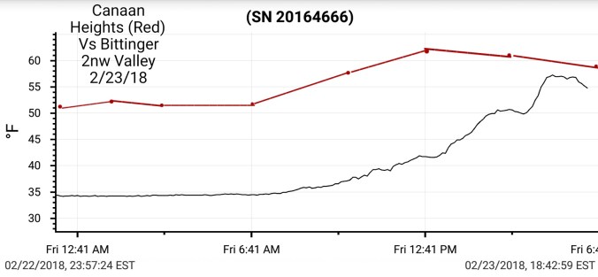


Few snippets


The month to date


3km nam run at 12z, nailing todays temp progression and look ahead at weekend temps. A mini version of the gradient that just occured.


Modeled weekend precip


Big Picture at 500mb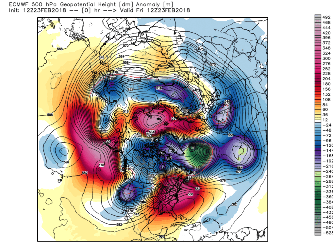
Long range with a return of winter March 4th +/- with a potential event before that. But sustainable looks to be the 4th +/-. Snaps from Euro Ensembles at 12z and a view of GEFS next 16 days.


Signals leading to that. Teleconnections-correlation, MJO- correlation, SST


Interesting read by Roy Spencer
