


Feb 26. min. max. avg
Bitt 2NW valley 23.9 44.1 34.0
Garrett College 30.5 45.1 37.8
Can-Heights 25.4 39.9 32.7
CRN-Canaan 31.2 41.5 36.4
Cabin Mt 28.2 39.4 33.8
Cabin Mt north 29.7 38.8 34.2
Spruce Knob 26.6 36.9 31.8
Snowshoe/S.C 29.7 37.4 33.5
Can-Valley Floor
Cresaptown 29.3 57.4 43.2
Green Bank Obs 23.3 47.6 35.4
7Springs 34.3 45.2 39.7
Overcast morning. Much cooler drier air. Flakes were seen midday on Snowshoe cam. I’d suspect a little rime, possibly flakes to the Roaring Plains area…Skies cleared north to south, as you’ll see below in todays satellite view.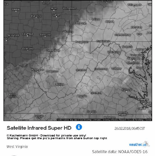
Temps today at Bittinger 2nw Valley and Cabin Mt. (through early evening) Also National temp profile this afternoon…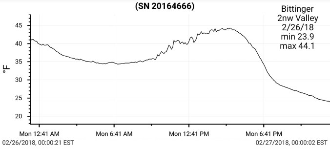


Skunk Cabbage….yes, still talking weather, kind of. This time of year, people often talk of, or post pictures of a plant popping up in wet areas. Some years through the snow (not this year) and always seem amazed. In which they should be. Skunk Cabbage is a thermogenic plant, with an ability to makes its own heat. It can and does melt its way through snow if need be. ” From Wiki below” and also Google thermogenic plants to learn much more and also some remains unknown.
“Thermogenic plants have the ability to raise their temperature above that of the surrounding air. Heat is generated in the mitochondria, as a secondary process of cellular respiration called thermogenesis. Alternative oxidase and uncoupling proteins similar to those found in mammals enable the process, which is still poorly understood”


Outlook for late week…rain Thursday, rain to snow into Friday. Timing, speed, track of initial low, and formation of coastal low and proximity to the coast and how quickly it escapes will be key. As mentioned yesterday, blocking is not in a ideal position for this storm to linger excessively long. However, we should get a nice period of wrap around as it forms and strengtens east. Models still honing in. As of today, this looks like a 3-6″ type snow to me off the models for the Wv mts, 2-4″ Garrett, Preston, Fayette, Somerset, Cambria and that will be tweaked as we go later in the week as models get a better handle. Below is how the 12z ECMWF plays out the scenario.
Snowshoe taking advantage of some temps finally conducive for snowmaking tonight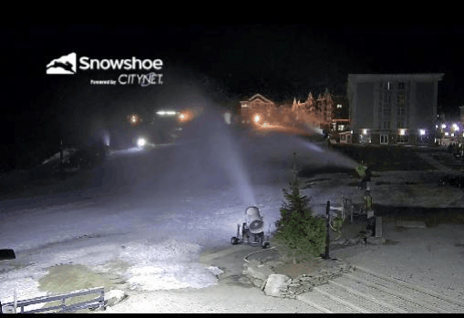
Satellite image off modis earlier today…cloud cover locally at that time, but the ice cover on Erie is still evident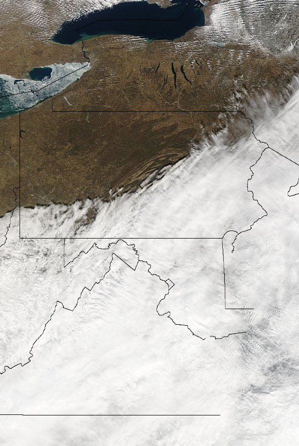
8 years ago we were in the midst of our 3rd major Feb snow. I have a few pics of before the storm I’ll post here. Also will try to hunt up a few and the majority I have of this storm was on a computer that crashed that I never recovered..
Some pics, data, radar of the event. Showing the incredible blocking we had that stalled the storm, giving us continuous wrap around, which was the majority of what we saw from it, with strong winds. The best drifting, deepest depths I have witnessed in my life.


