Feb 8.                      min.        max.      avg

Bitt 2NW valley    12.1       23.0       17.5

Garrett College     12.1       20.9       16.5

Can-Heights          11.5       19.7        15.6

CRN-Canaan         12.2        20.0       16.1

Cabin Mt                8.6          18.5       13.6

Cabin Mt north    9.9            17.6      13.8

Spruce Knob       8.4             18.0      13.2

Snowshoe/S.C     10.2           20.7       15.5

Can-Valley Floor

Cresaptown          20.3          36.7      28.5

Green Bank Obs  15.5          30.8      23.1

7Springs                14.0          21.6      17.8

Light periods of fluff n flurries scattered about throughout today. This also occured last night. Breaks of sun as well today intermixed with the light fluff. Winds 10-15mph.  Plenty of rime today on trees all the way to about 2600′ in Garrett.

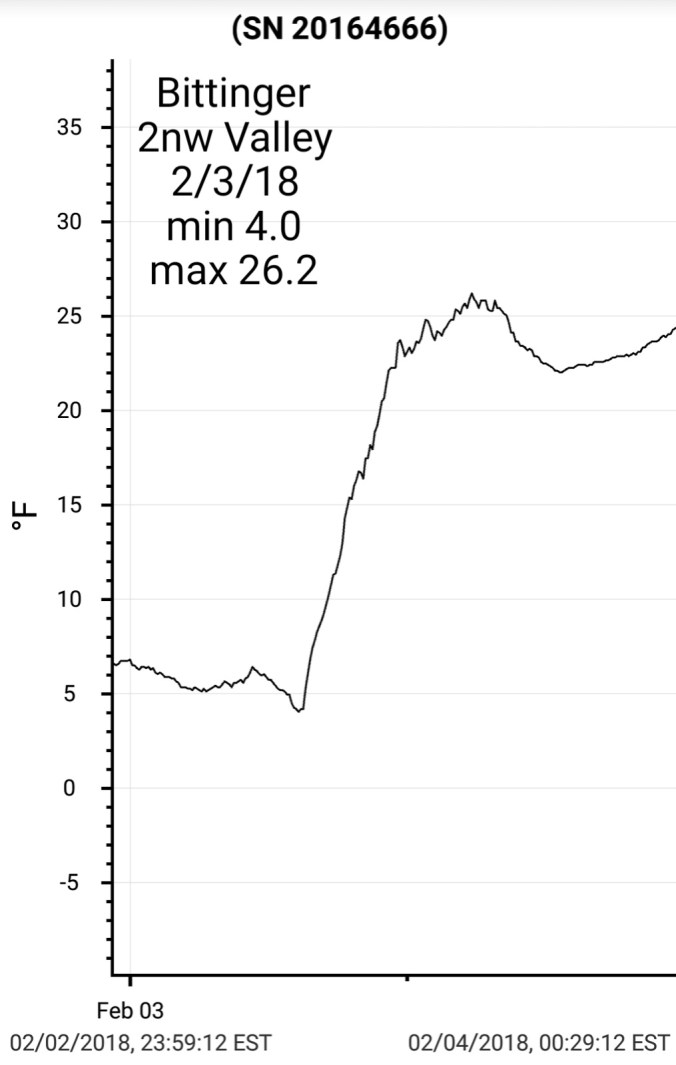
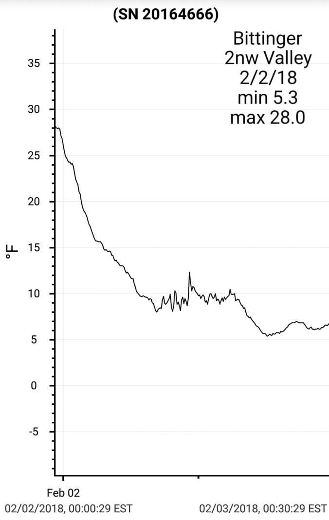
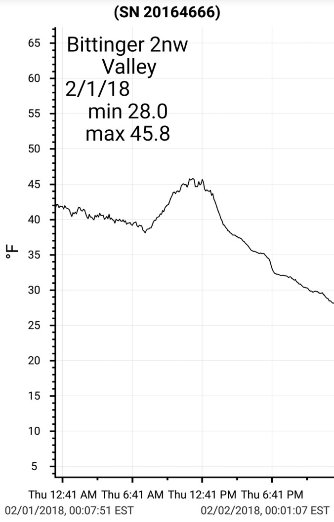
Temps today from Bittinger 2nw Valley and Cabin Mt 4350. Also national temp profile this afternoon2018-02-09-22-02-29

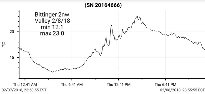
Snowfall today. Bittinger 2nw Valley , picked up .8″ overnight, and .5″ throughout todays very high ratio fluff.  83.1″ on the season


Canaan Heights 1.3″ late yesterday, through the overnight till 7am. .4″ more today. Season Total at 96.1″

Some other area co-ops on the season. I am leaving some off due to the VERY poor measuring practices. Such as 1 obs a day. Such as missing obs. Such as converting everything to 10 to 1 ratios from liquid. Such as measuring only on the inch/ not recording under a inch.

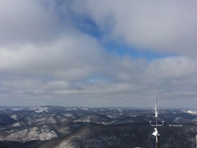
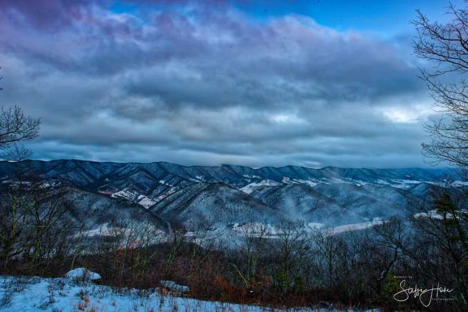
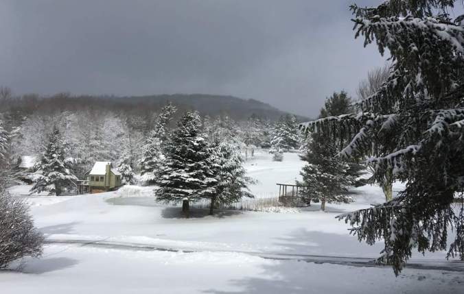
Pic today from Canaan ValleyIMG_20180208_202342_769

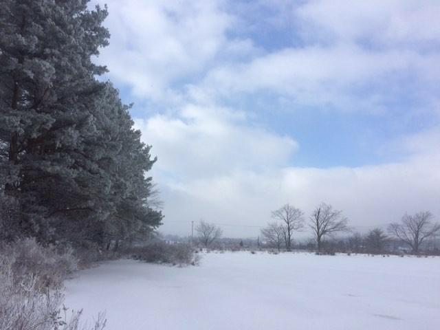
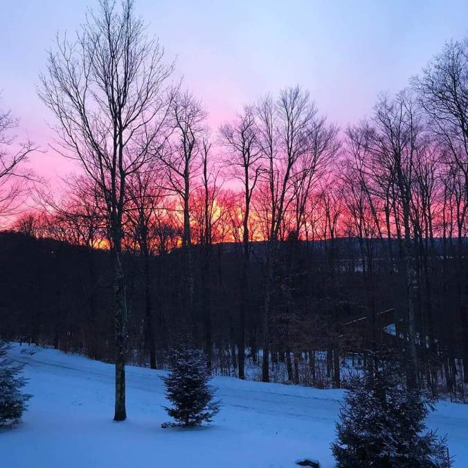
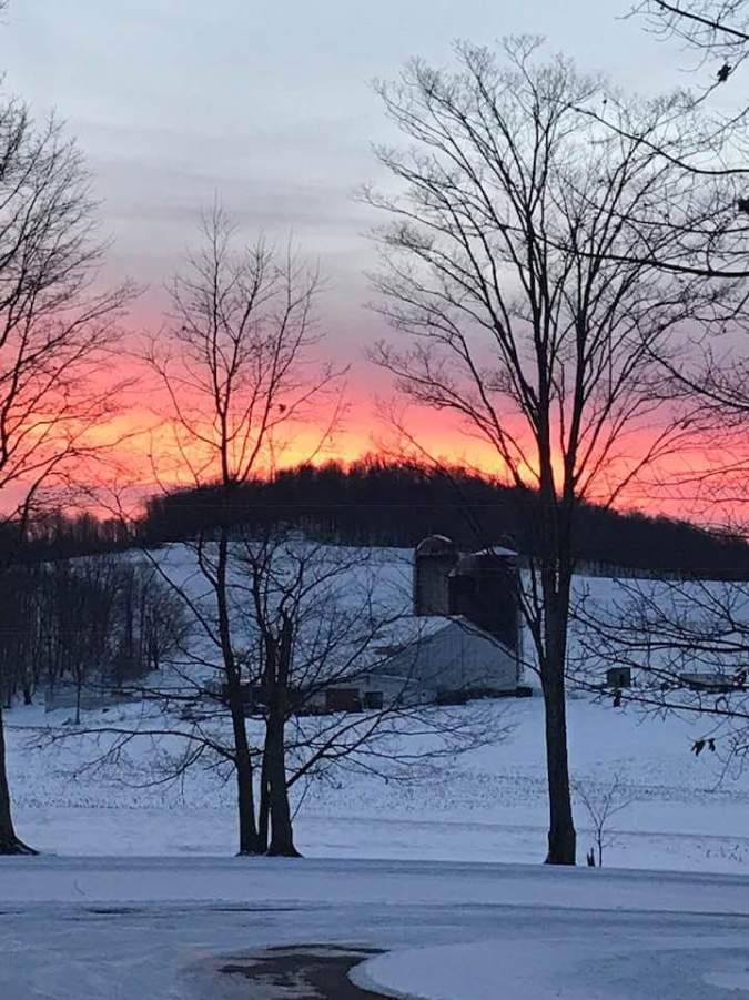
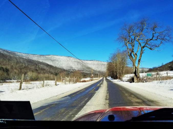
2 pics from Backbone Mt 219 near Tucker High

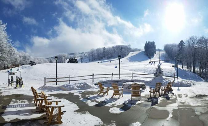
Pic today by Justin Harris at Canaan resort

FB_IMG_1518140302889

Pic off Social Media of Blackwater Falls todayScreenshot_20180208-194831

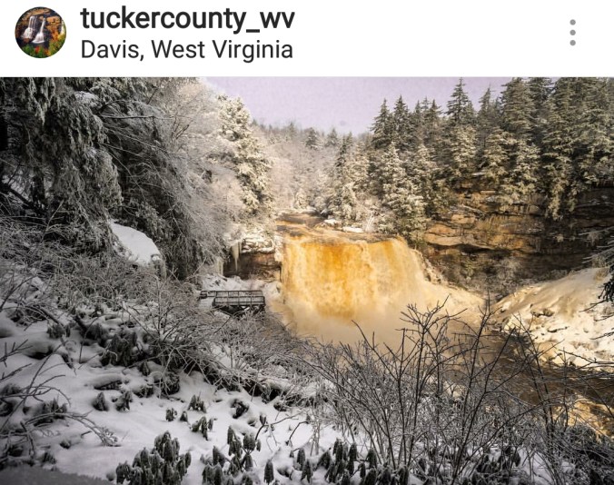
Pics by Justin Harris for Canaan Valley Resort

Pics today from Snowshoe off Instagram

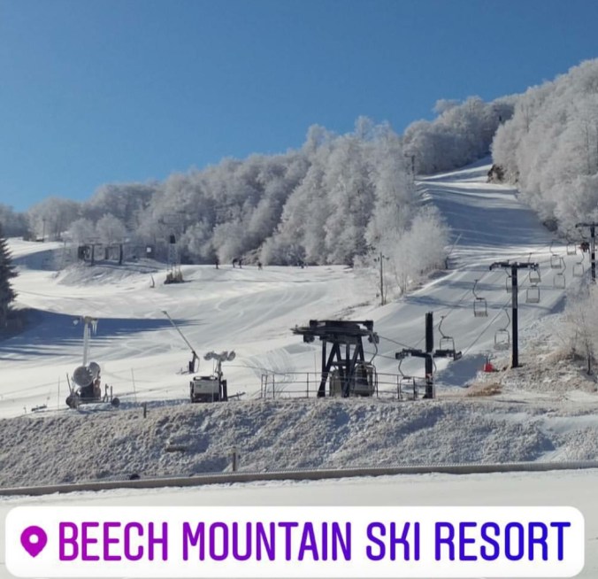
Pic further south from Beech Mt Ski area in N.CScreenshot_20180208-214021


Feb 7.               min.          max.         avg

Bitt 2NW valley  16.7       33.6     25.1

Garrett College 17.0       41.0        29.0

Can-Heights      18.9       40.8         29.8

CRN-Canaan      19.8       40.1        29.9

Cabin Mt            16.2       40.1        28.1

Cabin Mt north 17.4      40.1         28.8

Spruce Knob      14.5      37.0        25.7

Snowshoe/S.C      16.3      38.5      27.4

Can-Valley Floor

Cresaptown          24.5       39.6     32.0

Green Bank Obs.  24.0      38.6     31.3

7Springs                 15.2      37.7     26.4

A WIDE variety of weather today within the region. From rain, freezing rain, sleet, snow. Some areas around Canaan, this was primarily a rain event until the changeover to snow mid afternoon. West side of the mts, primarily rain until mid afternoon changeover. Elsewhere, brief sleet to freezing rain, to rain. Further north, across Garrett and points north east, the wintry aspect held much longer this morning. From southern end of Negro Mt, to southern end of Meadow Mt, along those ridge lines and northeast, cold persisted and thats pretty much the classic setup in this type of event. by late morning to early afternoon these area’s crept above freezing for 2-4 hours. At Bittinger 2nw Valley, the cold layed low as winds with the changing air masses only picked up as the cold was returning. Ice hung on in spots through the window. On top the hill, the breezes with temps mid 30s knocked a fair amount of ice off the trees but not all. The temp variance was significant at times. Will touch on that again inna moment.

First accumulation. Early accumulation.  .6″ snow/sleet(mainly sleet) feeezing rain combo.  Then the rain spell and then .7″ snow through 5:30pm 1.3″ total on the day       81.8″ on the season

ice amounts up to .3″ on branches


Canaan Heights .7″ snow this afternoon.  95.1 on the season

The crazy temps, in which 3km nam does very well at


Temps east to west across Garrett along I-68 was a large contrast through the morning


The area that holds cold the longest in this setup and routinely does the best(or worse) with freezing rain is Big Savage Mt. No different today. Temps held below freezing until the early afternoon.


Look at Bittinger 2nw Valley, Cabin Mt 4350 as well as series of national temps today2018-02-08-15-28-42


Radar images from today as well as a few gauges in the area. Most stations ran .8 to 1.5 liquid today.

Some area creeks and rivers saw a nice rise. Especially the areas that saw less in the way of freezing. A pretty good jump in flow on the Blackwater at Davis.


Screenshot_20180207-210829

Frostburg at 12 noon. Cold air holding. As 3km nam illustrated nicely. 3pm temps up, ice coming off trees. 3km nam shown that nicely as well


Pic from Davis this morning on a wet dreary morningIMG_20180207_204845_591

Feb 6.                   min.             max.       avg

Bitt 2NW valley   12.0          24.5        18.2

Garrett College    15.4          27.3        21.3

Can-Heights          18.2         25.4         21.8

CRN-Canaan         21.0          30.3        25.7

Cabin Mt               20.1           30.7       25.4

Cabin Mt north   19.9            29.8       24.8

Spruce Knob        19.0           30.2       24.6

Snowshoe/S.C        21.4          31.8      26.6

Can-Valley Floor

Cresaptown            18.7         37.6       28.1

Green Bank Obs.    10.2         34.6      22.4

7Springs                    18.5       25.3      21.9

Cloudy, a few widely scattered fine flakes on and off. High elevation fog and rime. This occured in Garrett some above 2700′ and more so in higher Wv ground.

Temps today at Bittinger 2nw Valley, Cabin Mt, and temps nationally this afternoon

Temps to begin February

Pics today at Canaan Heights and Backbone Mt near Tucker High

Pic Below by Vernon Patterson at Canaan, looking towards Timberline Ski Resort . Rimed up trees from the fog. FB_IMG_1517967432448

New cam located on North Fork Mt. This one looking west towards Allegheny Front, at 6pmScreenshot_20180206-180748

8 years ago today we just finished up with the first of 3 major storms in February 2010. 2-3′ fell in hard hit areas with the storm. Below is a link that will take you to the radar archive of the storm. Simply click mid atlantic region and the dates of Feb 5 2010 and Feb 6 2010. Also some graphics of the storm and pics.

http://www2.mmm.ucar.edu/imagearchive/ this is the radar archive

Below is pics from near Bittinger 2nw. Several from Bittinger 2nw Valley 2/6/ 2010

Some graphics- snowfall from the storm, snowfall depth(which includes snow already on ground) satellite view

Radar snippet as the storm pushed in on the 5th

220px-NEXRAD_5_Feb_2010


Feb 5.                 min.          max.        avg

Bitt 2NW valley  12.5        30.3        21.4

Garrett College   12.5        30.1        21.3

Can-Heights         10.6       27.8        19.2

CRN-Canaan         11.5      28.7         20.1

Cabin Mt                7.9       25.5         16.7

Cabin Mt north    8.1       26.4          17.2

Spruce Knob         7.9      25.3          16.6

Snowshoe/S.C       10.2     27.7         18.1

Can-Valley Floor

Cresaptown           23.6      37.8       30.7

Green Bank Obs   12.1      34.2       23.2

7Springs                 13.0     31.4       22.2

Snowshowers overnight, high ratio fluff. This continued across Garrett through late morning. Skies broke and gradually cleared


Snowfall: Bittinger 2nw Valley 2.4″ fluff overnight through 7a.m. Then .6″ fluff from 7am through 10:30am as it wrapped up pretty well.  80.5″ on the season.. Snow depths in open areas 9-11″

Canaan Heights 1.4″ overnight 93.2″ on the season

Past 48 hour snowfall analysisScreenshot_20180205-210410

Temps at Cabin Mt, and nationally this afternoon


Pics below by Todd Romero, first one Cortland Rd in Canaan this morning, then Tucker High School and 2 from Centennial Overlook on Backbone Mt


IMG_20180205_193115_098

Pic below by Renee Morris, sunset at CanaanFB_IMG_1517877445813

Pic below by Renatta Glotfelty south of GrantsvilleFB_IMG_1517874595558

Pics below by Mallory Richards at Canaan Ski area today

Pic below by the Greenbrier Screenshot_20180205-154636


Feb 4.                   min.           max.        avg

Bitt 2NW valley  24.0         33.5        28.7

Garrett College   28.3         35.4        31.9

Can-Heights        24.1         34.0        29.0

CRN-Canaan       23.6         33.0        28.6

Cabin Mt              21.4        32.2        26.8

Cabin Mt north  22.5         32.7        27.6

Spruce Knob       19.6         31.8       25.7

Snowshoe/S.C      19.6        34.0       26.8

Can-Valley Floor

Cresaptown         30.6         38.5       34.5

Green Bank Obs  24.6        35.9       30.2

7Springs                29.7        36.6       33.1

Snow began around daybreak. Snow was moderate to heavy at times, mid morning into the afternoon. Some lower elevations below 2500′ west side of mts changed to rain midday. I briefly went to light drizzle 4pm as main precip pulled away.


Snowfall amounts today. Bittinger 2nw Valley had 2.3″ through 10a.m, and 2.5″ more through 3pm as precip wound down. 4.8″ total through daylight hours.  77.5″ on the season

Canaan Heights- 4.7″ through the day – 91.7″ on the season

http://data.canaanmtnsnow.com

Temps at Bittinger 2nw Valley and nationally today


Pic from Cumberland in the afternoonreceived_10213144182533136

Pic below by Steffi Hone this evening,  overlooking Judy Gap, Germany Valley with North Fork Mt as backdrop

https://www.facebook.com/MomentsbySteffiHone/

FB_IMG_1517802907722.jpg

Pic below by Alex Kosowski, bike race at Whitegrass in CanaanScreenshot_20180205-080942

Pics below by Jeremy Cutlip around Mt. Grove Va today

Feb 3.                min.            max.         avg

Bitt 2NW valley  4.0           26.2          15.1

Garrett College   5.6           33.5          19.5

Can-Heights        0.8           29.3          15.0

CRN-Canaan       2.6           30.3          16.4

Cabin Mt             -0.8          28.9          14.1

Cabin Mt north  0.7           29.7          15.2

Spruce Knob       -1.8         25.7          12

Snowshoe/S.C       0.7         27.1          13.9

Can-Valley Floor

Cresaptown          12.2          41.2        26.7

Green Bank Obs   -4.4          33.2        14.4

7Springs                9.3            32.1        20.7

Cold start, mainly clear skies,intervals of sun, clouds today

Temps today at Bittinger 2nw Valley, Cabin Mt 4350 and temps nationally2018-02-04-15-55-23

Pics today by Eric Furr, around Blackwater, and one of the Cheat at Shavers Fork

Pic by Eric Domboski north of Elk Mt 219 in Pocahontas CountyFB_IMG_1517706005525

Pics by Jeff Lee at Falls of Hills Creek and Beartown

Pic below by Jason Funk at CanaanFB_IMG_1517702726795

Screenshot_20180202-183355

Feb 2.                    min.          max.      avg

Bitt 2NW valley                  28.0

Garrett College  5.9           27.9         16.9

Can-Heights       2.1          25.3          13.7

CRN-Canaan     3.1           25.9         14.5

Cabin Mt            -1.1         22.5         10.7

Cabin Mt north  0.1        24.3          12.2

Spruce Knob       -2.6      22.5          9.9

Snowshoe/S.C      -0.8     23.0          11.1

Can-Valley Floor  3.5     26.5         15.0

Cresaptown         14.6.    37.8        26.2

Green Bank Obs   1.9      29.8       15.8

7Springs               8.2        26.4       17.2

Snow overnight, into the a.m Continuing on and off during the day in a light fluff fashion, with breaks. Temps high wv ground -1 to 5 during the day 5-10 elsewhere. Blowing, drifting snow.

Snowfall Bittinger 2NW valley 5.8″ through 10:30am. I was unable to get a earlier measurement. .2″ from 10:30 through the day. 6.0″ total –  72.7″ on the season

Canaan Heights 8.3″ from the onset yesterday through 7 this morning.  .8″  thereafter 9.1″  – 86.0″ on the season

Morning readings

Terra Alta 7.5, Bayard 4.0,  7Springs 7, Snowshoe 6

Snowfall amounts in Garrett were less eastern County vs west. Meadow Mt had 3-4″, vs 4-6″ as you go west. 6-8″ Cranesville, Terra Alta, Auroua, Canaan areas.  All the while 0 in Cumberland.

Temp data today at Bittinger 2nw Valley, Cabin Mt and Spruce, and also nationally, temps/windchills2018-02-04-15-53-44

Pics below by Golden Anchor Cabins

Pic below by Black Bear Resort in CanaanFB_IMG_1517612250408

Pics below by Rosanna Springston at Cranberry Glades and Highland Scenic Highway area

Pic by Snowshoe ResortScreenshot_20180202-211352


Feb 1.                 min.          max.           avg

Bitt 2NW valley  28.0        45.8         36.9

Garrett College   28.0        43.5         35.8

Can-Heights        25.5        41.3        33.4

CRN-Canaan       25.9        41.4        33.6

Cabin Mt             22.5        36.5        29.5

Cabin Mt north 24.1        39.4        31.8

51mph wind gust recorded

Spruce Knob     22.5         36.9        29.7

Snowshoe/S.C   22.8         37.2        30.0

Can-Valley Floor 26.5      42.2        34.3

Cresaptown         23.6      59.7        41.6

Green Bank Obs 22.2      46.2        34.2

7Springs               26.5     44.2        35.3

Windy, cloudy overnight into today with breaks of sun. Temps held steady for a good portion of the day. Late afternoon, light rain to light snow, with elevations 3500+/- and above mainly snow breaking out late day…

Temps as precip shield pressed in and snow broke out… good job of illustrating the initial role of the elevation accumulation affect with this incoming snow


Temps at Bitt 2NW valley today2018-02-02-21-46-37