


March 4 min. max. avg
Bitt 2NW valley 20.8 36.5 28.6
Garrett College 20.8 37.7 29.2
Can-Heights 16.4 33.5 25.0
CRN-Canaan 12.0 34.0 23.0
Cabin Mt 12.9 31.1 22.0
Cabin Mt north 14.9 32.0 23.5
Spruce Knob 11.8 35.4 23.6
Snowshoe/S.C 16.0 29.7 22.9
Can-Valley Floor
Cresaptown 25.9 50.9 38.4
Green Bank Obs 19.9 43.7 31.8
7Springs 21.7 37.9 29.8
Sun/shade season. Wooded, shaded, north facing areas holding onto some snow, any sunny areas, the March sun taketh away. (Illustrated well in pics) Few clouds early again, to a blue sky sun filled day.
Temps today at Bittinger 2nw Valley(only through 1pm, will update those asap) and Cabin Mt 4350(some high spots remaining below freezing today) aa well as national profile this afternoon and a closer view in. When you look at the satellite image of snowcover and then at the temps, easy to see the role it plays, especially across N.Y. Our area is combo of elevation, and snowcover in some areas.


Wisp this morning
Timberline this morning, and 10am stillshot


Silver Creek this morning
7Springs this a.m… hard to see from snow making
Snowshoe 9pm 
North Fork Mt looking west towards Spruce Mt 10am 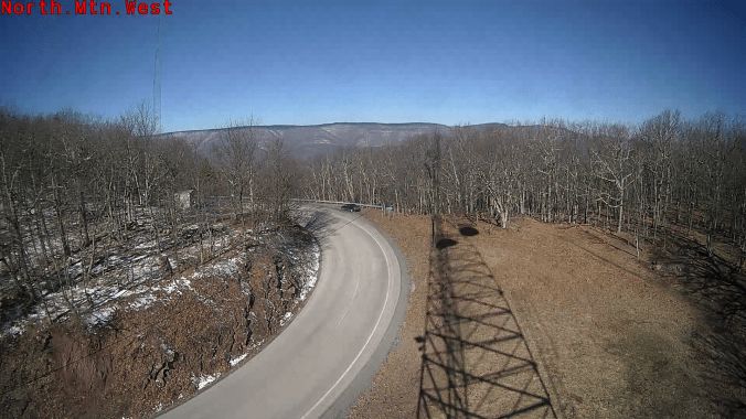
Photo by Stephanie Inskeep at Blackwater Falls today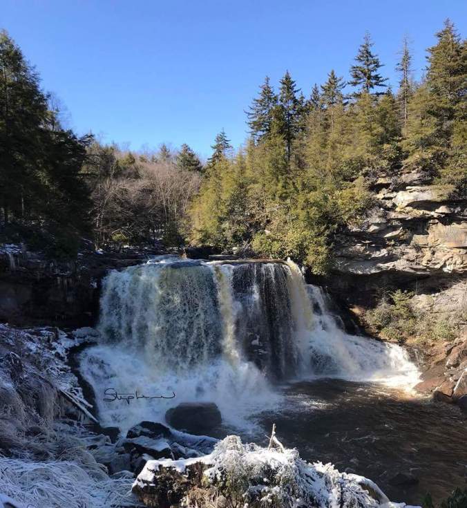
Photo by James Dumire on North Fork Mt looking towards the Allegheny Front
Modis subset satellite image today…shows the thinning of snowcover, to a dissapearing act in sunny areas. In Tucker and high ground from Allegheny Front, to Cheat Mt and back north still looking pretty white at the midday image. Few areas in Somerset, Cambria that did well the othe day holding onto a wooded cover also. Spottier in Garrett. Dark areas in Wv mts are the red spruce forest. Further north in Pa along N.Y border and north is where the heart of the snow fell 2 days ago. 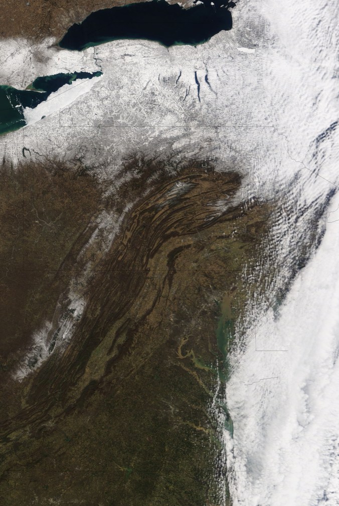
Northern Hemisphere and North America snow extent


Nor’ Easter out to sea
ON THE MODELS
12z 3km NAM temps through Tuesday afternoon
12Z GFS Surface next 10 days. Best shot of something significant for the Alleghenies looks to be between the 11th and 13th(next Sun-Tues). That doesn’t mean nothing between now and then. Some upslope snows mid to late week. Slightly higher amounts to what we just seen 2 days ago, with a more prolonged period, with less in the way of extreme wind. More of what you would classify as typical for the area. 
12ZGFS modeled amounts on late Wednesday/Thursday/Friday/Saturday and then jumped till Wednesday a.m. This is only a model run, not a forecast. I am a tad high on thinking this occurs. Are their bugs in the ointment, rivers to cross, hills to climb?Yes! One being we first have to get through the midweek event and see where things stand. Then models can get a better handle on the one I think can be our main potential pf significance. I love the fact the models teleconnections(pictured 12zgfs, ecmwf below) spike the PNA positive at the time frame. NAO is already negative and not badly positioned for us. Spike in PNA idicates to me, its not flying out to sea.

12ZECMWF at the surface. 
12ZECMWF modeled snowfall. End of Wednesday/Thursday/Friday/Saturday and then a jump to Tuesday a.m. The ECMWF is a tad faster in with that system. Again, I stress these are model runs. Not forecast. I do like this timeframe though.

12zECMWF ensembles for snow amounts next 15 days..with majority of this day 8-10 (10 to 1 ratio)

At 500mb on Ecmwf – op/ensemble for the 11-13th window


Big trough off west coast, reflection should be big trough on east coast. +PNA, west based -NAO which is favorable for us(if you like storms) that combo should keep this west and not out to sea if the models verify somewhat. As of today, and with weather, things change often, but as of today, I’m anxious to see how this timeframe plays out. Lots of potential. The 11-13th. AND we have winter weather before that as well.
