March 11. min. max. avg
Bitt 2nw Valley 4.1 38.7 21.4
Garrett College 11.3 40.5 25.9
Can-Heights 14.9 40.7 27.8
CRN-Canaan 15.9 41.0 28.5
Cabin Mt. 18.5 38.7 28.6
Cabin Mt north NO DATA
Spruce Knob 12.9 44.6 28.8
Showshoe/S.C 23.9 40.3 32.1
Can-Valley Floor
Cresaptown 19.2 52.2 35.6
Green Bank Obs 14.9 50.8 32.8
7Springs 18.2 39.0 28.6
Clear cold start once again. Sunny day, with a few periods of high clouds. Very low dew points. Type of March day that snow melts in sunny areas, remains powdery in shaded areas despite temp.
Todays modis satellite view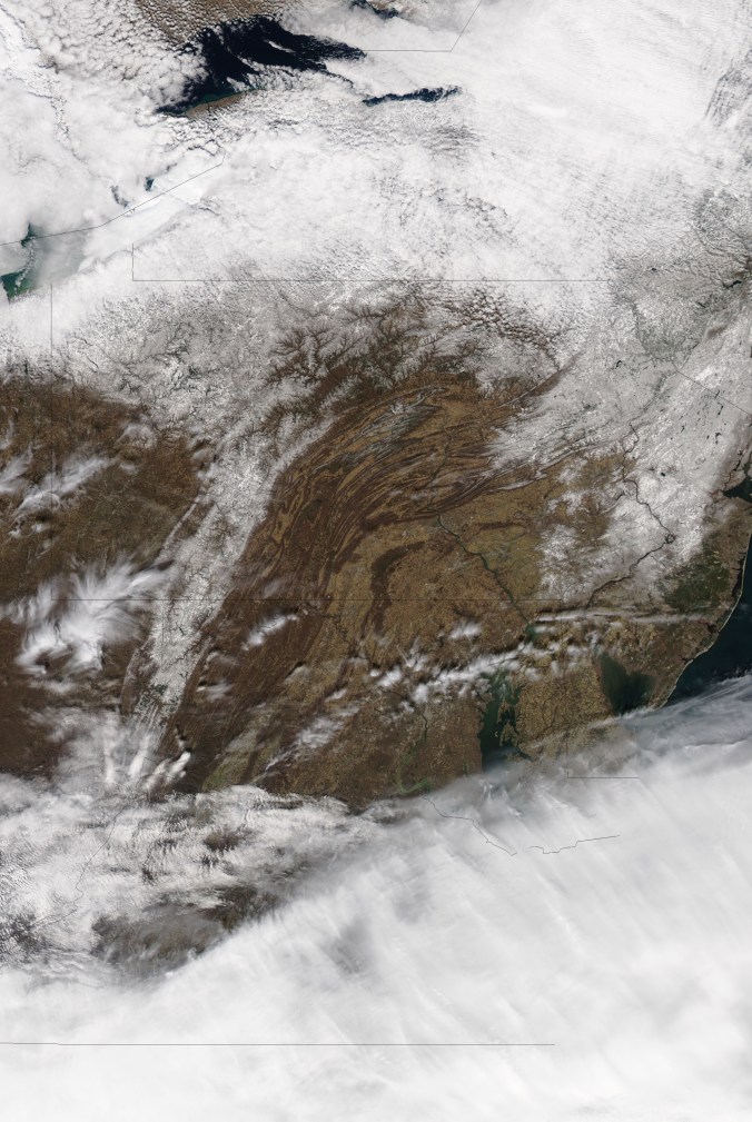
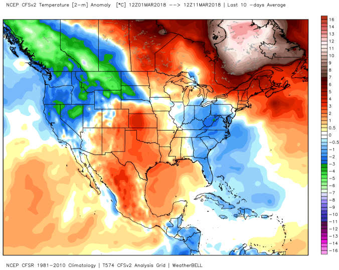
Temps today at Bittinger 2nw Valley, Cabin Mt, national profile this afternoon


Temps at The Glades dropped below 0 again this morning, with some cool looking hoarfrost around. Many get hoarfrost and rime mixed up. This is hoarfrost, rime is what we get across the high ground often with fog events in winter


Thoughts ahead on snow this week. The storm tomorrow is mainly a southern Alleghenies event as it looks now. With lighter amounts north. More impressed with the upslope there after through Friday a.m than tomorrow’s event. Unfortunately for snow lovers, this did not become the “Big One”. Lots of ingredients on the table but didn’t time out right.
A generalization map in part 1 for tomorrow. Leaning low in those amounts.
Part 1 is tomorrow’s event, Part 2 is upslope Tuesday through Friday a.m


March to date