


March 18. min. max. avg
Bitt 2NW valley 10.4 45.7 28.0
Garrett College 19.3 46.6 32.9
Can-Heights 14.7 44.2 29.5
CRN-Canaan 18.6 44.5 31.6
Cabin Mt 19.0 41.9 30.5
Cabin Mt north no data
Spruce Knob no data
Snowshoe/S.C 22.8 42.4 32.6
Can-Valley Floor 7.8 52.0 29.9
Cresaptown 22.7 60.3 41.5
Green Bank Obs 25.8 54.3 40.0
7Springs 23.9 45.6 34.8
Wall to wall sun. Cold start, milder day vs the previous week. Low dew points, the dry air doesn’t allow for much snow melt on the north facing slopes and shaded areas, while the March sun does its work elsewhere.
Modis satellite image today showing the snowcover through the Alleghenies. 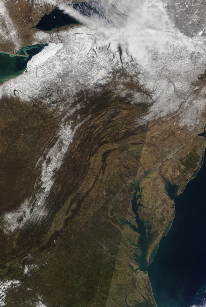
Pic below by Peggy Thorne Church flying over Harman today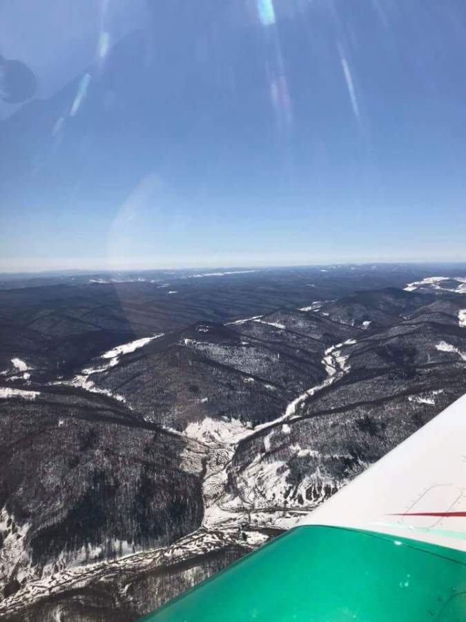
Tuesday-Thursday Snow Event
Caution- Models are trying to piece together how this system will play out. With so many players on the field, the models have struggled to figure out which piece is strongest, if it will have room to trend north, and therefore track, timing has been back and forth on the models. Today, some converging has occured. Is it final? No. That said, this system does have the potential to be the biggest snow of the season for parts of the area. 
As of this evening, this is the area that looks like the heaviest axis may occur, and that window will tighten as we get closer and a trend north or south may still occur. If anything, I’d lean north if it does trend. Its one of those systems I like for the Allegheny Front, Mt. Storm, Savage Mt best. That area, and then on east. If this materializes, as it looks like it could, the heaviest zone could be in the 8-16″ window. (orange zone)With higher pops east. Outside of that, in that blue zone 6-12″. Elsewhere common amounts of 3-6″.
Things to consider- Timing. How much falls during daylight hours. It looks to come in predawn Tuesday. Snow during Tuesday. Anytime snow rates go lighter, it will be harder to accumulate during the day and on the ground amounts may compress. (Especially lower elevations, 6″ -8″may never be more than 2 to 4″ on the ground. Timing and rates important)Actual fallen amounts may not equal actual snowfall depth. I don’t see this being high ratios. 8-12 to 1 range. Marginal temps, but cold enough to support snow. Onset could very briefly begin as a mix. Snow continues Tuesday night, Wednesday at varying rates and lingers possibly into Thursday a.m in the Alleghenies.
We still have a ways to go, this can still trend north, south, lighter, heavier. .
On the models. Here is the 12z ECMWF
Snowfall off the model
18z Nam outlook
Snowfall off the model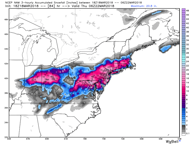
Good combo to begin seeing if the Nam and ECMWF line up. The 12z ECMWF also has lots of agreement in its ensembles.
18z GFS ensembles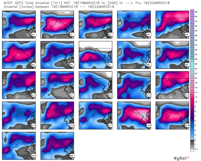
Watching next weekend with another system coming across. That potentially could set up a wintry period for the snowmobile races at Timberline resort.
As always, lots of time, effort, and cost go in to provide this free service. If you would like to contribute, you can at
https://www.paypal.me/AlleghenyMts
Thank you.
