

March 19. min. max. avg
Bitt 2NW valley 18.1 51.6 34.8
Garrett College 22.5 54.9 38.7
Can-Heights 24.8 49.9 37.3
CRN-Canaan 21.7 49.6 35.7
Cabin Mt 29.1 46.9 38.0
Cabin Mt north no data
Spruce Knob no data
Snowshoe/S.C 35.6 47.8 41.7
Can-Valley Floor 13.0 54.2 33.6
Cresaptown 24.3 64.8 44.6
Green Bank Obs 20.8 56.5 38.7
7Springs 33.3 54.8 44.0
Clear to start with some cloudiness later, more so south. Low dew points limited snow melt in north facing slopes, and shady areas.
Temp profile this afternoon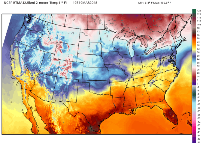
Storm outlook Tuesday-Wednesday
First up, a look at today’s 12z ECMWF (AKA The Euro)
The model is in relative good agreement with its past runs and other modeling very similar. The GFS remains a bit of a outlier, but has came around.
Precip pushes in predawn tomorrow. Rain south, mix north and in this area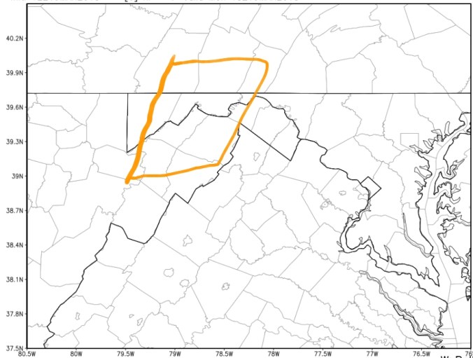
I think is the zone to watch for that brief mix to go to heavy snow early tomorrow. This is part 1. The current(posting this at 3:30pm) NWS outlook has the Winter Storm Warning beginning for later tomorrow and is not including this currently. This is an area to watch in my opinion for a quick changeover to snow and quick accumulation and poor driving early tomorrow. Likely a backoff period tomorrow then a return to accumulating snow. Timing is such the next round may come back during the night Tuesday and therefore could accumulate at better rates vs daytime snow. To note, lower elevations, and anywhere with lighter snows will struggle to accumlate during the day tomorrow and may compress what does fall. Snowfall totals likely will not be snowfall depths.
For some areas, this looks like it may be the biggest snowfall of the season. Refer to yesterdays post. Expanded the 6-12″ zone on latest guidance. 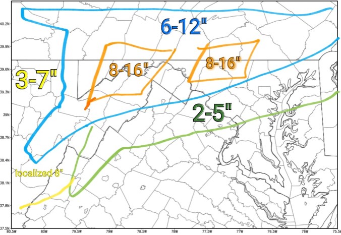
I always like to lean low to mid range of these numbers. Lower elevations in the zones, lean to the lower side, and figure in compression. On ground depths reduced to lower than actual snowfall amounts. High ground lean to the middle of the totals with potential to reach the top. Really like that Allegheny Front, Mt. Storm, Finzel area for this. Some areas will likely bust low, and or top the top end amount numbers. Its impossible to predict where heavier banding will setup, and where it will miss. Thats almost every storm. In general, these are my areas that look to be the hardest hit.
Lets look at some model totals. But first, bear in mind, models will not take into account, daytimes struggling to accumulate, and compression of snow. Ratios looking 8-12 to 1 with this.
Here are the models… A tool to gives a idea where the heavier amounts will fall. Not the gospel of what will exactly fall. Models still at a bit of odds on the second piece tomorrow night. Parts of Wv that were hit last week, may sneak in a better snow period than forecast. I think Pocahontas County, 50-70 miles west need watched for that. Complex setup, tweaks, adjustments will need made and in the end, even those will ne off with areas that did better or worse.


Once this clears, we turn eyes to the weekend system. Gfs suppresses the storm south. Rising NAO, correction is likely north, 12z ECMWF is a hit on the region. Canadian is north and would equal a mix, sleet, snow, rain. So that needs watched. Could be a active weekend unless the GFS wins the day. Long range continues the big highs north with systems cutting underneath. May be talking snow potential into the first week of April. With milder interludes in between.
As always, lots of time, effort go into this free service, if you would like to contribute, feel free, if not, enjoy, cause I’ll do it anyway. You can at-
https://www.paypal.me/AlleghenyMts
Thanks!
