May 31. min. max. avg
Bitt 2nw valley 60.8 74.8 67.8
Garrett College 65.9 77.1 71.5
Can-Heights 62.9 73.2 68.1
CRN-Canaan 62.3 72.1 67.2
Cabin Mt. 60.3 70.7 65.6
Cabin Mt north no data no
Spruce Knob 59.2 70.5 64.8
Snowshoe/S.C 61.3 70.5 65.9
Can-Valley Floor
Green Bank Obs. no data
7Springs 67.3 78.4 72.9
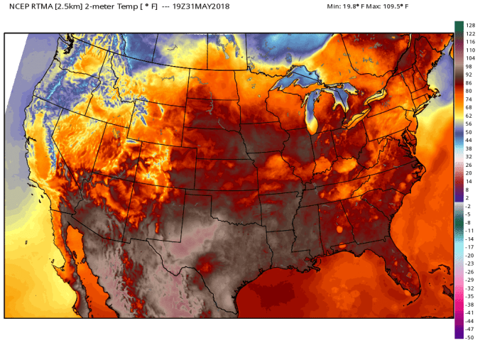
On and off rain, intervals with sun. Muggy day
Temp profile
Rainfall past 48 hours with brunt past 24 hours. Flooding in skyline drive area
Radar today
Satellite this afternoon
May Summary
Bittinger 2nw Valley and Canaan data put together by Dave Lesher
Overall a warmer than normal May, and wetter than normal. After a cold April we went into May leafless and that carried into mid month, and some areas to week 3 with minimal foliage. Thoughts on that, that limits evapotranspiration and allows for more daytime heating in an already warm pattern. So, a cold April can IMO contribute to an even warmer May due to that. By no means was that a cause of warmth, the overall pattern flipped to a summerlike one after the cold April. Lots of cloudy nights with the wet held temps up overnights. Overall combo of the above led to a very warm May.

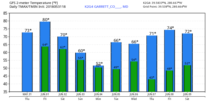
18Z GFS modeled temps next 10 days. Possibility next week as brief high works in, if it times out correctly, the coldest valleys could run a frost risk.
12Z ECMWF a bit different look on the coming cool. 


