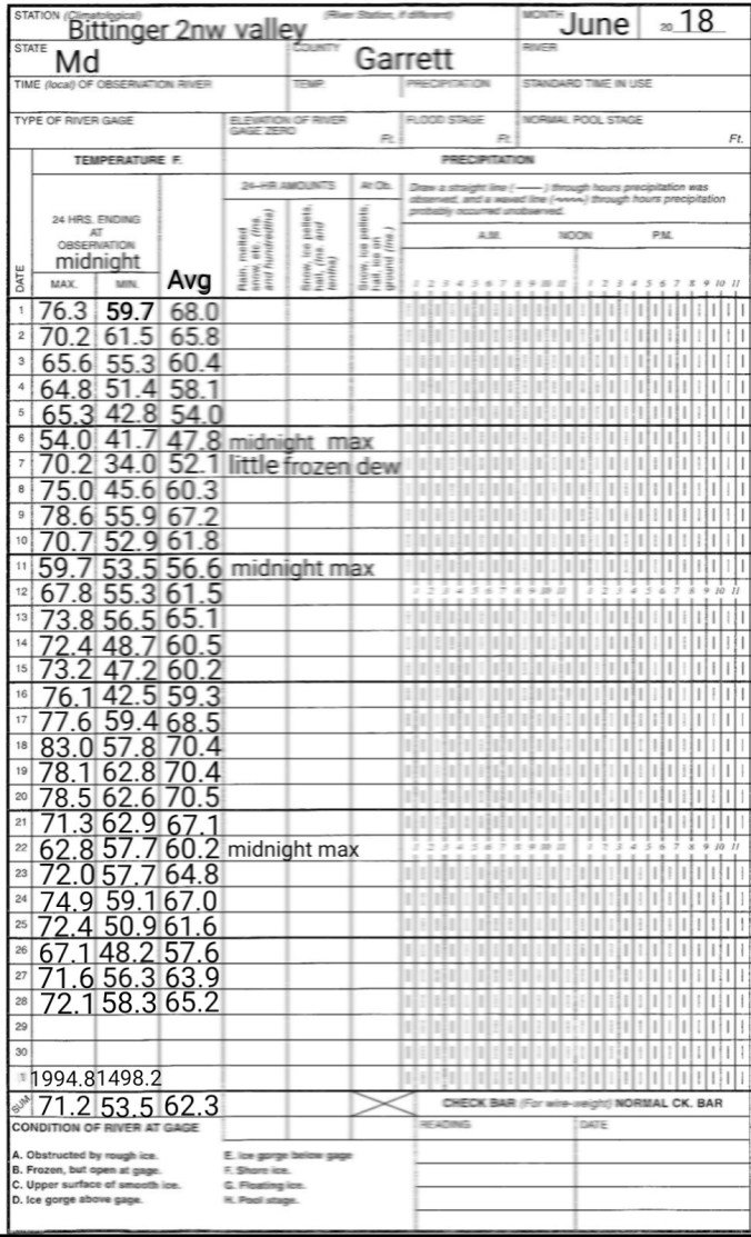
June 28. min. max. avg
Bitt 2nw valley 58.3 72.1 65.2
Garrett College 63.1 74.4 68.8
Can-Heights 58.0 71.0 64.5
CRN-Canaan 56.8 70.6 63.7
Cabin Mt 58.3 69.8 64.1
Cabin Mt north 59.1 69.4 64.2
Spruce Knob 57.6 68.9 63.2
Snowshoe 57.7 68.2 62.8
Can-Valley Floor
Green Bank 59.7 84.0 71.8
7Springs 64.0 74.3 69.2
Brief patches of blue at daybreak to light showers, drizzle on and off through early afternoon…then skies began to break
Temp profile this afternoon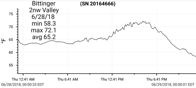


 Radar(I picked up .25 since 6pm last night) Some areas around Canaan Heights, Davis picked up over 2″ last night. Some areas in western Tucker in lowlands had flooding. Amounts in these areas are greater than depicted by the estimate in the photo.


Satellite this afternoon
Flow
500mb anomaly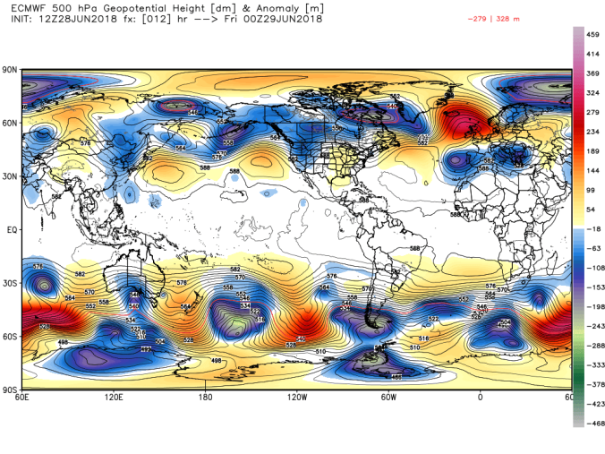
Current SST and 7 day change


Upcoming Heat Wave
Earlier in the week, I posted a list of expected temps based off model data. That still looks to hold on par for Sat-Mon, those days being the hottest but holding up beyond that. Here is the list
Johnstown Pa 88-93
Somerset Pa 87-92
Mt. Davis Pa 81-86
Grantsville Md 87-92
Bittinger Md 82-87
Accident Md 88-93
Friendsville Md 89-94
Mchenry Md 85-90
Oakland Md 89-94
Morgantown Wv 93-98
Cumberland Md 97-102
Keyser Wv 95-100
Parsons 91-96
Davis 83-88
Canaan Heights 81-86
Canaan Valley 82-87
Cabin Mt 78-83
Dolly Sods 80-85
Harman 85-90
Seneca Rocks 91-96
Spruce Knob 76-81
Elkins 90-95
Green Bank 88-93
Snowshoe 76-81
Marlinton 88-93
Cranberry Glades 82-87
** Car thermometers, bank/store thermometers will likely read higher than reality during this period. Lots of heat, radation reflecting back off artificial surfaces, objects.
Some numbers off todays 12z Euro Sat-Mon for Snowshoe area, Canaan area, Deep Creek area. Keep in mind, highest locations will run touch under these numbers, lower, town areas will top there numbers.


Pics posted by Tucker County 911 on Facebook


