July 21. min. max. avg
Bitt 2nw valley 58.5 69.0 63.7
Garrett College 59.1 70.2 64.6
Can-Heights. 56.2 70.3 63.2
CRN-Canaan
Cabin Mt 53.8 66.6 60.2
Cabin Mt north 54.7 67.3 61.0
Spruce Knob 52.9 64.6 58.7
Snowshoe 56.5 66.7 61.6
Can-Valley Floor 57.4 74.5 65.9
7Springs 55.5 67.3 61.4
Eastern Mts cloudy, some fog to start that carried through the day.. Elsewhere intervals of cloudy periods, some sunny breaks through mid afternoon. Then high ground fog, very isolated light showers ruled from the evening on. East flow ruled the day.
Temp profile this afternoon, with 24 hour temp change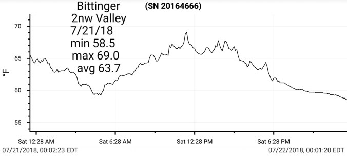


Satellite this afternoon
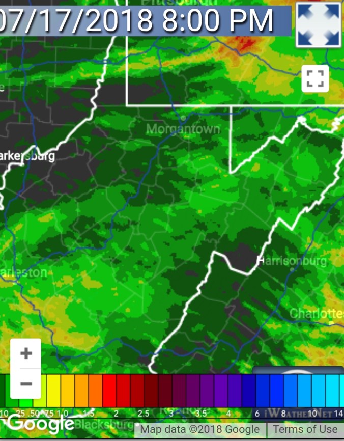
Radar with radar estimated 24 hour precip through 7pm

Water Vapor loops this afternoon
Flow 7/21/18
Surface features and 500mb height anomalies


500mb flow


Savage Mt morning…typically one of the foggier spots in this type of setup..built in thicker late day.
Pics by Jeremy Cutlip this afternoon in Edray looking north


Upcoming week off the 12z ECMWF
Cuurent SST anomalies and 7 day change. Circled, 3 key areas to watch for winter hints. Uncircled but also important, dateline 30-40N cool pool. The warm anomaly there, modiki nino look with cooler waters southeast seaboard vs PNW. That favors a western ridge, eastern trough as the predominant pattern. It also can initially lead to a fast west to east flow early season that inhibits cold surges, but when they come, they come full steam ahead. This is July however, and these features will shift, adjust. How they do, will affect the pattern setup.


 Satellite this afternoon


 Radar
Radar


 Flow
Flow