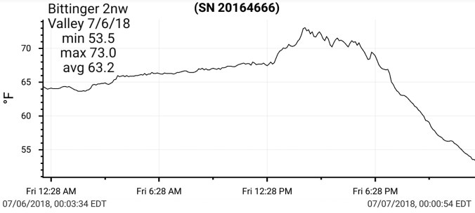
July 11. min. max. avg
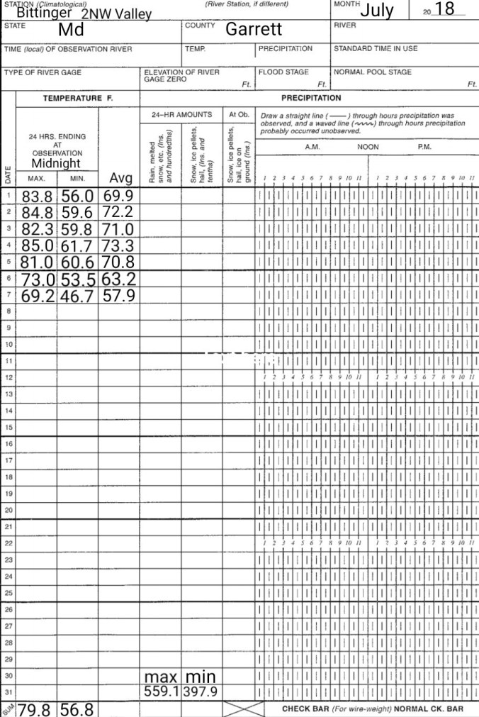
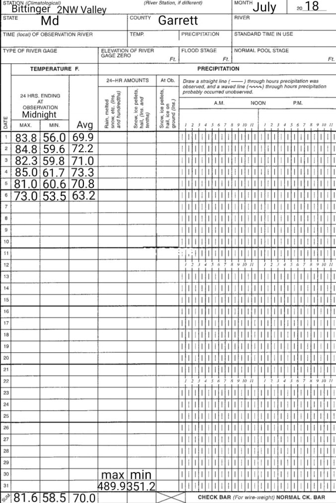
Bitt 2nw valley 54.2 77.5 65.8
Garrett College 58.4 79.1 68.8
Can-Heights 58.5 74.5 66.5
CRN-Canaan 55.1 74.4 64.8
Cabin Mt 57.2 73.6 65.4
Cabin Mt north 59.5 73.8 66.6
Spruce Knob 56.5 72.9 64.7
Snowshoe 57.9 71.2 64.6
Can-Valley Floor 51.4 77.5 64.4
Green Bank Obs 60.1 84.4* 72.2
7Springs 63.0 78.0 70.5
Cloudy, foggy early, giving way to a mix of clouds and sun mid to late morning on.
Temp profile this afternoon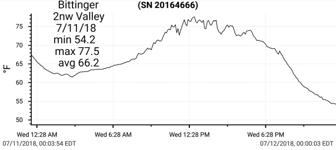


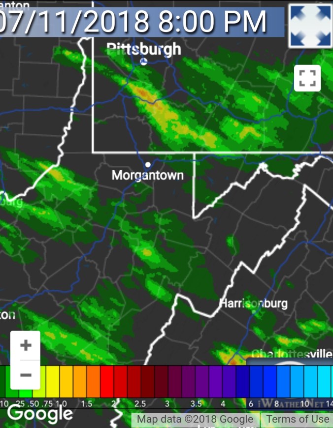
Radar past 24 hours. The rain really died out last evening pressing in as you’ll see in radar and the precip estimate map
Satellite this afternoon
Flow
Surface features and 500mb today


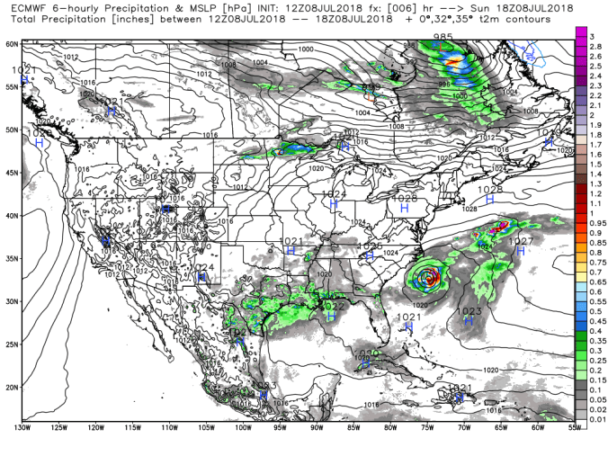
Hurricane Chris moving away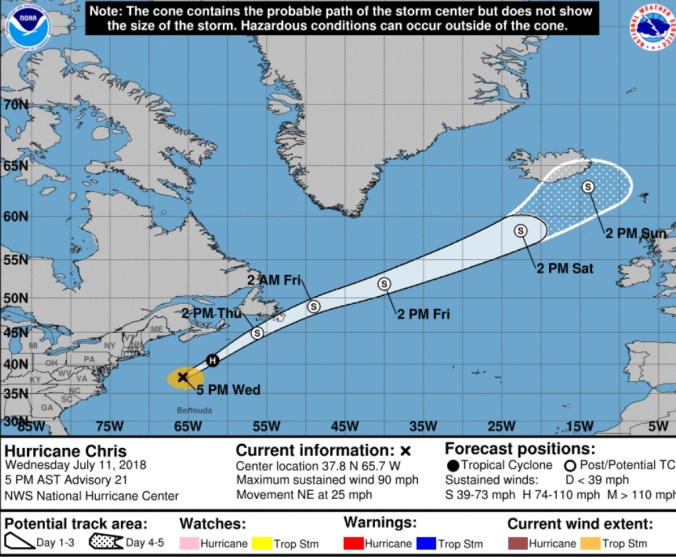


 The Glades dropping to 37.6 overnight. A much calmer night with minimal mixing. Models, including 3km nam did poor with indications temps would fall as much, GFS somewhat better. Generally 4-8 under modeled dewpoint if calm winds, clear skies rule in these coldest pockets.


 Satellite this afternoon, with blue sky. nl need for zoomed im version


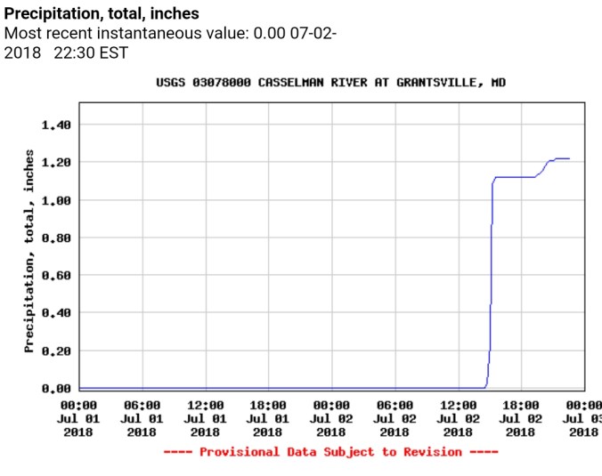
 Radar, and Grantsville and Davis gauges. Radar estimated precip, for whatever reason is horribly off today. Most Wv sites, Cabin Mt, Canaan Heights, CRN, Spruce Knob all in between .1 to .3, Garrett College at .4

 Satellite this afternoon
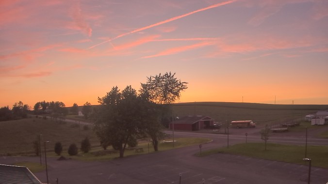


 Radar
Radar


 Radar..and precip estimates. Report of 1.1 near Savage Mt, .4 Grantsville, .9 Cabin Mt at Bald Knob, 1.0 Spruce Knob
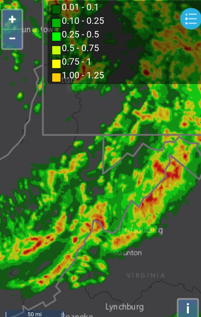


 Radar, radar estimates putting out 3″ of rain near Thomas/Davis this afternoon. Given the nature of the slow moving drenchers and the fact Tucker Landfill had 2.3, Davis USGS gauge at 1″, Canaan Heights at 0.0″, 3″ amounts were highly possible.


 Radar this afternoon + precip estimates that look overdone in areas
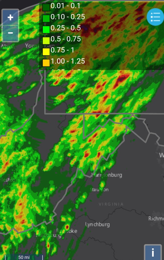
 Satellite this afternoon