Aug 31. min. max. avg
Bitt 2nw valley 58.8 76.4 67.6
Garrett College 62.0 80.9 71.4
Can-Heights 59.5 77.1 68.3
CRN-Canaan 57.6 78.2 67.9
Cabin Mt 60.3 75.7 68.0
Cabin Mt north 61.9 74.8 68.3
Spruce Knob 58.5 72.5 65.5
Snowshoe 60.6 73.0 66.8
Can-Valley Floor 53.8 80.6 67.2
7Springs 63.9 76.7 70.3
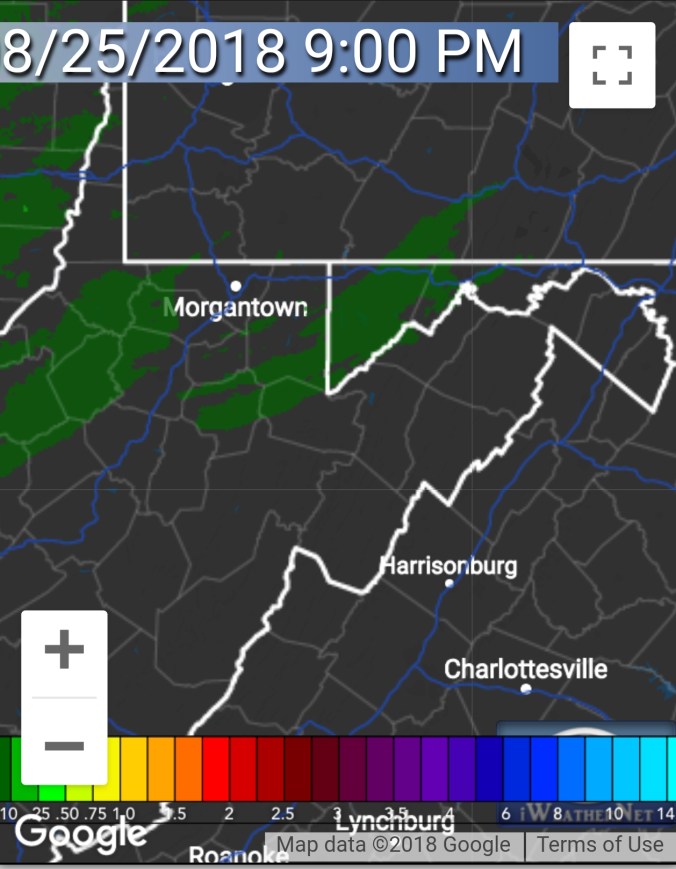
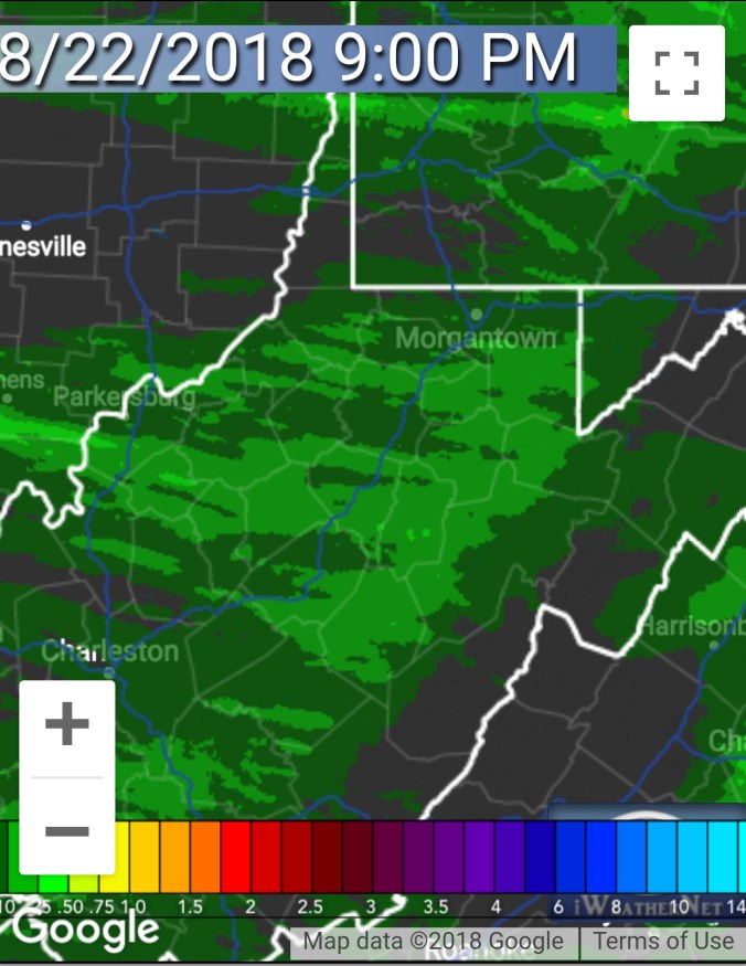
Ground fog to start, semi dense in some areas. Skies breaking through early afternoon with some downpours developing. A second round late day, and in the same location as the first in a few spots.
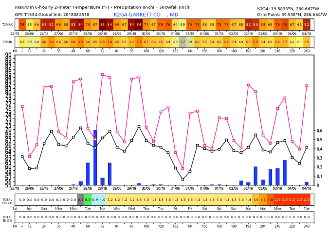
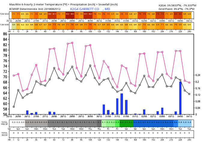
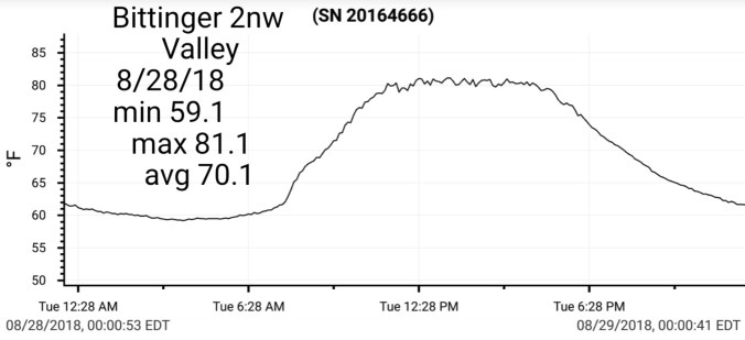
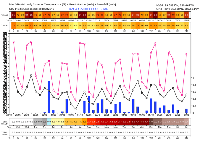
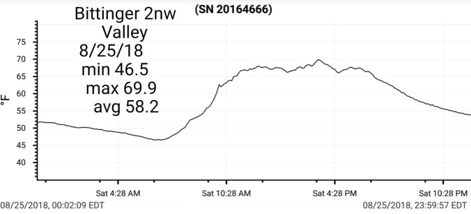
Temp profile this afternoon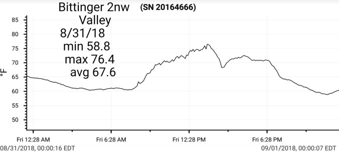


(other temp charts in monthly summary at the bottom)
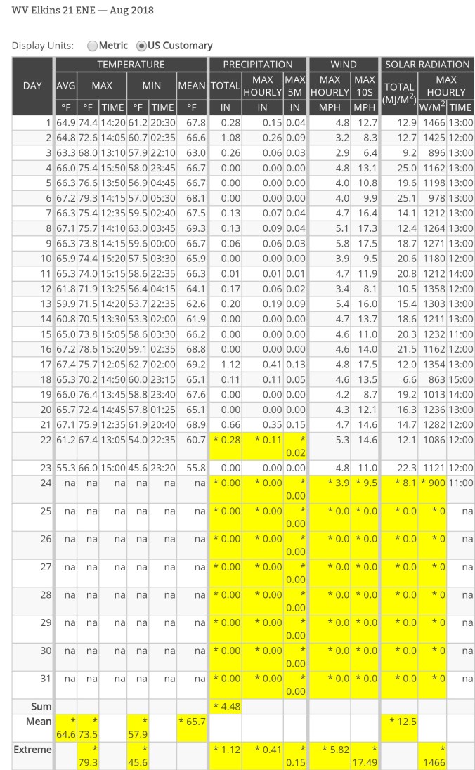
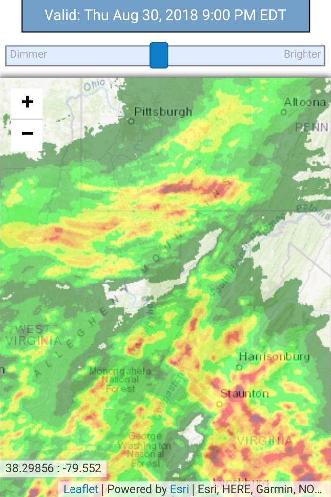
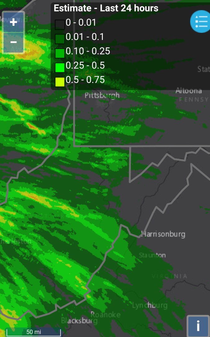
Radar plus estimates with a few more details . I came in with 1.35″ today. I had .25 with round 1 this afternoon, 1.1 this evening. And .35 last night after 6pm. Total 1.6 since 9pm… Radar estimated .28 this afternoon and 1.1 this evening and 1.58 overall…so very impressed with the accuracy. Nearby, south on Foxtown Rd, it appeared more rain fell and radar estimates at 2″. Mchenry at Garrett College reading .01 today, and that was dew this morning, but estimates from 9pm till midnight gave the amounts for 24 hour 9pm to 9pm… There was no measurable precip there today. . A sharp cutoff. Interestingly, the afternoon storm and evening storm built in from opposite directions but had the same cutoff zones, and heavy zones.


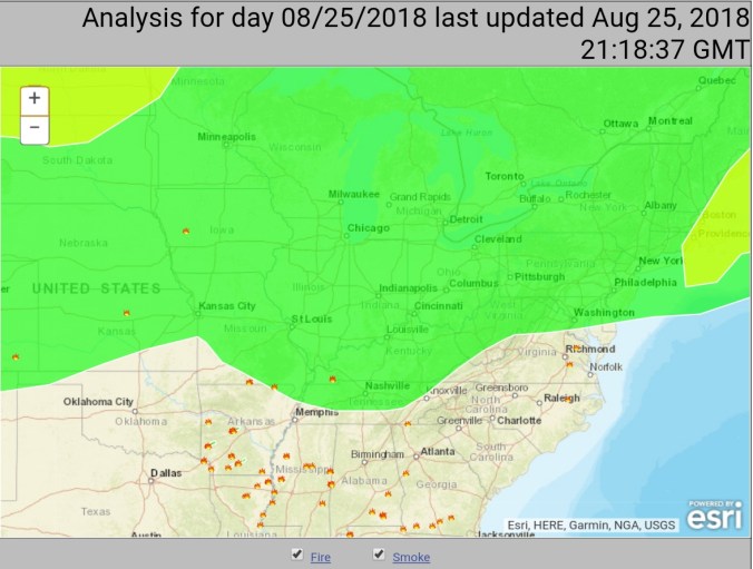
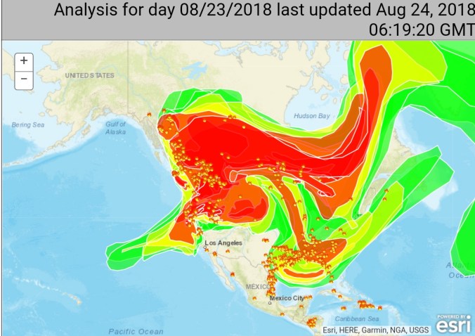
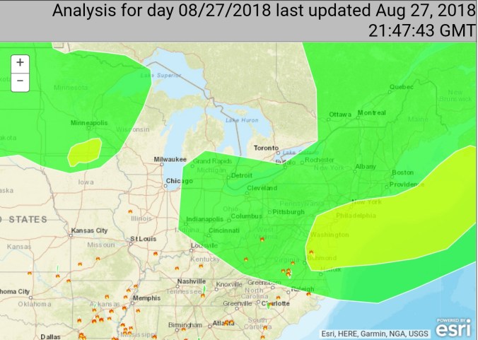
Satellite
Flow
Surface features and 500mb height anomalies and flow


Videos from the rain…


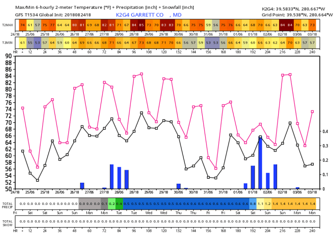
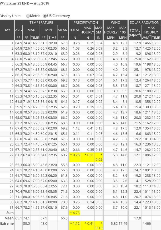
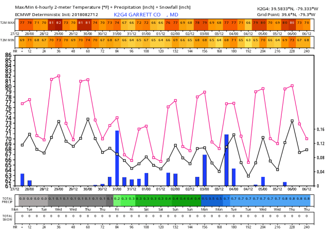
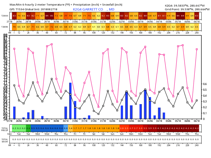
August summary
Temps August 2018


Precipitation August 2018


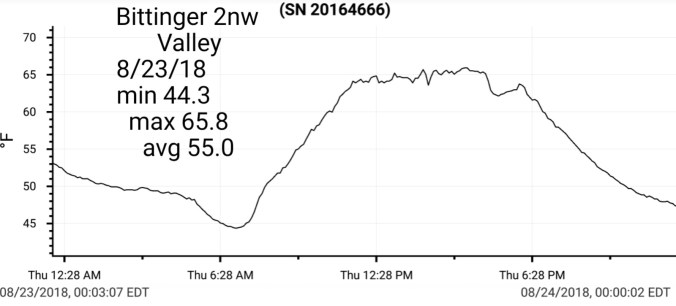
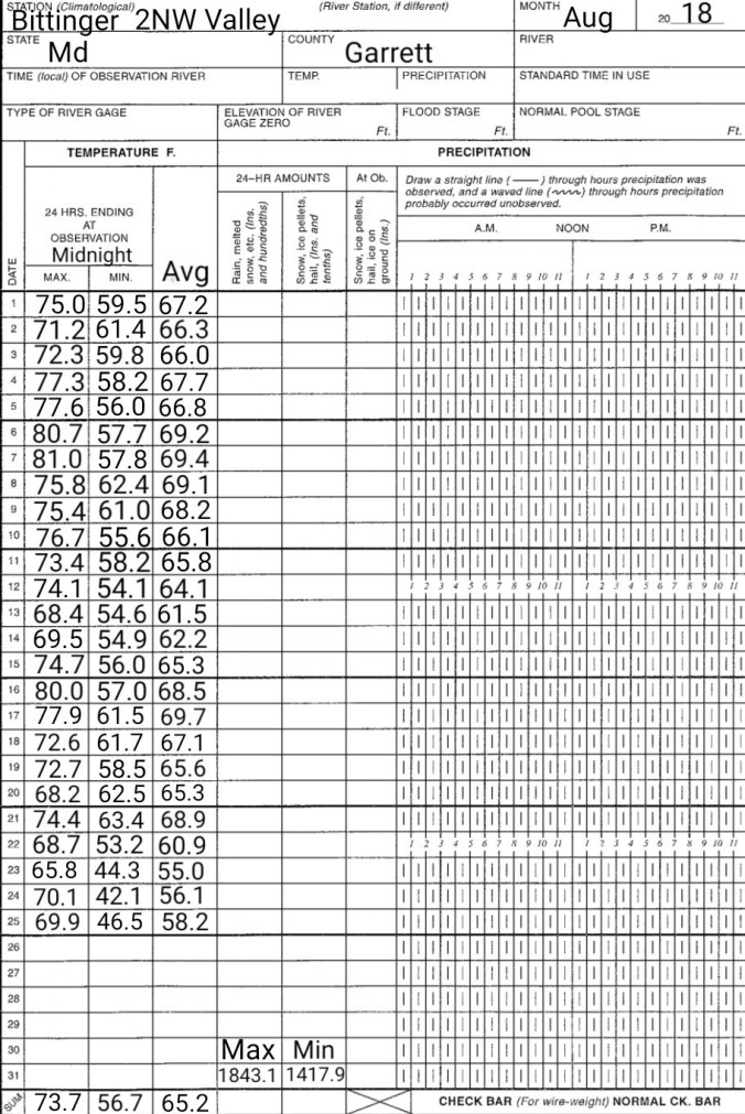
Bittinger 2nw Valley
Temps:


Warmest Min 63.4
Coolest Max 65.8
Days of highs in the
80s- 6 (All of 80 or 81°)
70s- 19
60s- 6
Days with lows in the
60s- 9
50s- 19
40s- 3
Precip: 7.6″ on the month
Canaan-CRN
 Warmest Max 80.0
Coolest max 66.0
Warmest Min 65.4
Coolest Min 43.0
Days with highs in the
80s-1
70s- 26
60s- 4
Days with mins in the
40s- 2
50s- 19
60s- 10
Precip 4.73
Precipitation….Keep in mind, co-ops(off scasis here) are 7am to 7am recording times.


Chart put together by Dave Lesher at the frost pocket test sites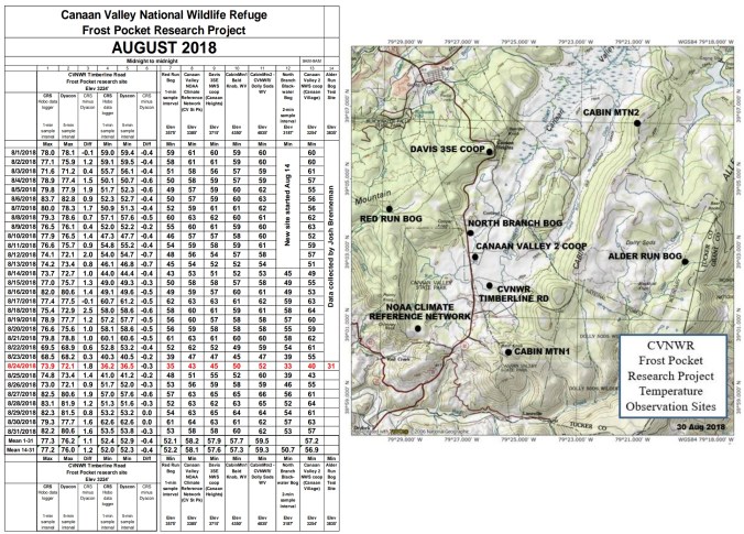
Year to date
Temps


Precip


 Satellite


 Satellite


 Satellite this afternoon


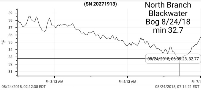
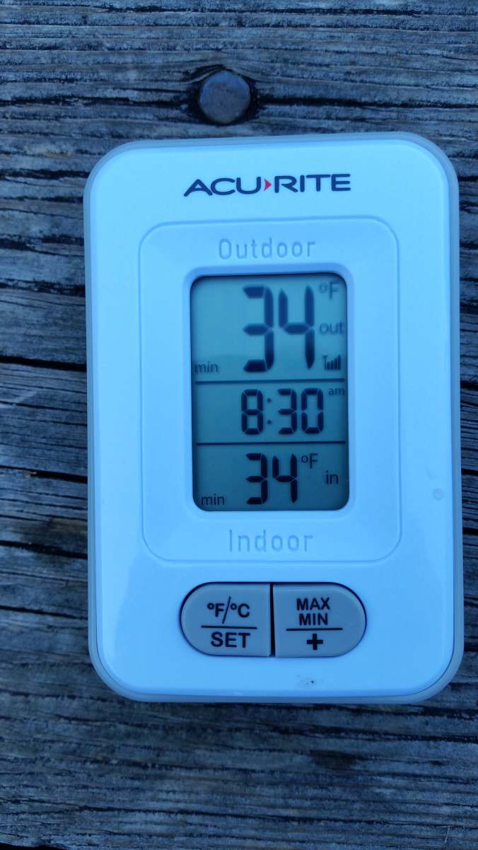
 Min at The Glades