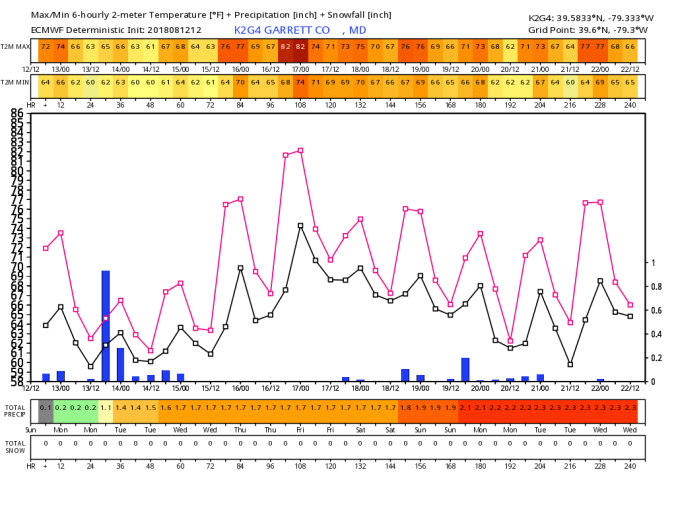
Aug 12. min. max. avg
Bitt 2nw valley 54.1 74.1 64.1
Garrett College 57.3 76.7 67.0
Can-Heights 56.1 72.6 64.3
CRN-Canaan 56.4 71.9 64.1
Cabin Mt 56.5 66.6 61.5
Cabin Mt north 58.1 68.5 63.3
Spruce Knob 56.3 70.3 63.3
Snowshoe 56.1 68.9 62.5
Can-Valley Floor 54.7 72.1 63.4
7Springs 63.2 74.7 68.9
Valley fog, some areas of clear skies, some areas with clouds to start the day. Cloudiness more so in the Wv mts. Building clouds today, some periods of sunny breaks, showers in the Wv mts morning, with more widespread showers including northern areas later in the day with thunder.
Temp profile this afternoon


Radar with estimates(24 hours 9pm – 9pm) Picked up .4 at Bittinger 2nw Valley

Satellite
Flow
Surface features and 500mb height anomalies and flow


Henry Oester near Keysers Ridge had hail with the evening storm.


The runs of the 3km Nam kept showing a large 2m temp drop with some of the individual cells. Casual glance not digging to deep into it, I thought it may been modeling some hail. (not a parameter of the model) The SPC had no hail threat near.
Freezing levels looked to run 12-13k feet. Precip tops 25-30k feet with some of the storms. It appears tomorrow should run this isolated risk as well. 500mb “cool” pool overhead with upper level low. 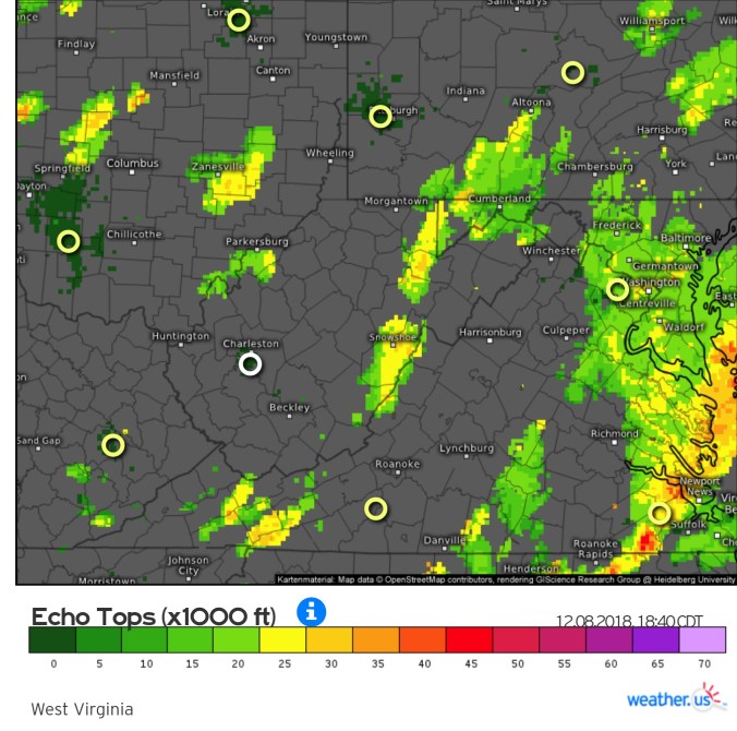
18z 3km Nam
Temps
Simulated Radar
2m Dew Points
Cloud Cover Percentage