Aug 27. min. max. avg
Bitt 2nw valley 61.8 80.4 71.1
Garrett College 66.9 83.0 74.9
Can-Heights 66.0 77.6 71.8
CRN-Canaan 65.4 78.8 72.1
Cabin Mt 65.1 77.5 71.3
Cabin Mt north 65.7 79.0 72.3
Spruce Knob 63.7 76.5 70.1
Snowshoe 64.6 74.7 69.6
Can-Valley Floor 57.6 80.6 69.1
7Springs 68.5 78.1 73.3
Cloudy,foggy, hazy start, some periods of morning sun, few pop up brief showers, afternoon featured clouds and sun with scatterded showers.
Temp profile this afternoon


Radar with estimates 9pm-9pm

Satellite
Flow
Surface features and 500mb height anomalies and flow


Smoke areas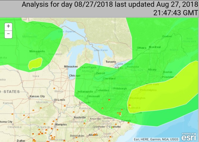
18z 3km Nam
2m Temperatures
2m Dew Points
Heat Index
Simulated Radar
12z ECMWF meteogram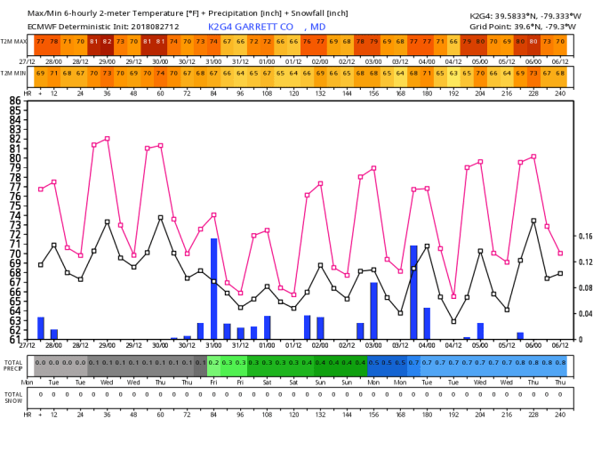
18z GFS meteogram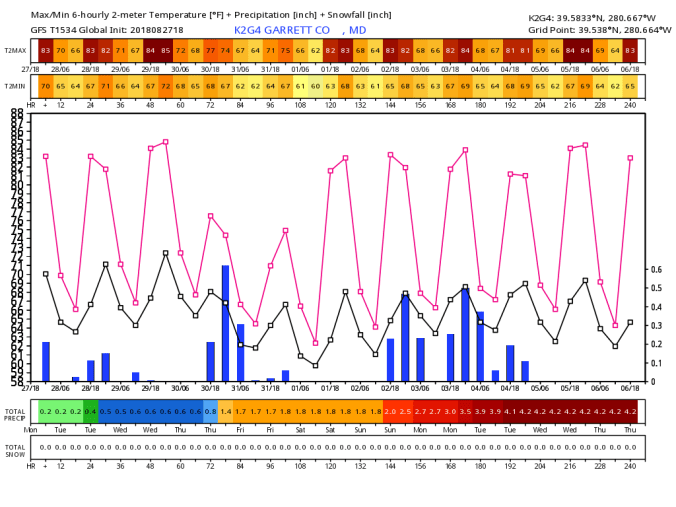
The ridge in the east looks to hold through the first 10 days of September. Beyond that, CFSV2, the new(just in) Euro weeklies, GFS, all pointing to a Canadian influence on the air mass incoming in the 11-15th range. This is very far out and could be derailed. This far out though, this would be the next potential of any type of nightime lows in our cold pockets to reach freezing potential.
few pics today


In the last pic, and a little in the first pic. A fairly common site in at least this part of the region. That is, maples losing their leaves very early. Some turned a little color and fell, some fell while green. We had a very wet summer, except July. Locally(Garrett) July went dry. August returns and it has been back to above normal precip. I am guessing its a stress factor, overleaf abundance early in the leaf season, dry shot, followed by very wet. Some maples in bog, swamp areas typically are early changers, and droppers, this year, some of these have just dropped. As seen in pic 3. That is not an uncommon site in many areas currently. If anyone has any other info about this, feel free to comment. This is the most early maple leaf drop I’ve seen and it may have an effect on the fall color season.
Snow! Not locally but out west it has begun.
A few social media pics.


