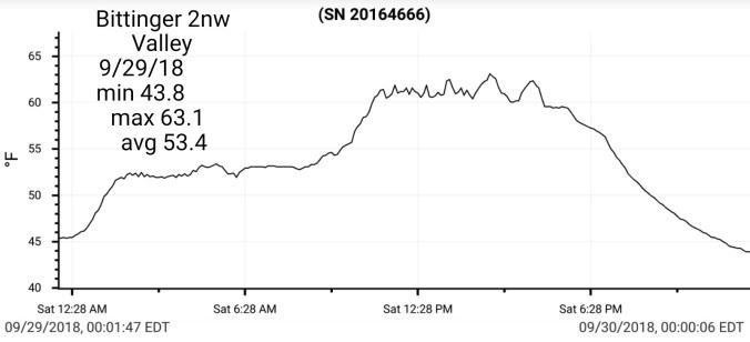
Sept 30. min. max. avg
Bitt 2nw valley 40.5 69.2 54.8
Garrett College 43.5 75.8 59.7
Can-Heights 47.6 70.5 59.0
CRN-Canaan 42.2 72.0 57.1
Cabin Mt. 49.5 69.1 59.3
Cabin Mt north 50.2 72.3 61.2
Spruce Knob x station down
Snowshoe 53.2 66.2 59.7
Can-Valley Floor 37.0 74.8 55.9
7Springs 49.5 69.9 59.7
Partly Sunny day. Really a perfect mild fall day.
Temp profile this afternoon


Canaan Mt bog as seen from Cabin Mt. Temp bottomed out at 37° on the bog, vs upper 40s, low 50s outside of that pocket across the top.


Flow
Surface features and 500mb height anomalies and flow


Pics today


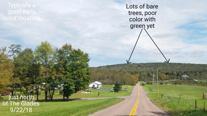
Foliage at present- Anthracnose has took its toll on the typical early changing vibrant maples. From yesterday to today. Things of notice. The high ground across the sods, excluding the reds of the huckleberry/blueberry. Trees are mainly bare or of poor dull color on what remains. The huckleberry/blueberry reds look like a peak in 7-10 days is likely. That said, some are dropping reds, while some half green. Spruce Knob and west,70- 80% bare trees. Riding to Spruce Knob lake, color that was shared on social media a week ago, was basically gone today. This holds true for the areas around the Sinks and along Gandy Creek.
Up to Canaan the lower 2/3rds of Cabin Mt and areas within the valley look like a peak in 10-14 days. This area, for whatever reason looks less affected by anthracnose vs surrounding areas. East side of Canaan Mt looks poor, and on top of Canaan Mt, currently at peak, and not anywhere near as vibrant as typical. Once those maples drop, it will be basically bare. The west side of Canaan Mt, fair amount of color with a peak in 6-10 days.
Backbone Mt and west, some color, lots of green. 2-3 weeks away for good color if it exists.
The holdouts for the best color looks to be portions within Canaan that hold a heavy concentration of birch, and the Blackwater Canyon. The birch look largely unaffected. Peak in 14 days +/-.
North in Garrett. Colors are advancing. Again the typical early changing maples, mostly are bare. Around Deep Creek Lake, which holds a high concentration of oak varieties. Mostly green. Late month when they turn there dull color and oaks are also affected by anthracnose. Marsh Hill has lots of birch, as does Swallow Falls area, expect a peak similiar to Blackwater…
Month Summary
Temps Sept 2018


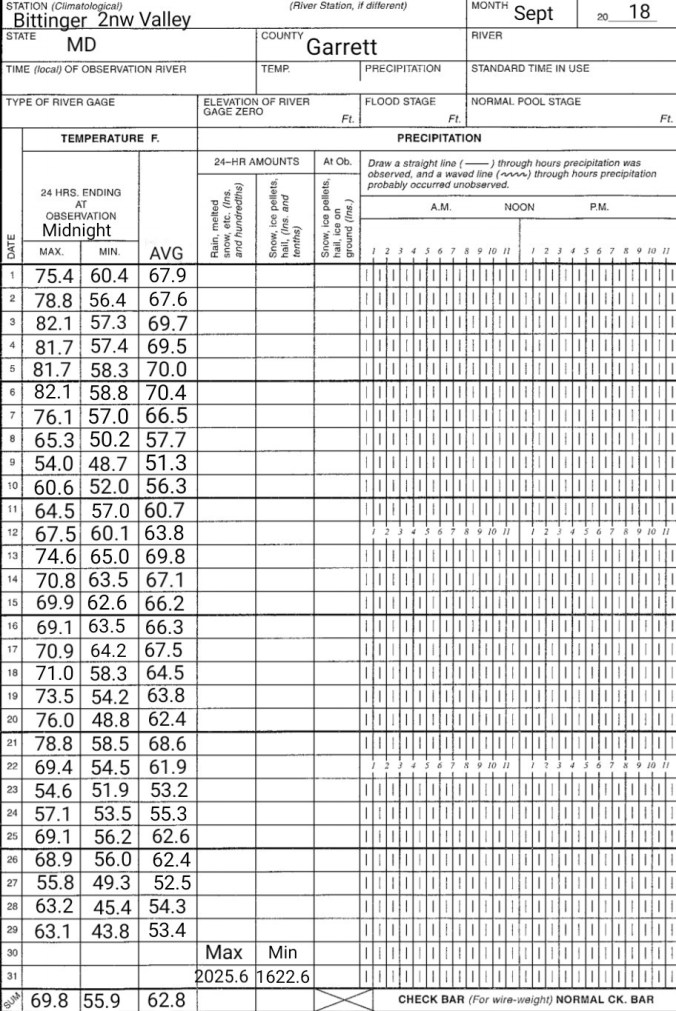
Bittinger 2nw Valley


CRN-Canaan
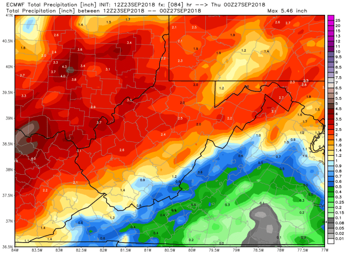
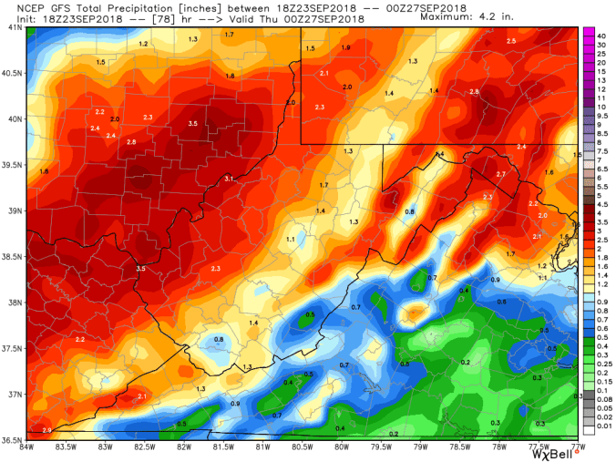
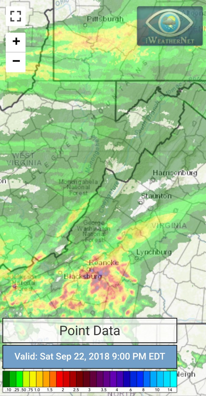
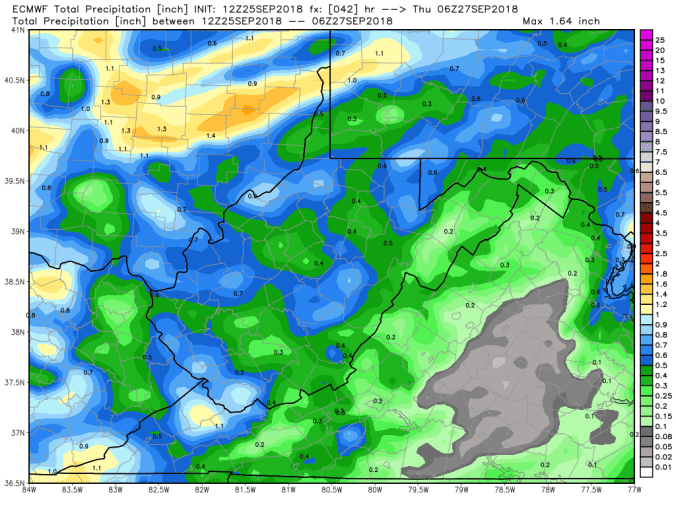
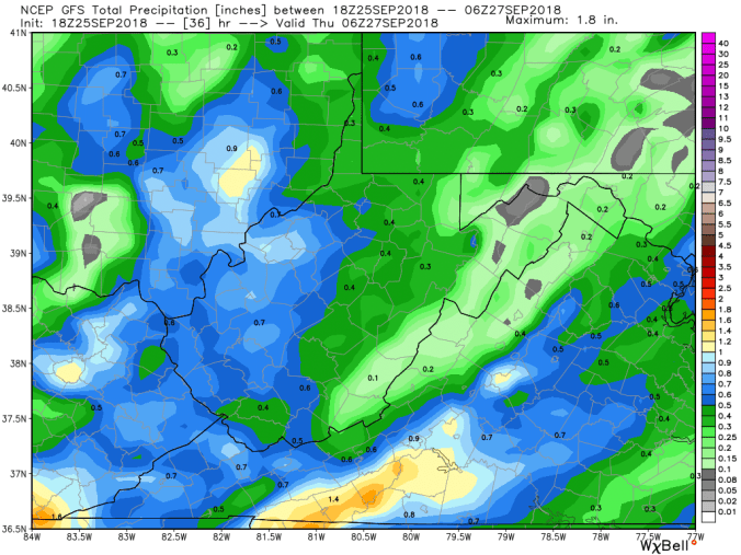
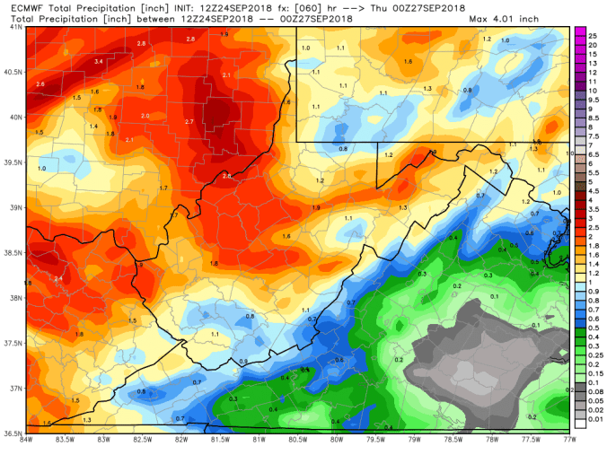
Precipitation


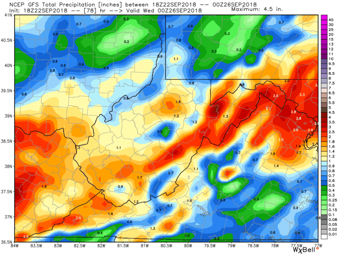
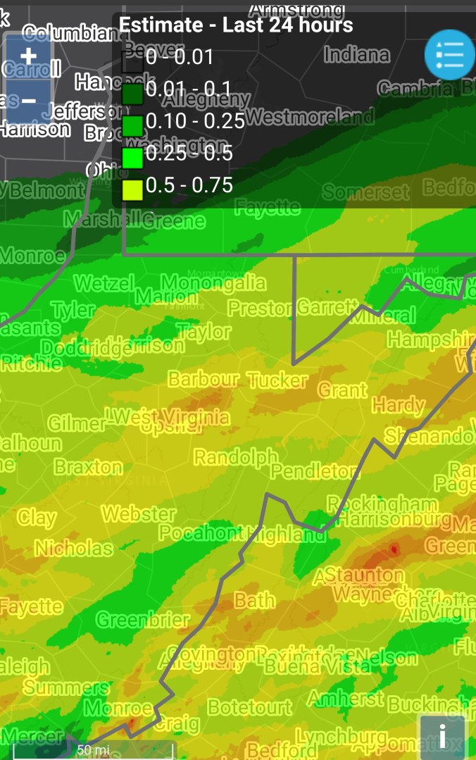
I finished with 11.2″ at Bittinger 2nw Valley ….elsewhere,


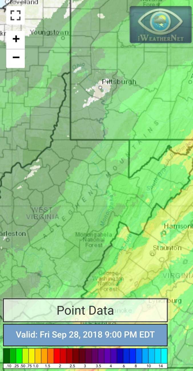


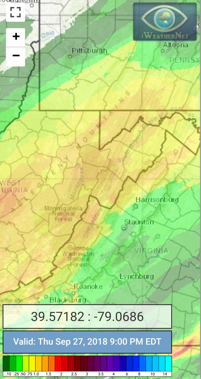


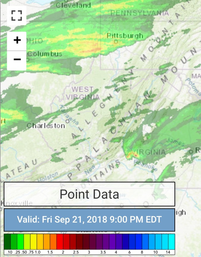
 Satellite


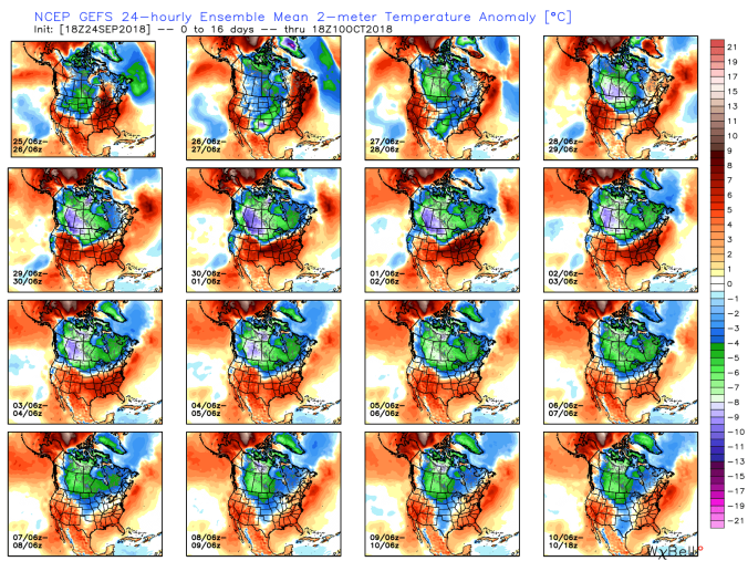 Now look at that pattern the GEFS holds on to and compare that to MJO correlation that is holding phase 8 and 1


 Satellite