Sept 1. min. max. avg
Bitt 2nw valley 60.4 75.4 67.9
Garrett College 62.2 81.0 71.6
Can-Heights 61.2 74.1 67.7
CRN-Canaan 59.4 75.7 67.6
Cabin Mt 61.3 73.4 67.3
Cabin Mt north 61.7 75.0 68.3
Spruce Knob 59.0 70.9 64.9
Snowshoe 62.4 70.0 66.2
Can-Valley Floor 52.0 78.8 65.4
7Springs 63.8 76.8 70.3
Dense fog to start in areas that recieved appreciable rain yesterday. Some valley fog elsewhere. This gave way to some sun and clouds then downpours of rain developing towards midday and through the afternoon and evening. Pockets of rain was the nature of it.
Temp profile this afternoon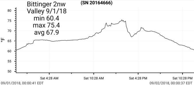


Radar with estimates… isolated pockets of heavy rain. Henry Oester near Keysers Ridge in with 1.69 this afternoon and radar estimates of 2.5+ near Little Bear Creek and Rabbit Hollow area, while a short distance away at Bittinger 2nw Valley, I only recorded .05. The heaviest rain fell in pretty steep terrain causing a fast rise on Bear Creek at Friendsville according to the USGS gauge.


Satellite
Flow
Surface features and 500mb height anomalies and flow


Looking around today, and I have not previously looked much at the Red Oaks, vs the noticeable leaf drop, sickly leaves of the maples standing out so much. The red oaks are largely affected with anthracnose as well. 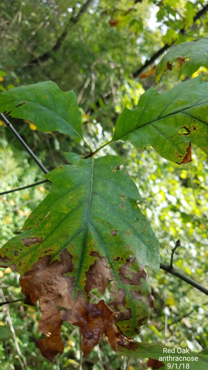
18z 3km Nam
2m temperatures
2m DewPoints
Pop up shower, downpour, storm threat continues as well.
