Sept 4. min. max. avg
Bitt 2nw valley 57.4 81.7 69.5
Garrett College 60.9 85.1 73.0
Can-Heights 61.2 81.2 71.2
CRN-Canaan 57.6 82.1 69.8
Cabin Mt 65.8 78.8 72.3
Cabin Mt north 67.6 79.7 73.6
Spruce Knob 62.1 76.3 69.2
Snowshoe 67.1 77.2 72.1
Can-Valley Floor 53.8 83.5 68.6
7Springs 72.6 84.8 78.7
Mainly clear start, valley fog again….clouds bubbling mid morning, showers, thunderstorms popping up midday.
Temp profile this afternoon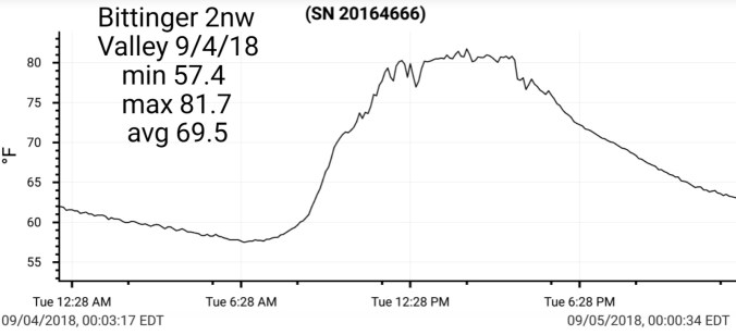


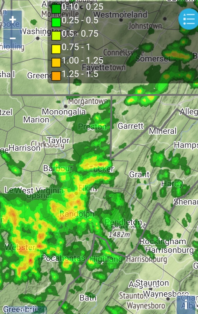
Radar with estimates 9pm-9pm
Satellite
Flow
Surface features and 500mb height anomalies and flow


Evening storm. Viewable from Mchenry area looking west.. Storm in Preston County. Radar echo tops showing 40k feet with the precip tops.


Monitoring the trees
Continuing watching the premature foliage drop. Especially of the maples in areas. Wild cherry looking poor as well.


Ramp seeds maturing
Few pics today


Sandhill cranes return

Models for the weekend
Going to for today resist posting rainfall amounts. Flooding potential does exist for this weekend. While there is no lock on where the boundary and rain goes, there is a strong leaning of the heavy rains pushing across the Alleghenies. Timing, track of this rain threat does need watched. For now, I will post the modeled temps off the models for the weekend, as I do that, Saturday will be determined by how fast the rain moves in. If it arrives early, temps holding 55-62, later temps 62-68, Sunday looks wet. Temps holding 52-60 as it looks now. Temps off the 12z ECMWF and 18z GFS


Having said that, I will post the operational runs, with the ensemble mean precip. With the GFS being the most significant at this point. Stay monitored to this, as it has “potential” to cause significant flooding, especially due to the already wet ground. Here we go, the 18z GFS op
The ensemble mean precip(using this as the op run seems a bit far fetched)..
The 12z ECMWF op run, still significant, but very manageable.
The 12z ECMWF ensemble mean precip….. So all in all, we need to watch to see how this pans out. Is it a 1′-2″ rain or a 3-5″ rain. 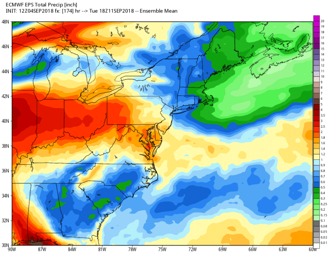
This year, September off to the hot start, last year the exact opposite