Sept 5. min. max. avg
Bitt 2nw valley 58.3 81.7 70.0
Garrett College 61.1 87.1 74.1
Can-Heights 63.6 81.6 72.6
CRN-Canaan 61.0 82.0 71.5
Cabin Mt 64.4 78.1 71.2
Cabin Mt north 65.8 81.5 73.6
Spruce Knob 63.5 76.3 69.9
Snowshoe 65.7 77.4 71.6
Can-Valley Floor 53.9 83.8 68.8
7Springs 71.1 82.7 76.9
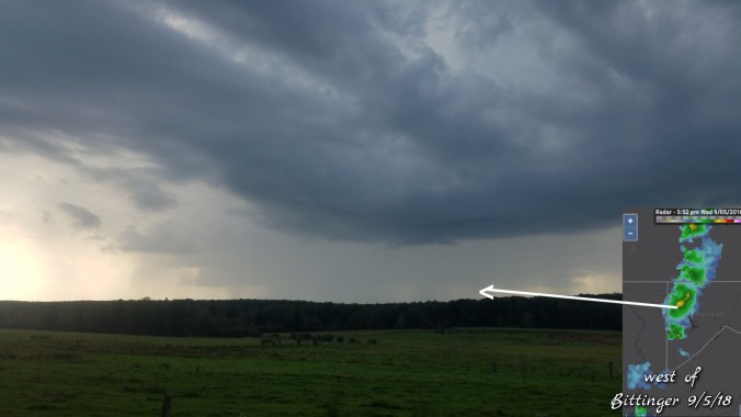
Mainly clear start once again, valley fog. Really a repeat daily pattern. Clouds building and some popup showers, storms later in the afternoon.
Temp profile this afternoon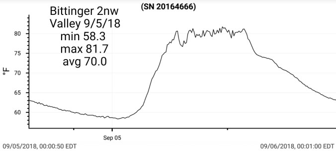


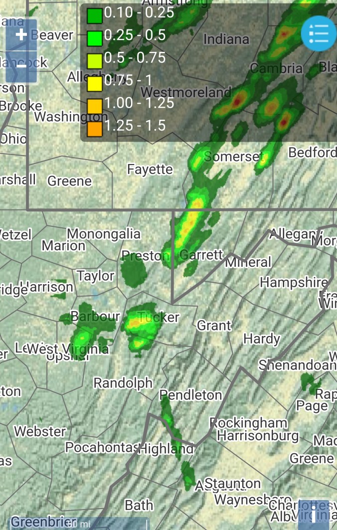
Radar with estimates 9pm-9pm. .05 Bittinger 2nw Valley
 Satellite
Flow
Surface features and 500mb height anomalies and flow


On the models….
18z GFS 6HR Precip
18z GFS Temps/Flow
18z GFS temps
18z GFS ensemble mean precip into Tuesday
12z ECMWF 6hr precipitation
12z ECMWF temps next 10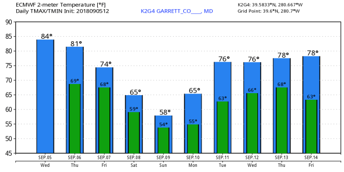
12z ECMWF ensemble mean precip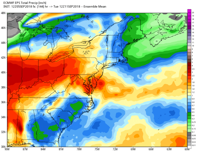
WPC Precipitation Map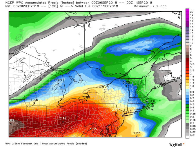
So….as of right now, focal point locally for the greatest potential rain looks 50-65 miles either side of the Mason/Dixon line. Those amounts looking to be in the 1.5 – 3″ amounts with locally higher amounts. Further south, .5 to 1.5 amounts look possible. Much cooler weather associated with the rain event. The GFS, ECMWF still are not conclusive on precip on Saturday. Which will affect temps as well. Further out, about 8 days, a east coast system needs watched.
Continue to monitor the latest rainfall potential as some flooding potential does exist in the heaviest axis zone.
