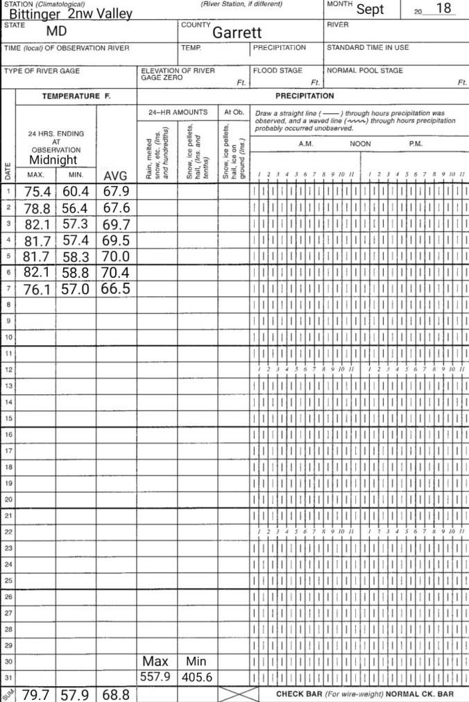
Sept 7. min. max. avg
Bitt 2nw valley 57.0 76.1 66.5
Garrett College 59.4 81.2 70.3
Can-Heights 61.3 75.9 68.6
CRN-Canaan 58.5 76.5 67.5
Cabin Mt. 60.1 76.1 68.1
Cabin Mt north 61.0 75.7 68.3
Spruce Knob 59.0 72.5 65.7
Snowshoe 62.1 71.2 66.6
Can-Valley Floor 52.9 78.8 65.8
7Springs 64.1 75.8 69.9
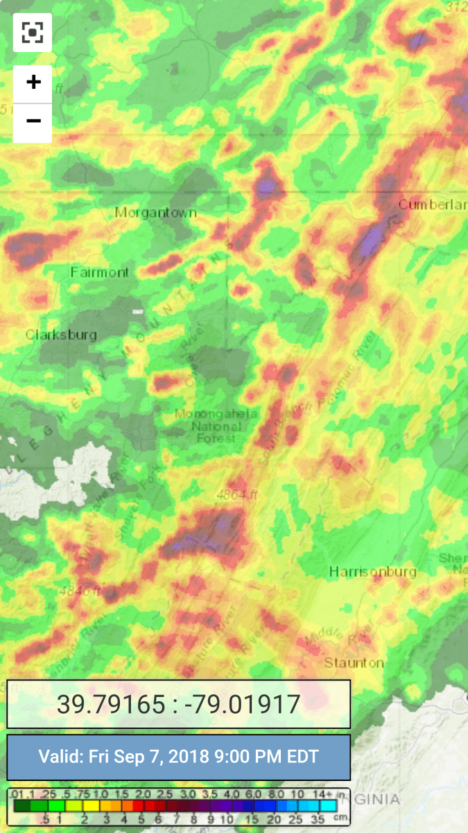
Mostly cloudy a.m..breaking for sun, to afternoon showers….heavier storms afternoon as well. Rainfall amounts vary greatly.
Temp profile this afternoon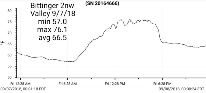


 Radar with estimates 9pm-9pm .1 with evening burst at Bittinger 2nw Valley by 6pm , next recording will be Saturday, away tomorrow
(CRN .15, Cabin Mt .12, Cabin Mt north 1.9, Spruce Knob .45, Snowshoe 2.54, 7Springs .04)
Satellite
Flow
Surface features and 500mb height anomalies and flow


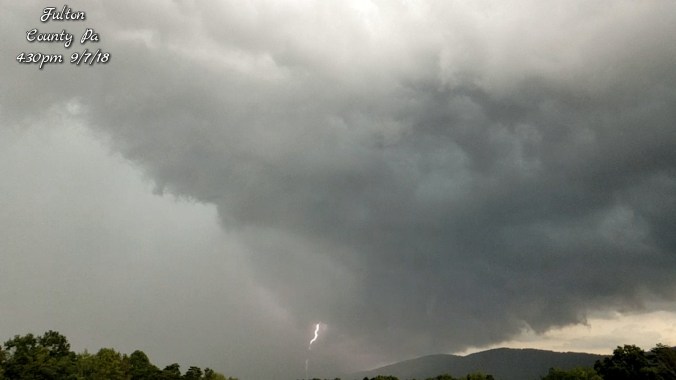
Storm in Fulton County Pa(fast motion capture)
Latest on the models
Rain pushing in this weekend. The heaviest axis looks to focus more towards the northern Alleghenies(Closer to the mason-dixon) and points NW. Garrett County 1.5-3″ amounts through Monday, Somerset 2-4″ amounts through Monday, Tucker County 1-2″ amounts through Monday and further south .75-1.5″ amounts through Monday. All locations can see isolated higher amounts.
Temperatures will be the warmest early Saturday with temps creeping backwards as the day wears on. Temps falling into and through the 50s. Some of the eastern ridges(Savage Mt, Dans Mt, Allegheny Front) should fall into the upper 40s early overnight Saturday. This will be accompanied by strong winds, wet conditions and real feel temps in the upper 30s Saturday night/Sunday a.m. Hikers and campers be prepared and advised to dress appropriately! Sunday remains chilly with minimal temperature fluctuation. A major change in the recent air mass temps.
18z 3km Nam
2m temperatures
windchills
Rainfall from 12z ECMWF, 18z GFS, and WFOs(weather forecast offices)


Looking further ahead, eyes immediately will turn to Florence in the Atlantic. Its a big unknown, but models have shown some potential tracks, landfalls, impacts. This could be a very big rain producer late next week “IF” it comes into the area. A week out on a storm like this is a long time and gives a long time to watch trends. If by Monday/Tuesday model trends hold or look more likely to be a major impact to the area, take proper precautions. Just a heads up to think about. With any luck, it will stay out to sea and a complete miss.
Here are the latest 12z ECMWF run and 18z GFS
