Sept 12. min. max. avg
Bitt 2nw valley 60.1 67.5 63.8
Garrett College 60.5 70.3 65.4
Can-Heights 60.0 73.3 66.7
CRN-Canaan 60.0 74.3 67.1
Cabin Mt 59.2 70.3 64.7
Cabin Mt north 57.7 71.4 64.5
Spruce Knob 58.8 67.5 63.1
Snowshoe 62.1 70.3 66.2
Can-Valley Floor 60.1 76.5 68.3
7Springs 58.6 65.1 61.8
Fog, few light showers, drizzle, se flow. North central Garrett held low clouds, fog the entire day, some breaks late elsewhere it appeared
Temp profile this afternoon


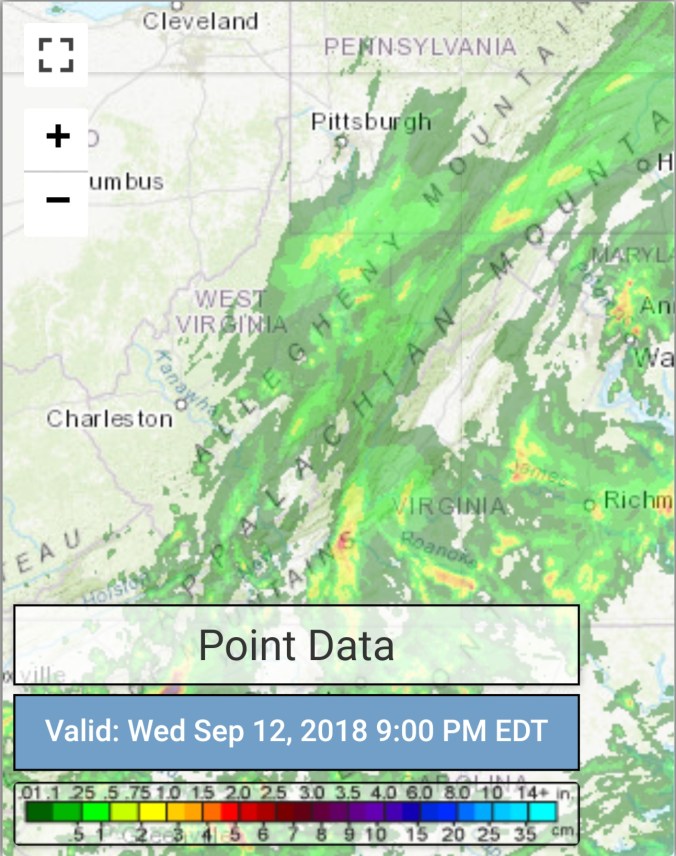
Radar with estimates 9pm-9pm , .05 at Bittinger 2nw Valley
Satellite
Flow
Surface features and 500mb height anomalies and flow


FLORENCE
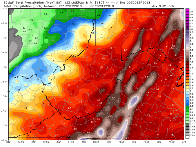
The track from last night holds fairly well tonight, with the exception of another slight south trend. The broad moist east flow will provide the opportunity for showers over the next few days, mainly Friday and Saturday. Our significant rain potential comes early to mid next week. Tweaks in timing and amounts remain. As of now it looks like a 1-3″ rain event with areas up to 4″. Now, the 12z Euro turned north a tad earlier, tad juicier and puts out 2-4″ amounts. Should that occur, flooding of more significance would occur. Right now going with 1-3″ which would cause some flooding with waterways already high.
12z ECMWF precip type next 240hrs
18z GFS precip type next 384hrs

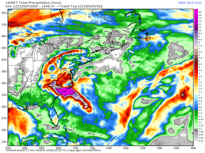
12z UKmet
NHC 8PM UPDATE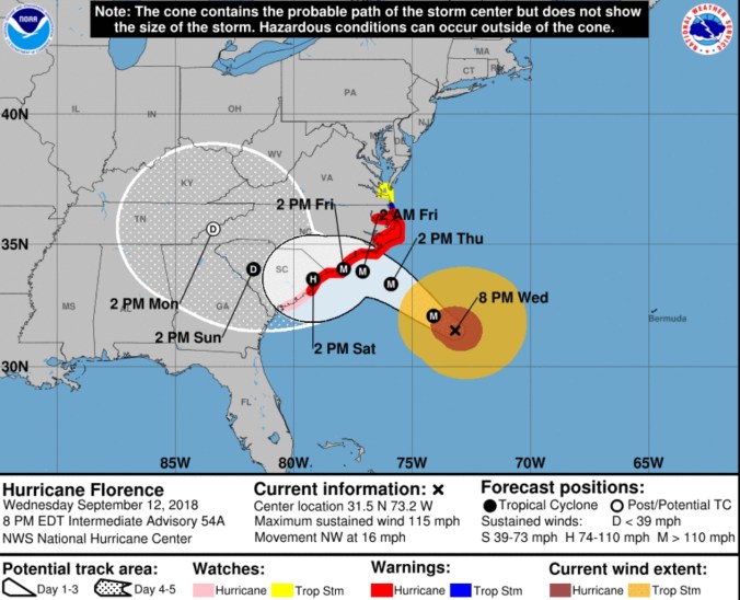
Spaghetti Charts


Breakdown of the precip by the NWS, really like their thoughts on this


