Sept 16. min. max. avg
Bitt 2nw valley 63.5 69.1 66.3
Garrett College 63.2 69.4 66.3
Can-Heights 59.6 63.5 61.5
CRN-Canaan 60.8 66.7 63.7
Cabin Mt 57.2 61.0 59.1
Cabin Mt north 57.4 61.5 59.4
Spruce Knob 57.0 60.1 58.5
Snowshoe 58.6 61.2 59.9
Can-Valley Floor 61.5 66.6 64.0
7Springs 61.7 69.2 65.4
Cloudy, some fog early, foggy all day in WV mts, little drizzle early, wetter as you went south in WV mts. I had a few peaks of sun, but majority of the time, just cloudy, east flow.
Temp profile this afternoon


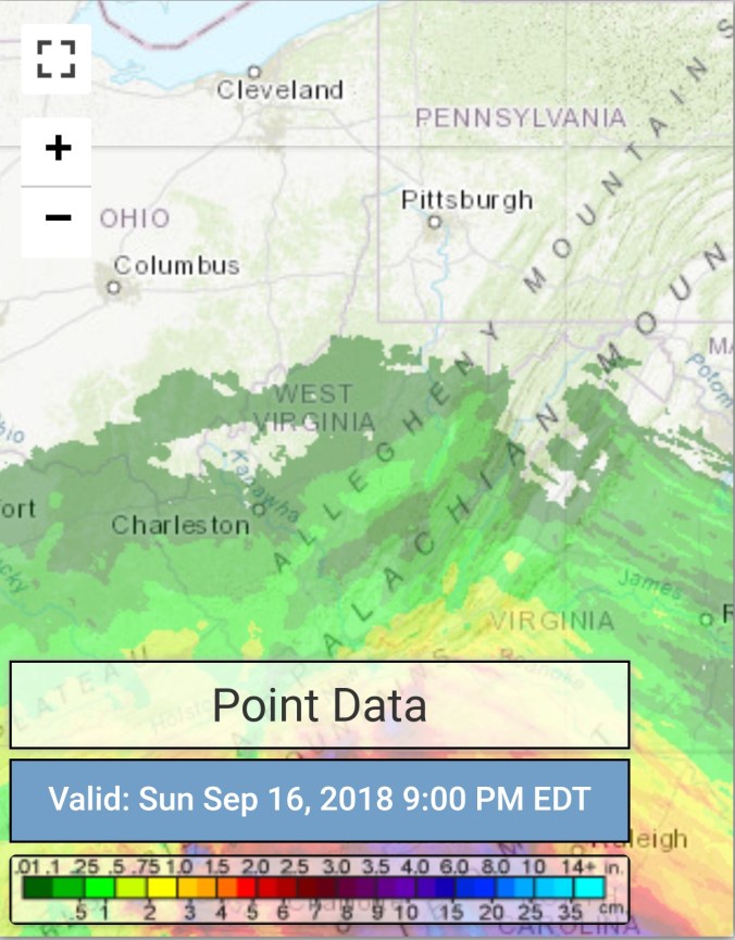
 Radar with estimates 9pm-9pm , picked up only trace at Bittinger 2nw Valley..
 Satellite
Flow
Surface features and 500mb height anomalies and flow


On the models..
Rain looks to push over the area during the overnight and by dawn tomorrow most all of the area seeing rain. Model output continues in the 1-3″ range, so no need to waver from those totals. Lingering showers through Tuesday.
18z 3km Nam 2m temperatures
18z 3km Nam Simulated Radar and amounts

12z ECMWF precip type next 240hrs with amounts through Florence remnants

18z GFS precip type next 384hrs with amounts through Florence remnants

