Sept 18. min. max. avg
Bitt 2nw valley 58.1 71.0 64.5
Garrett College 62.2 75.2 68.6
Can-Heights 59.8 70.5 65.2
CRN-Canaan 60.3 69.9 65.1
Cabin Mt 59.0 66.2 62.6
Cabin Mt north 59.7 67.8 63.7
Spruce Knob 57.9 64.6 61.2
Snowshoe 59.0 65.5 62.2
Can-Valley Floor 52.7 72.9 62.6
7Springs 61.5 69.9 65.7
A deary rainy start, low clouds, fog. That gave way to breaking skies and some sun during the afternoon.
Temp profile this afternoon


 Radar with estimates 9pm-9pm, right at .5 since 6pm last night at Bittinger 2nw Valley
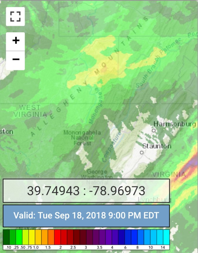
Event rain totals- Bittinger 2nw Valley 1.2, Garrett College 1.3, Grantsville 1.6, Snowshoe 2.0, Canaan State Park .96, Olson Tower 1.3, Blackwater 1.1, Northern Cabin Mt 2.9, Bald Knob 2.2, Spruce Knob 3.1, 7Springs 2.0. Overall 1-3″ event range held well.


Satellite
Flow
Surface features and 500mb height anomalies and flow


On the models…..
Short term, some drier air into the picture.. looking at 10m winds, dew points, some coldest pockets may run in the 39-44 range Thursday morning. Warmer afternoons late this week. 72-80
18z 3km Nam 2m temperatures
18z 3km Nam 2m dewpoints
12z ECMWF precip type next 240hrs, with precip amounts through day 10. Models backed off on the wave along a stalled boundary this weekend. Cooler air as we go into the weekend.

18z GFS…. S, S, S, S YES, the S word is on the model. S should stand for, take with a huge grain of Salt. BUT, its 15 days out, and while October does look to start out cold. I believe first widespread frost and freezes are late Sept or the first week of Oct. The 18z GFS does put out the seasons first flakes around Oct 3rd-4th. At this point, is it likely. NO. Is it impossible, no, its possible. Way too early to tell. How much cold air is able to push on the heels of a early season cold front, and how much moisture is available. Long shots for it to occur. . So the 18z GFS out day 10-16 is as much for fun as to take serious. Having said that, here it is
18z GFS precip type next 384hrs, precip through day 10

Now the flakes on the model…only posting this as its the first run with the cold pushing in and enough so to provide that threat on the season.


Long range as we close out September, open October looks to be on the below normal side of things. Off the 18z GFS ensembles and CFSv2.


