Sept 22. min. max. avg
Bitt 2nw valley 54.5 69.4 61.9
Garrett College 55.4 69.7 62.5
Can-Heights 55.7 68.6 62.2
CRN-Canaan 56.0 69.7 62.8
Cabin Mt 52.5 66.2 59.3
Cabin Mt north 52.7 66.9 59.8
Spruce Knob 54.0 64.8 59.4
Snowshoe 57.9 66.9 62.4
Can-Valley Floor 56.5 71.1 63.8
7Springs 50.7 64.5 57.6
Partly cloudy skies through the heart of the day, with periods of mostly cloudy skies
Temp profile this afternoon


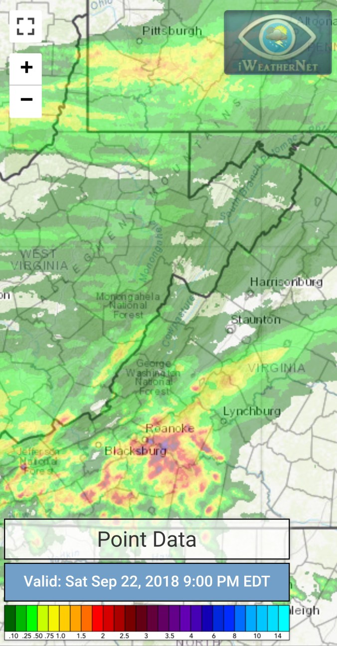
Radar with estimates 9pm-9pm At Bittinger 2nw Valley , picked up .25 past 24 hours
Satellite
Flow
Surface features and 500mb height anomalies and flow


On the models….
Rain pressing in overnight, and south of the mason dixon, a wet Sunday setting up. Temps holding 52-58 for most, 47-53 Wv high ground. Wet weather continues into Tuesday. Overall looking like a 1-3″ rain event. Chilly weather continues through Monday with moderation Tuesday.
Further out, models have delayed and backed off how much “chill” pushes in for early October. The 18z GFS returned to a stronger push Oct 5-8… However it originally appeared next weekend was the onset. That is not to say we won’t see some valley cold before that period. Concerned about the amount of warmth off the mid Atlantic coast feeding back and keeping a stubborn ridge and sw flow aloft , limiting the fronts ability to push through and bring in early season cold. As wave lengths shorten, and cold builds north, that location of warmth can be our friend for inland snows. Way far off and loose speculation.
18z 3km Nam 2m temperatures
18z 3km Nam Simulated Radar
12z ECMWF precip type next 240hrs
12z ECMWF 2m Temperatures
12z ECMWF precip totals through Tuesday
18z GFS precip type next 384hrs
18z GFS 2m temperatures
18z GFS precip totals through Tuesday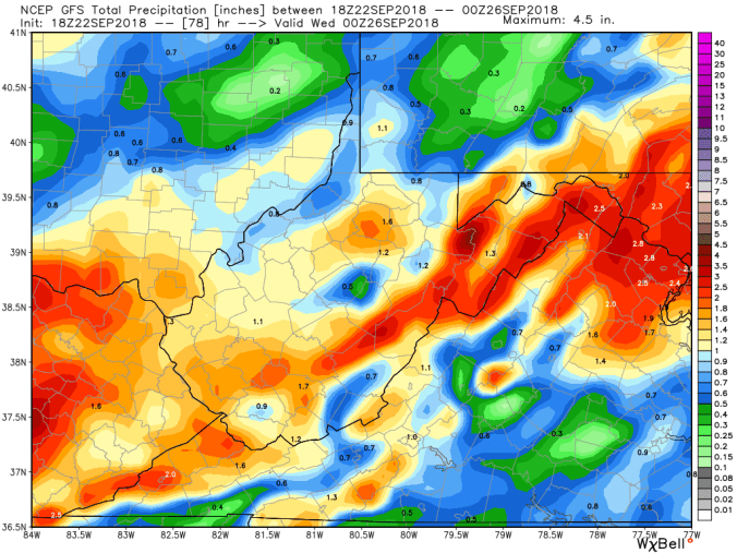
18z GEFS ensemble means… 500mb height anomalies and 2m temp. Really just holds the overall pattern through week 1 Oct. The 18z op run was different, more importantly the 12z ensemble mean looked cooler Oct 5-8. Again, models may adjust and pull back as we get closer.. Only time will tell. The “warm” look to the GFS ensembles that are nearly opposite of only a few days ago.


leaves…..
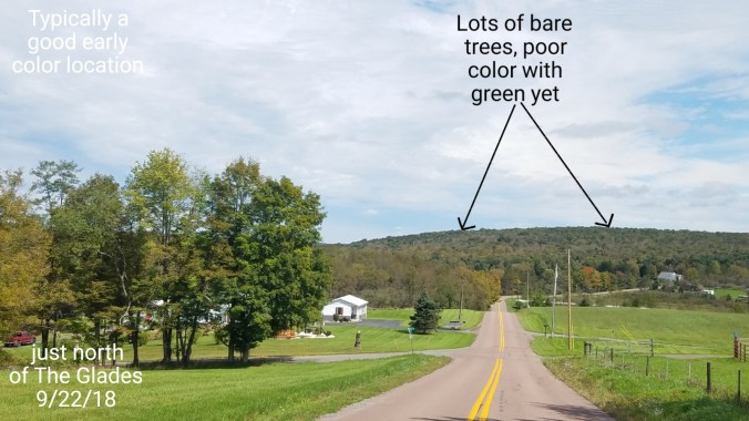
The very poor foliage look continues..Some of the typical more vivid pretty locations with lots of maples are just plain “blah”. Lots of premature leaf drop, and sickly speckled looking dull colors, with healthy looking trees mainly green yet, really poor colors. I do believe this will be the poorest season for maple colors that I can recall. Birch, birch dominates the Blackwater Canyon, Swallow falls state park, some of the cooler high ground river, creek ravines, and mixed with Red Spruce up high…I still believe they are largely unaffected by anthracnose thats plagging some other varieties, namely making that are so vivid usually in the fall.
Example of a area that typically very colorful, pretty. South of Bittinger, north of the Glades. Brenneman Hill in Garrett County Md. Lots of bare trees. I’d estimate 40%+. Other trees sickly, dull looking leaves with red oaks mostly green, with some of them affected by anthracnose as well, with brown patches on the leaves. The chamber of commerce would scream “shut up”, but very low hopes of vivid foliage from current views of the area. Word is, many areas through the Alleghenies are seeing similar occurences. Green, or yet dull and or premature leaf loss.