Sept 23. min. max. avg
Bitt 2nw valley 51.9 54.6 53.2
Garrett College 51.8 55.4 53.6
Can-Heights 54.0 59.6 56.8
Cabin Mt 51.6 56.7 54.1
Cabin Mt north 50.2 55.2 52.7
Spruce Knob 52.0 55.6 53.8
Snowshoe 55.0 57.9 56.5
Can-Valley Floor 54.0 60.6 57.3
7Springs 50.4 53.2 51.8
Cloudy, some fog, times of rain, drizzle, and just cloudiness, east breeze
Temp profile this afternoon


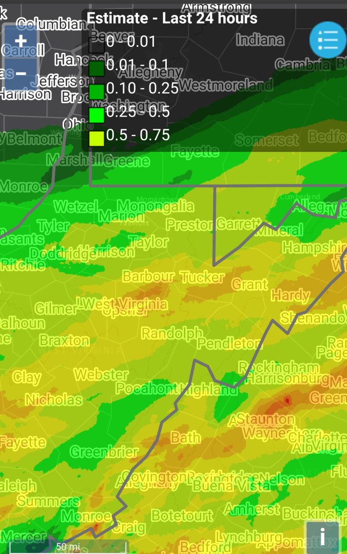
Radar with estimates 9pm-9pm, .23 rain at Bittinger 2nw Valley, .7 at Bald Knob, .5 at CRN at Canaan, .4 at Spruce Knob
 Satellite
Flow
Surface features and 500mb height anomalies and flow


On the models…
Rain, cool yet tomorrow into early Tuesday. Milder Tuesday but the rain threat exist into Wednesday. Not constant, but a on and off fashion.
Further out, the chill for the weekend looks weak, and overall the big chill is delayed. Models differ on the outcome. Some ensemble members still carry the 1st flake threat in early Oct..some members keep the stubborn ridge in place directing the chill further north. Models in limbo on that, plenty of time for things to change.
18z 3km Nam 2m temperatures
18z 3km Nam Simulated Radar
12z ECMWF precip type next 240hrs
12z ECMWF 2m Temperatures
12z ECMWF rainfall through Wednesday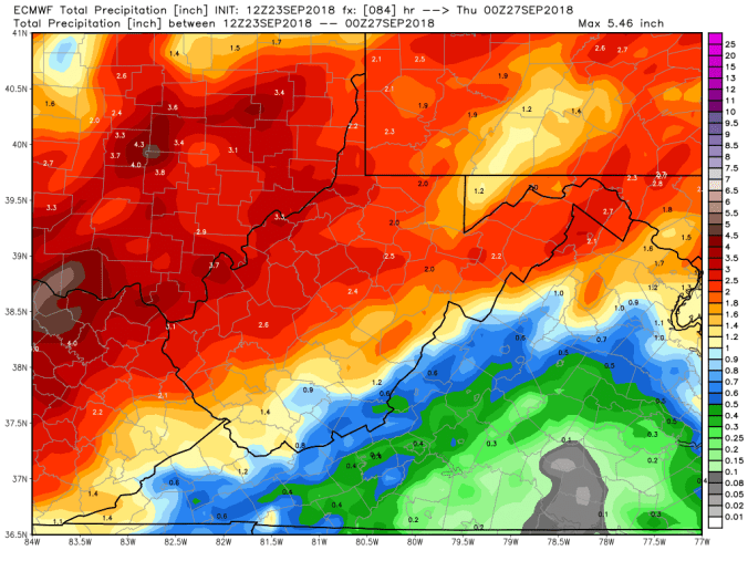
18z GFS precip type next 384hrs
18z GFS precip through Wednesday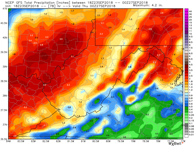
The slow go on the foliage. There is some decent fall color on Canaan Mt, and pockets. Really depends on tree type, soil, location to those areas. West side of Cabin Mt mostly green yet. Here is a comparison of 9/22/17, to today 9/23/18
Some other pics on the day


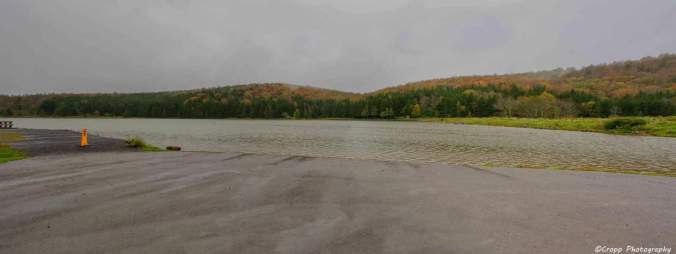
Photo by Charles Cropp at Spruce Knob Lake