Sept 24 min. max. avg
Bitt 2nw valley 53.5 57.1 55.3
Garrett College 53.6 57.7 55.6
Can-Heights 53.5 56.0 54.8
CRN-Canaan 54.4 57.9 56.2
Cabin Mt 50.9 53.6 52.2
Cabin Mt north 50.5 54.0 52.2
Spruce Knob 51.1 54.1 52.6
Snowshoe 54.3 57.0 55.7
Can-Valley Floor 54.7 58.1 56.4
7Springs 52.4 55.4 53.9
Cloudy, fog, drizzly….dreary sums up today
Temp profile this afternoon


Radar with estimates 9pm-9pm, .15 at Bittinger 2nw Valley…apologies for poor radar image. Normal site is down
 Satellite
Flow
Surface features and 500mb height anomalies and flow


On the models….
Showery day tomorrow and milder….then eyes go to a cold front late Wednesday with some storms…
18z 3km Nam 2m temperatures
18z 3km Nam Simulated Radar
Longer range, still no extended dry periods in sight, and the model battle of what happens in the long term remains. As of now, the intrusion of the chill looks weak, and largely gets turned off to the north. That first 10 days of October contains lots of question. Some model runs break the ridge, some do not. Some bring in the seasons first flakes, some runs hold above seasonal temps. Worried(as a cold lover) the ridge has holding power until week 2 Oct. Part of that is the MJO..
12z ECMWF precip type next 240hrs
12z ECMWF total precip through Wednesdays cold front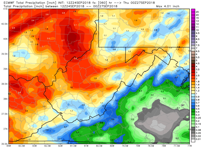
18z GFS precip type next 384hrs
18z GFS Total precip through Wednesdays cold front
18z GFS 2m temperatures next 384hrs
Long range,18z GFS ensembles maintain the ridge in the east through the period. ECMWF is very similiar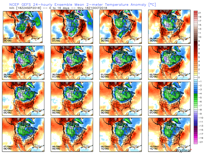 Now look at that pattern the GEFS holds on to and compare that to MJO correlation that is holding phase 8 and 1


Look at what phase 8 and 1 is correlated to bring. So, that may be a hint, that ridge will fight to hold.
This is not to say a strong front can’t push through during this. A few ECMWF and GFS ensemble members see the cold booting the ridge. A few 12z ECMWF ensemble seeing flakes in early Oct.


Pics today


