Sept 27. min. max. avg
Bitt 2nw valley 49.3 55.8 52.5
Garrett College 49.1 57.3 53.2
Can-Heights 48.2 56.4 52.3
CRN-Canaan 50.1 56.2 53.1
Cabin Mt 46.4 55.6 51.0
Cabin Mt north 45.5 54.3 49.9
Spruce Knob 46.8 56.5 51.6
Snowshoe 50.4 57.7 55.2
Can-Valley Floor 50.4 58.8 55.6
7Springs 48.6 53.1 50.8
Cloudy, to rain, rain began earlier in the southern Alleghenies.. Rain, steady to moderate, at times heavy. Fog across wv high ground.
Temp profile this afternoon


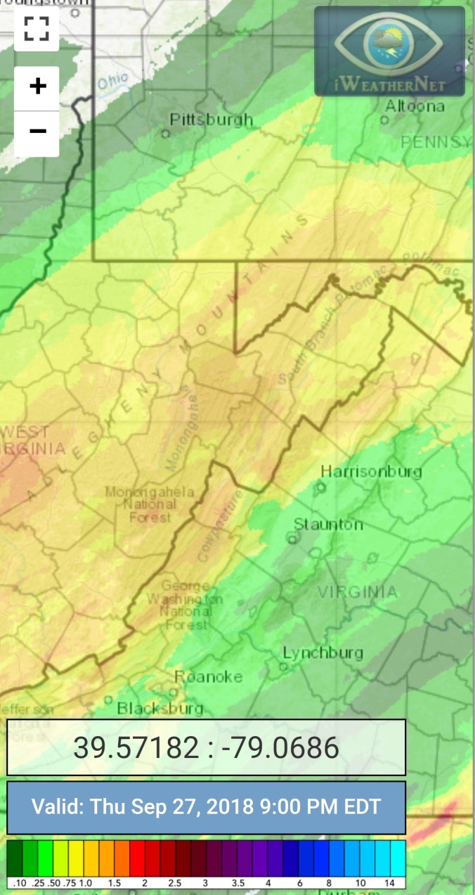
Radar with estimates 9pm-9pm event totals, including the wee hours in to the 28th when the rain halted. Bittinger 2nw Valley 1.7, Garrett College 1.47, Canaan Heights 1.17, CRN 1.68, Cabin Mt at Bald Knob 1.87, Northern Cabin Mt 1.61, Spruce Knob 1.74, Snowshoe 1.61, 7Springs 1.5
Satellite
Flow
Surface features and 500mb height anomalies and flow


On the models..
Short term, heavy rain early tonight, into the predawn hours of Friday, before becoming scattered, and light and shutting off with the clouds breaking some tomorrow. Chilly few days ahead before moderating Sunday. Monitoring a shot at some scattered pockets of 30s Saturday and or Sunday a.m. Be careful out tonight with the flooding occuring.
18z 3km Nam 2m temperatures
18z 3km Nam Simulated Radar
18z GFS precip type next 384hrs
