Sept 20. min. max. avg
Bitt 2nw valley 48.8 76.0 62.4
Garrett College 52.3 80.0 66.1
Can-Heights 56.6 75.6 66.1
CRN-Canaan 52.4 76.5 64.5
Cabin Mt 57.4 75.0 66.2
Cabin Mt north 57.6 76.5 67.0
Spruce Knob 57.9 74.3 66.1
Snowshoe 60.6 73.4 67.0
Can-Valley Floor 50.9 78.8 64.8
7Springs 62.1 77.1 69.6
Clear start, valley fog, allowing for some cooler conditions to start. Some clouds popping up throughout the day.
Temp profile this afternoon


Radar estimates from 9pm to 9pm. No radar video with no rain in the area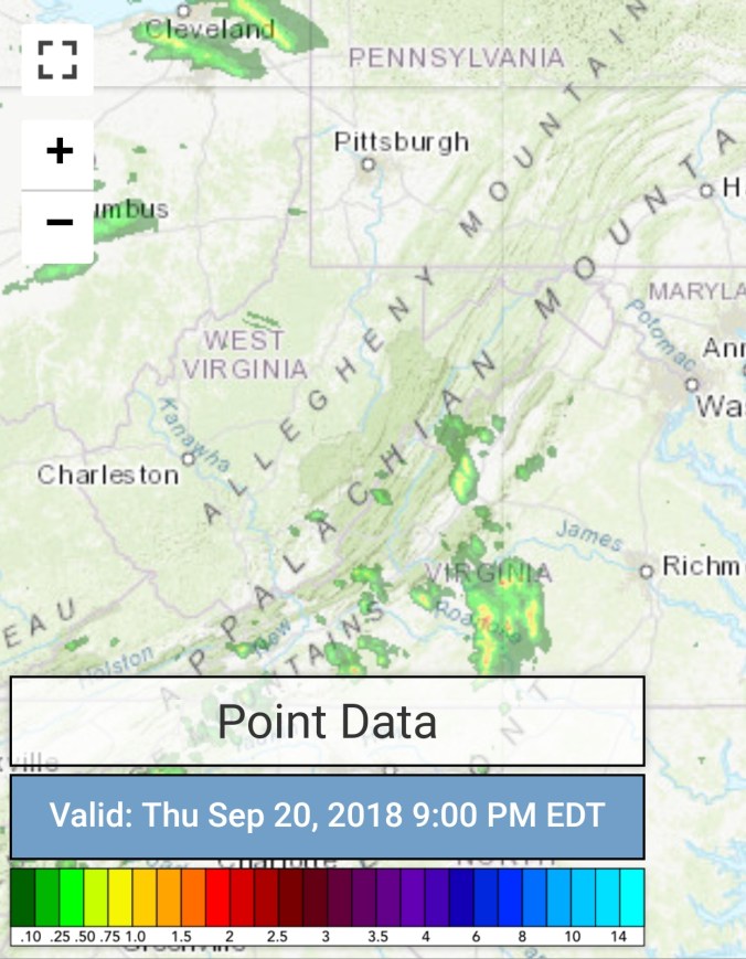
Satellite
Flow
Surface features and 500mb height anomalies and flow


On the models….
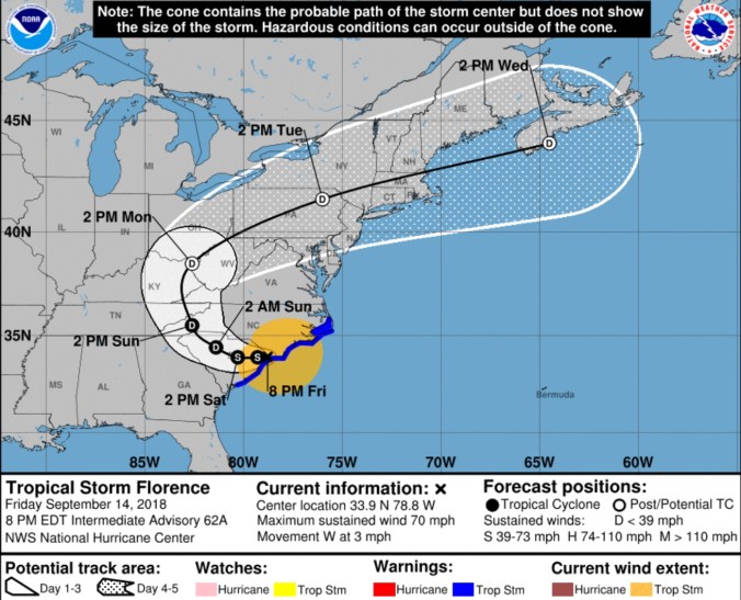
Short term, how far south does the line that potentially has some severe storms tomorrow make it tomorrow evening. Right now it looks to be after nightfall tomorrow that the front nears and it appears the line of storms weaken as well, but still may contain some severe cells. Stay alert on that tomorrow, and will post to facebook. Then that front stalls and will be a focal point of another round of rain this weekend. Question is, how far does the front push and where the steady rain sets up Saturday night, and Sunday. There will also be showers Saturday, mainly Wv mts.
18z 3km nam 2m temperatures
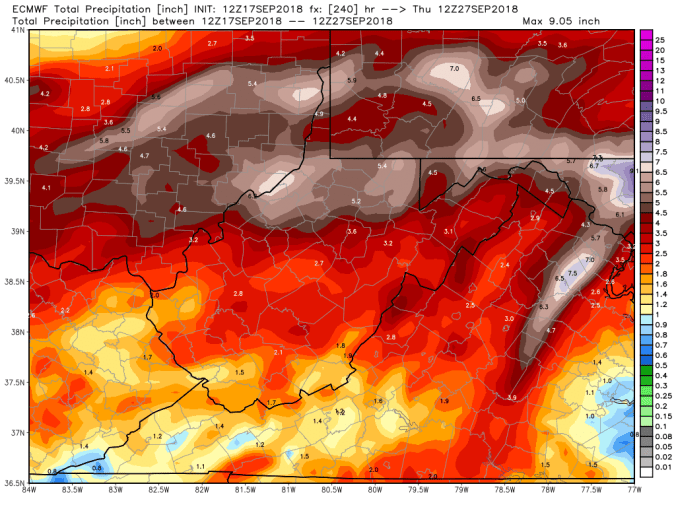
12z ECMWF precip type next 240hrs, with precip amounts next 10 days
 12z ECMWF lightning density. The model clearly picking up on a dying of the storms tomorrow
18z GFS precip type next 384hrs with precip next 10. (Keep in mind op runs can change significantly on precip placement several days out)

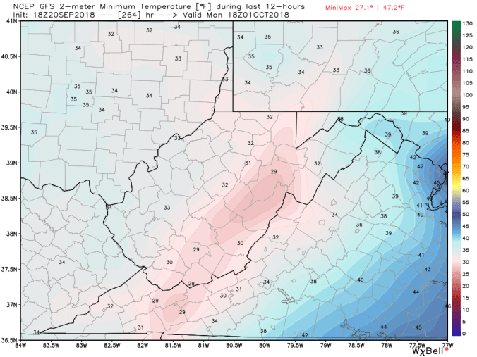
18z GFS 2m temperatures next 384 hours. Now details will fail, overall outlook should hold. What to expect. As we close September and go into October, expect widespread frost ,freezes.. Especially valley freezes and those frost pockets, looking from this far out, a range with some mins falling into the 18-24° range looks reasonable. 28-33 most locations. Again, this will ne tweaked on numbers, and timing.
This will kick start areas of slow changing leaves. It may also make for a shortened foliage season. Keep in mind, many areas that have those typical early changers, a lot of those spots, the trees have already lost some leaves prematurely due to anthracnose. You go out on western Cabin Mt across the top. Some maple areas are past peak now, and that did not contain much color, due to early leaf drop. Heres a pick from Bittinger 2nw Valley today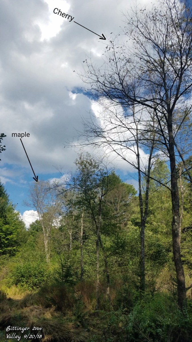
Those leaves fell without much color at all. So, its some of the early changer are bare, others remaining green to just beginning to change. Wv high ground, Sept 29- Oct 6 should be good for best colors. Blackwater Canyon, Oct 4-12… Those cold temps should ignite the change. Many areas will fall in that date range as well. Later than last year with the warmth of this month vs the cold start to Sept last year. Not much off normal, assuming these dates play out this year. Last year, the 2nd half of September warmed, and that slowed down the later changing trees to early Oct.
Last but not least. This will all involve timing of the fronts and precip available, first flakes early Oct are not ruled out yet. 3 members of the GFS ensemble package has it, 2 of the ECMWF. Here is the GFS 
GFS ensemble temp outlook next 16, frost, freeze opportunity should exist multiple mornings. 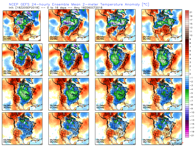


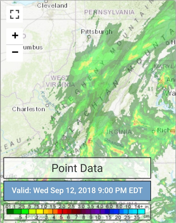
 Radar with estimates 9pm-9pm, right at .5 since 6pm last night at Bittinger 2nw Valley
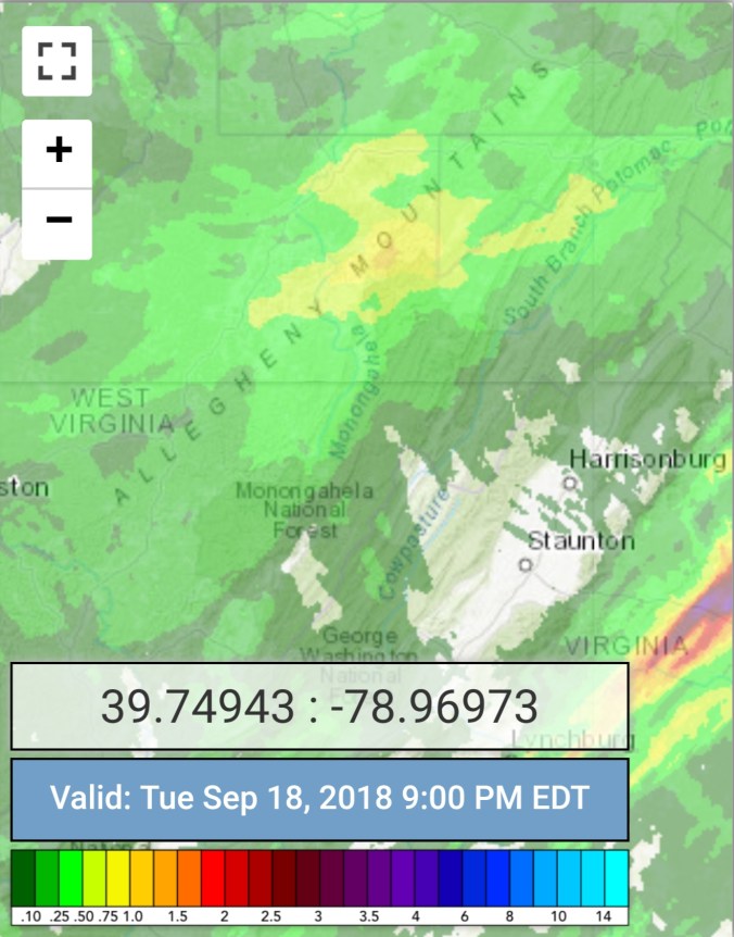


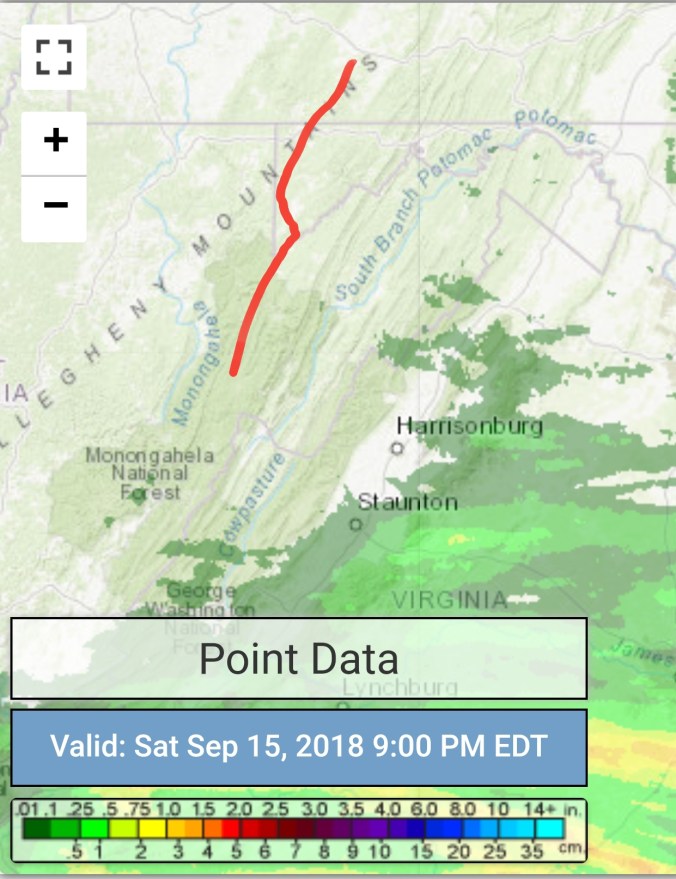
 Radar with estimates 9pm-9pm, .65 at Bittinger 2nw Valley
 Satellite


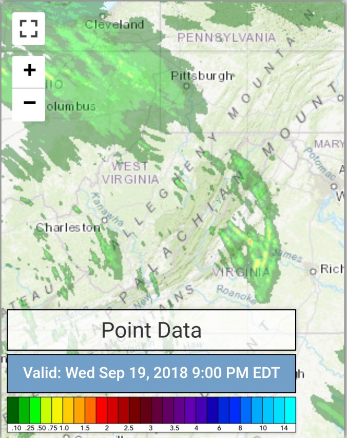
 Radar with estimates 9pm-9pm , picked up only trace at Bittinger 2nw Valley..
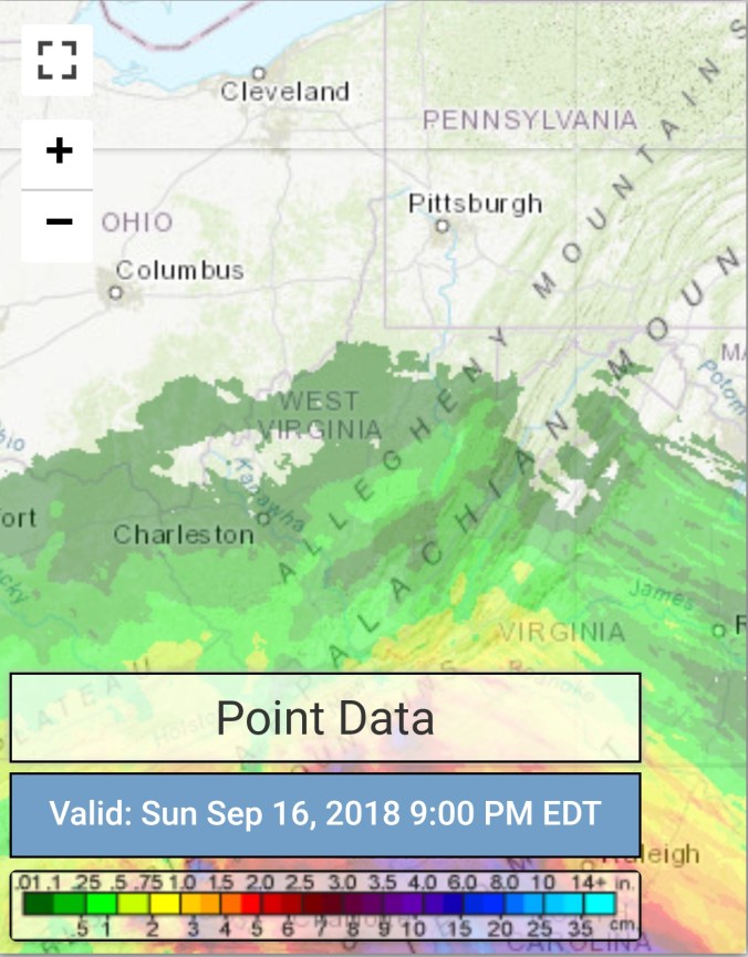 Satellite


 Satellite


 Satellite