Oct 2. min. max. avg
Bitt 2nw valley 49.8 72.4 61.1
Garrett College 53.8 73.0 63.2
Can-Heights. 56.5 69.9 64.2
CRN-Canaan 57.7 69.6 65.5
Cabin Mt 58.1 64.6 61.3
Cabin Mt north 58.5 68.2 63.3
Spruce Knob. x
Snowshoe 58.8 63.7 61.2
Can-Valley Floor 45.0 70.2 57.6
7Springs 62.5 68.4 65.4
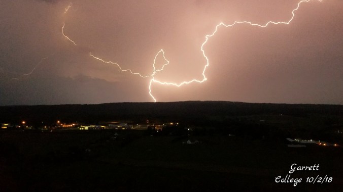
Partly cloudy start to quickly building random storms after daybreak. The low eastern sun, incoming storm, big puffy white and dark clouds gave a weird hue to the morning sky, with even a rainbow forming in the western sky. Morning showers, then mainly cloudy with a few peaks o sun. Late evening storm that put out a lot of severe watches, including tornado.
Temp profile this afternoon


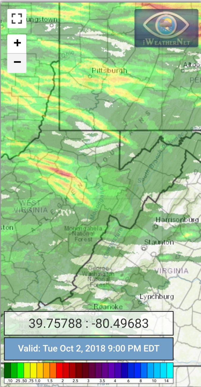
Radar with estimates 9pm-9pm..picked up .05 at Bittinger 2nw Valley through 6pm, that was with the morning showers
Satellite
Flow
Surface features and 500mb height anomalies and flow


Pics today


Late day severe weather…
7 years ago today
1st snow of the season across the Wv high ground. 4-10″ fell across the Wv mts above 3500 with a few inches down to 3000′. Temps marginal in that lower elevation range. I spent the night of Oct 1, morning of Oct 2nd on Spruce Knob. By morning several inches of snow had accumulated. Going down the east side, snow accumulation on the ground quickly tapered off, but the trees seemed to hold more. Enough so, there were some trees down. Once below 3800′ things were mainly bare. At Canaan the valleys were bare, but light accumulations above 3500′. Through that day, snow levels lowered and picked back up. Temps failed to climb above freezing across some of the high ground the 2nd and 3rd.


Spruce Knob after round 1 of 2 (all these pics Oct 2, 2011)


Seneca Rocks, all clear down low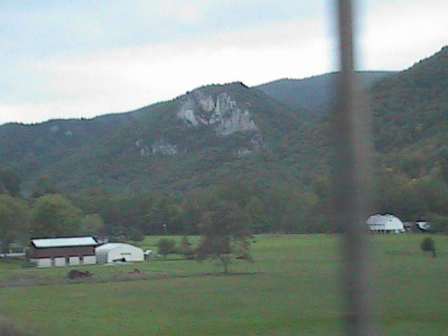
Canaan Heights after round 1 of 2


