Oct 12. min. max. avg
Bitt 2nw valley 40.1 47.7 43.9
Garrett College 40.1 47.8 43.9
Can-Heights 34.1 45.0 39.5
CRN-Canaan 35.2 47.0 34.7
Cabin Mt 31.3 44.6 37.9
Cabin Mt north 32.0 44.1 38.0
Spruce Knob. x
Snowshoe 32.0 45.7 38.8
Can-Valley Floor 36.5 48.0 42.2
7Springs 37.4 45.3 41.3
Cloudy morning, high elevation Wv fog with temps below freezing,,windchills teens there. This also lead to reported first flakes with the available moisture freezing and falling around 4000′. Likely a touch of rime above 4100′.. Skies broke for a sunnier afternoon.
Temp profile this afternoon


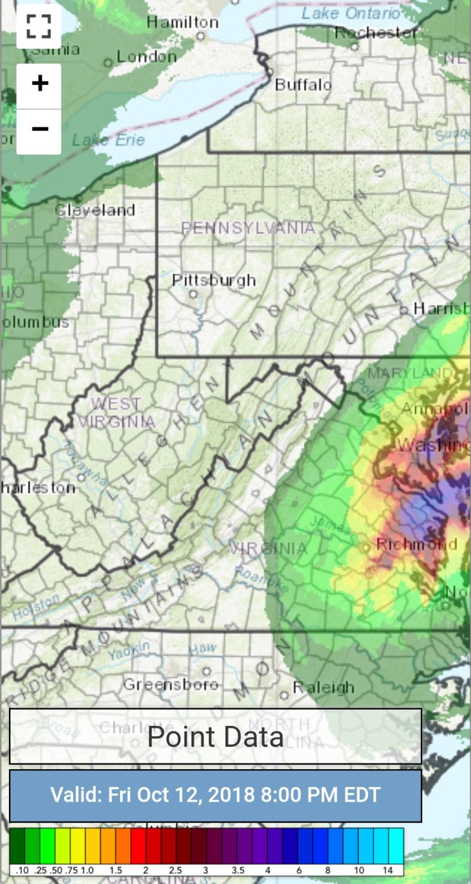
Radar with estimates 9pm-9pm
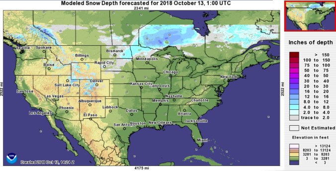
Snow depths
Satellite
Flow
Surface features and 500mb height anomalies and flow


Flakes…
Vernon Patterson reported flakes at sunrise at Bear Rocks. Likely similar across Cabin Mt, Plains, and through the highest parts of the Alleghenies. Enough moisture in the air, temps below freezing, strong winds, enough to freeze the moisture and let it fall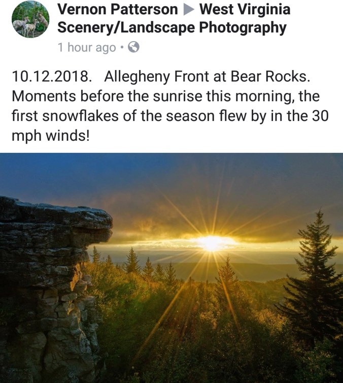
On the models..
Sticking short term with 3km Nam..
Precip pushing in overnight. Rain initially, switching to snow above 2600′. Temps mild enough(relatively speaking) that coatings to 1/2″ should be limited to 3700’+. Temps 29-33° above 3700′, 33-38° 2500-3700′, 36-42° 2000-2500′. Windchills upper teens, low 20ss above 4000′ 25-35 elsewhere. Not a lot of temp rise Saturday. 35-40 above 3700′ 40-45 2500-3700, 43-49 1500-2500′. One more cold night Saturday night before moderation Sunday-Tuesday before the next cold surge.
18z 3km Nam 2m temperatures
18z 3km Nam 850 temps (5000′ temps)
18z 3km Nam WindChills
18z 3km Nam Simulated Radar
North America Snow Extent
Highest in 14 years of this data set that has monitored it. This on the heels of a very cold September across Canada. I believe I read(need to DoubleClick)Canada as a whole had its coldest September in 65 years. The snowpack has built on our side of the pole and may play a role as we go into our snow season. 
