Oct 13. min. max. avg
Bitt 2nw valley 35.9 41.7mn 38.8
Garrett College 37.9 41.0 39.5
Can-Heights 30.6 39.1 34.8
CRN-Canaan 29.4 40.0 34.7
Cabin Mt 29.7 36.1 32.9
Cabin Mt north 30.2 37.4 33.8
Spruce Knob * afternoon max 34
Snowshoe 30.9 38.3 34.6
Can-Valley Floor 28.9 41.0 34.9
7Springs 32.2 39.4 35.8
Cloudy, showers early, few areas with wet flakes mixed in, with straight snow showers across the Wv high ground with whitenings above 4000′. Some areas saw a peak or 2 of sun.
Temp profile this afternoon. Bald Knob peak temps occured at the midnight periods. Midnight of the 12th into the 13th, then the afternoon hovered near freezing and a bit of a return flow pushed the midnight temp going into the 14th back up. The high ground mins, valley mins were reached at different times. The pm hours after dark, the skies broke some with calm winds allowing the valleys to briefly fall. The high ground reached their mins in the a.m after daybreak on NW winds. At Bittinger 2nw valley, I had no breaks in sky cover.


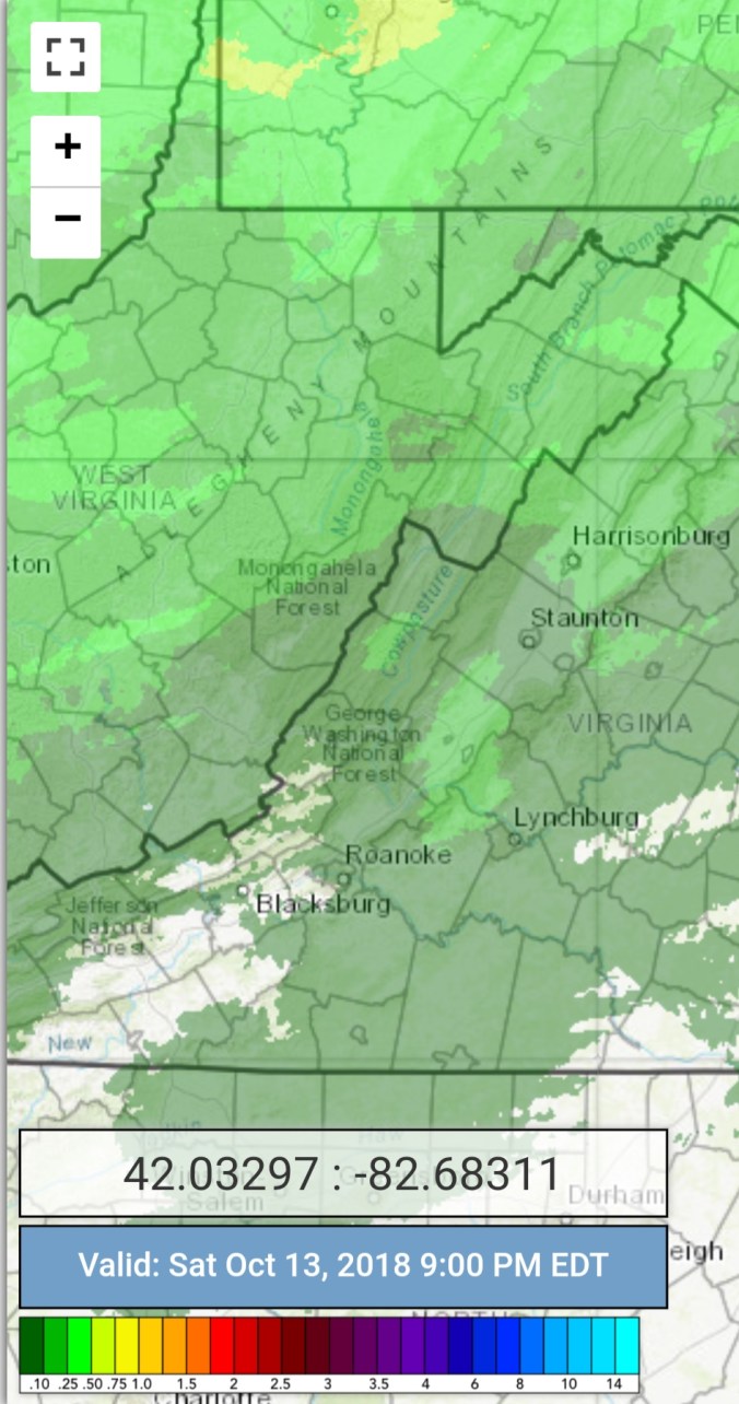
Radar with estimates 9pm-9pm . Picked up .2 at Bittinger 2nw Valley
Snow depths
Satellite this afternoon
Flow(late day)
Surface features and 500mb height anomalies and flow


Snow and Rainbows


Pics by Jeremy Cutlip on the Highland Scenic Highway


Pics from Spruce Knob by David Carroll and his Virginia Tech students. They make so much of this data collecting possible. Without them, a lot of this would not be doable. A huge thanks for all they do. They bring the outdoor harsh conditions available to view in the comfort of your living room.


Webcam shots at Snowshoe. A widely shared photo predawn today, is one that appears to be snowcover and in reality its wet grass illuminated by lighting, camera lighting distorts it. Appears as snow. Ive been fooled 500 times by it.


Videos heading up Baldy and atop Baldy
The holdout foliage hope. Blackwater Canyon still on par to provide nice color. Birch in the process of going yellow. Over the next week it should peak out


