Oct 14. min. max. avg
Bitt 2nw valley 36.0 52.7 44.3
Garrett College 36.9 53.2 45.0
Can-Heights 30.6 50.7 40.7
CRN-Canaan 31.0 50.9 41.0
Cabin Mt 35.1 48.9 42.0
Cabin Mt north 31.5 48.7 40.1
Spruce Knob 34.3 46.6 40.4
Snowshoe 36.9 48.7 42.8
Can-Valley Floor 29.3 52.7 41.0
7Springs * 34.4 49.8 42.1
7Springs at 2540′ * 38.1 54.6 46.3
(The 7Springs 2900′ appears to be calibrated low for readings. The difference in 400′ seems to great for max temps often)
Cloudy start, a period of morning rain, cloudy afternoon with some mist, fog around 6pm, transitioning to a light rain 9pm.
Temp profile this afternoon


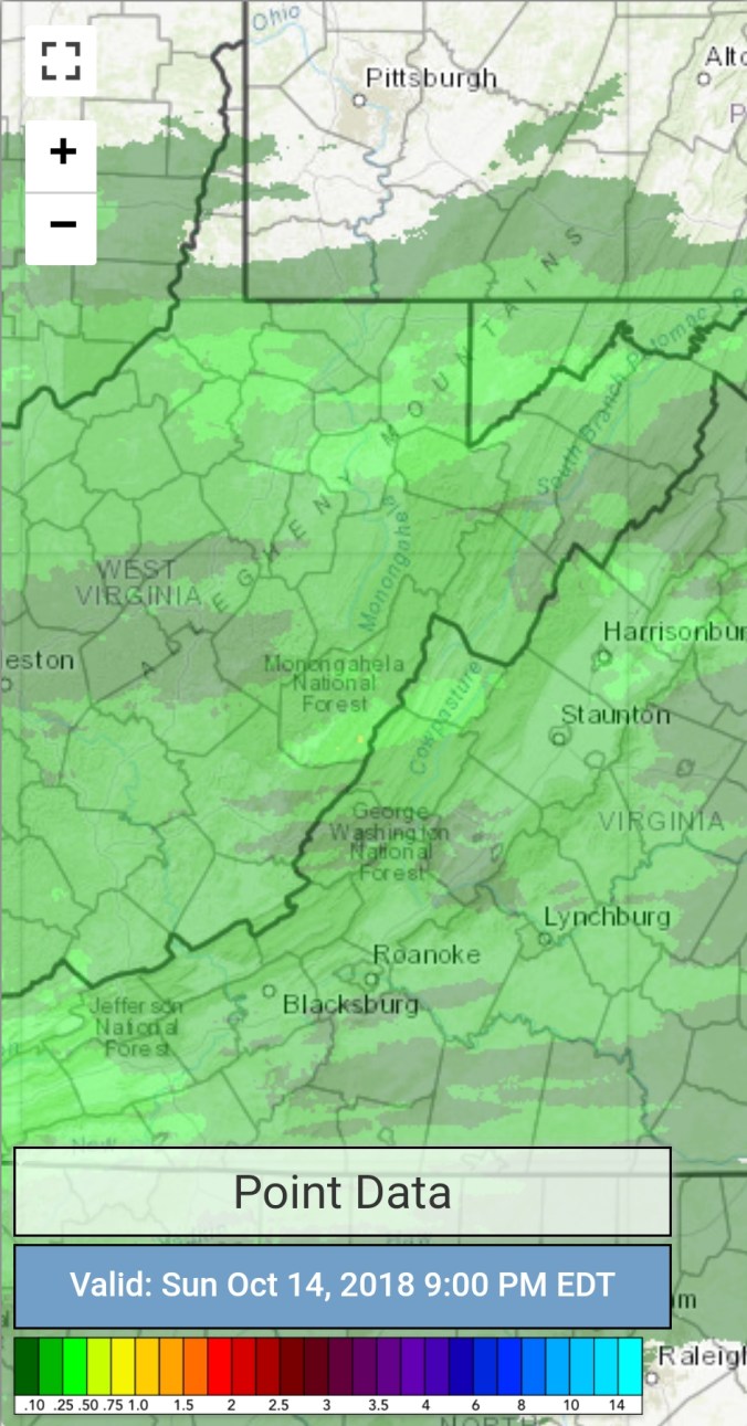
Radar with estimates 9pm-9pm. Rainfall of .15 at Bittinger 2nw Valley today.
Satellite
Flow
Surface features and 500mb height anomalies and flow


Pics….
Most of these around the Cunningham Swamp. Lots of maple in this area, some cherry…few oaks. Hillsides 80-90% bare.


On the models…..
Showers tonight, Monday, before clearing off overnight Monday. That should setup Tuesday a.m as the most widespread morning with temps below freezing across the valleys. A chilly midweek. I think Thursday a.m should see the coldest pockets run temps into the 15-20 range to start the day. Most widespread killing frost/ freeze… Next snow potential to whiten things, currently looks like next Sunday, low confidence in that 7 days out.
