Oct 15. min. max. avg
Bitt 2nw valley 44.1 62.0 53.0
Garrett College 44.7 61.8 53.2
Can-Heights 44.0 58.3 51.2
CRN-Canaan 42.4 59.2 50.8
Cabin Mt 42.4 54.9 48.6
Cabin Mt north 42.3 57.2 49.7
Spruce Knob 41.5 54.1 47.8
Snowshoe 45.0 55.9 50.5
Can-Valley Floor 46.2 61.0 53.6
7Springs 40.4 57.9 49.2
Cloudy, showers breaking out mid morning, on and off all day. Turning windy. The peaks of blue you see off the Rt 40 cam, never saw that back towards Bittinger, Mchenry.
Temp profile this afternoon


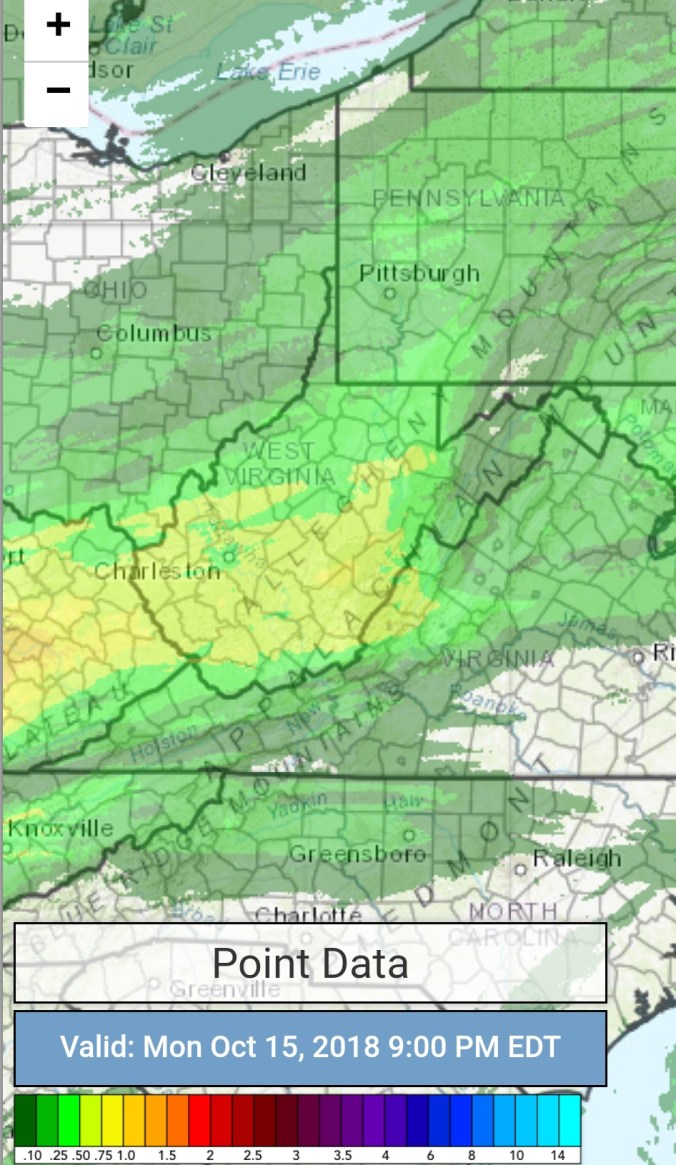
Radar with estimates 9pm-9pm . Picked up .25 through 6pm at Bittinger 2nw Valley
Satellite
Flow
Surface features and 500mb height anomalies and flow


Pics


On the models…..
Cold air returns overnight after the hiatus today. Dropping temps, lowering dewpoints, and things drying out. Finally. Areas at or below freezing in the morning. The chill holds through the week, with Thursday a.m being the coldest period. If things go calm pre daybreak, coldest valleys see teens. If winds hold up just a little, as it looks like now they may, high ground will see the coldest temps with mins 21-25. Most all areas below freezing Thursday a.m. If you’ve not seen a frost, freeze yet. Thursday a.m should change that. Watching the weekend with some rain to snow. Possibly some light accumulations Sunday. May be a good period to get some some snow on foliage pics in the Blackwater Canyon if this pans out, stay tuned. If it occurs, its likely not exclusively only above 4000′. Long range, cold shots and precip opportunities. Can they match up for a early season thump? The potential is most definetly alive.
18z 3km Nam 2m temperatures
18z 3km Nam 2m Dewpoints
18z 3km Nam Windchills
18z GFS precip type next next 384hrs
18z GFS 2m temperatures next 10
Little peak at some of the 12z ECMWF ensemble members on snowfall next 15 days. Potential is there. 
