Oct 24. min. max. avg
Bitt 2nw valley 28.2 43.5 35.8
Garrett College 29.6 41.8 35.7
Can-Heights 27.5 41.1 34.3
CRN-Canaan 25.6 42.7 34.1
Cabin Mt 26.4 39.7 33.0
Cabin Mt north 27.3 38.3 32.8
Spruce Knob 26.2 36.1 31.1
Snowshoe x
Can-Valley Floor 21.9 44.2 33.0
7Springs 30.2 38.0 34.1
Times of clouds, times of clouds and sun, breezy.
Temp profile this afternoon


nothing on radar
Satellite
Flow
Surface features and 500mb height anomalies and flow


On the models….
Sticking short term. Precip pushing in Friday and running into the weekend. For most, its looking like a cold, check that, a miserable cold, rainy period coming up. As the rain pushes in Friday afternoon, there may be a brief mix shortly after the precip onset along the Allegheny Front. Wet Flakes, and or a little freezing rain before temps creep back up. The next piece of energy comes in Monday-Tuesday. That may end as brief snow across the mts.
18z 3km Nam 2m temperatures
18z 3km Nam precip type through Friday….hinting at a little wintry mix along the high ground of the Allegheny Front.
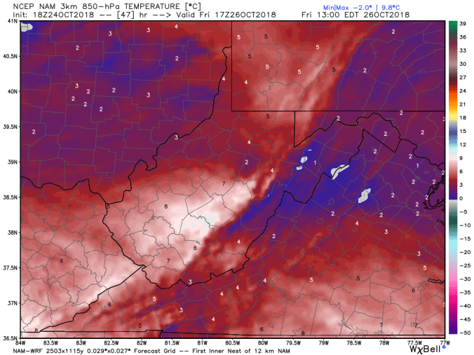
850 temps off the 18z 3km Nam Friday afternoon.
12z ECMWF precip totals through Sunday
