Oct 25 min. max. avg
Bitt 2nw valley 22.4 44.9 33.6
Garrett College 25.7 47.9 36.8
Can-Heights 22.7 46.2 34.5
CRN-Canaan 23.9 47.4 35.6
Cabin Mt 24.3 45.9 35.1
Cabin Mt north 25.7 45.1 35.4
Spruce Knob 25.5 46.6 36.0
Snowshoe** 28.9 48.6 38.8
Can-Valley Floor 16.5 48.9 32.7
7Springs 28.0 39.0 33.5
**using Snowshoe station at 4800′, other site still down.
Mainly clear start, some clouds pushing in shortly after daybreak. A high cloud deck worked in, in the afternoon.
Temp profile this afternoon


No precip
Satellite
Flow
Surface features and 500mb height anomalies and flow


Pics on the day


On the models…..
Precip pushing in tomorrow, looks light and increasing later in the day. This looks primarily in the rain form for most. Along the high areas of Cheat Mt, up the Allegheny Front, possibly along Dans Mt, Savage Mt also(less likely) a wintry mix may occur for later tomorrow afternoon into the early overnight. A likely difference from Bear Rocks to Cabin Mt. 1 or 2 degrees will make a big difference. Question is, is all areas above freezing or do these areas slip just below. This transitions to all light rain region wide after midnight into Saturday a.m. As the NW winds wrap back around, maybe some wet flakes at the highest spots later Saturday. More showers Sunday, Monday that again may end as flakes as it ends into Tuesday.
18z 3km Nam 2m temperatures
18z 3km Nam precip type
18z 3km Nam 850 temps later Friday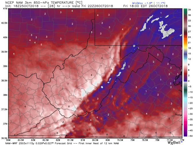
12z 2m temperatures
12z ECMWF precip type next 240hrs
12z ECMWF wintry precip
12z ECMWF precip totals through Sunday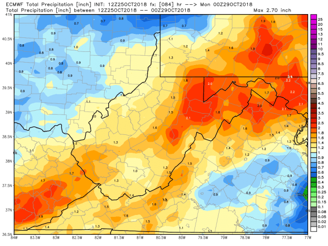
Monitor some of the surface temps tomorrow after precip onset at Snowshoe, Spruce Knob, Mt.Storm, Savage Mt.
