Oct 27. min. max. avg
Bitt 2nw valley 36.6 45.1 40.8
Garrett College 36.5 45.4 40.9
Can-Heights 35.7 44.6 40.2
CRN-Canaan 36.2 44.1 40.1
Cabin Mt 32.7 41.9 37.3
Cabin Mt north 32.2 42.1 37.1
Spruce Knob 31.8 41.0 36.4
Snowshoe 31.5 42.1 36.8
Can-Valley Floor 37.4 47.1 42.2
7Springs 35.1 41.4 38.2
Cloudy, mist, light rain, fog, dreary, miserable.
Temp profile this afternoon


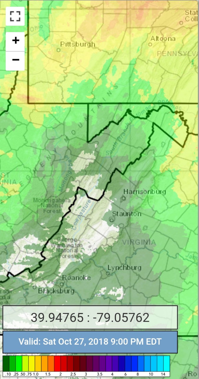
Radar with estimates 9pm-9pm . Picked up .4 at Bittinger 2nw Valley since 6pm the 26th through 6pm tonight
Satellite
Flow
Surface features and 500mb height anomalies and flow


On the models….
Sticking short term. Light rain, mist, drizzle continuing overnight. Some fine flakes, rime , light icing may develop above 4000′. Another piece of energy drops in tomorrow afternoon. Initially re-warming the upper levels to provide straight liquid. As we go through Sunday night into Monday morning, as the system passes, colder air rushes back in Changes some liquid to some snow. . Marginal cold air, but cold enough a light coating up to a inch above 3700-3800’+ with the best and most likelihood above 4000′. Temps holding 29-33 above 4000′ Monday as temps fall from midnight maxes. Winds gusting 35-50mph above 4000′ with windchills 15-20. Elsewhere 36-40°Monday, wind gust 15-35mph and some flakes possible in the western upslopes down to 2500′ , no stickage. Windchills 20s.
Beyond that, a nice,but brief midweek warm up.
18z 3km Nam 2m temperatures
18z 3km Nam precip type
18z 3km Nam 850 temps
18z 3km Nam 10m Wind gust
18z 3km Nam Windchills
