Oct 21. min. max. avg
Bitt 2nw valley 28.5 36.0mn 32.2
Garrett College 28.9 36.3 32.6
Can-Heights 25.4 31.5 28.5
CRN-Canaan
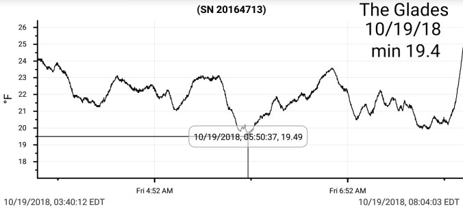
Cabin Mt. 22.5 28.2 25.3
Cabin Mt north 23.9 29.7 26.8
Spruce Knob 21.4 26.8 24.1
Snowshoe 21.6 28.6 24.8
Can-Valley Floor 28.2 33.2 30.7
7Springs 27.0 33.3 30.1
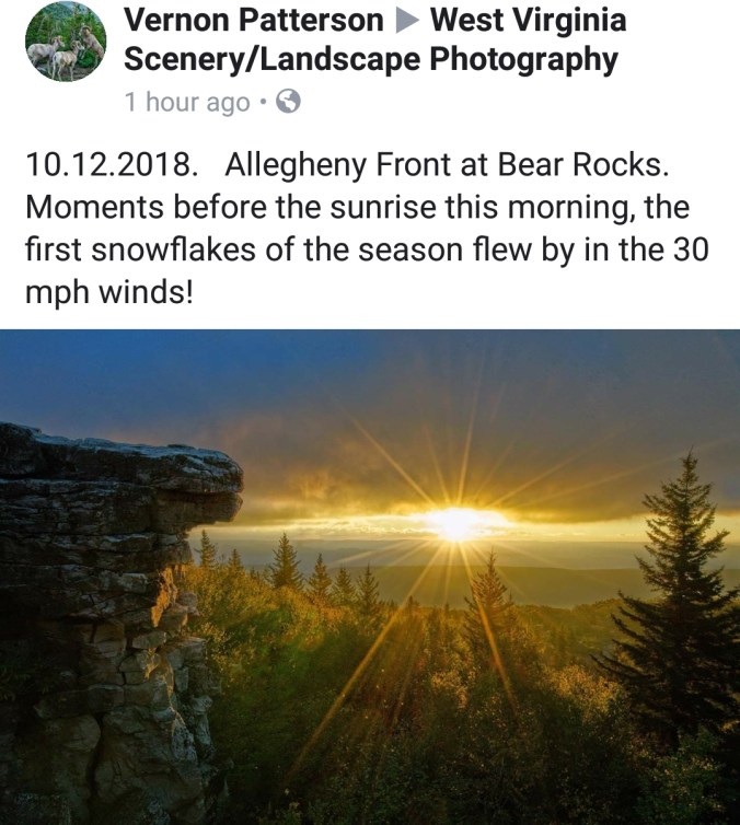
Overnight snow, a few pockets of light snow scattered about today. High ground fog. Otherwise it was just a mainly cloudy day. Snow cover remained all day.
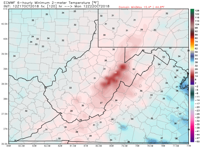
Temp profile this afternoon(Wv high ground above 4000′ holding lower to mid 20s all day. Northern Cabin had wind gust over 50mph later yesterday.


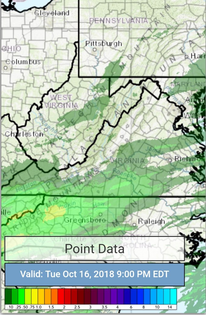
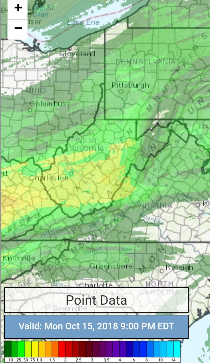
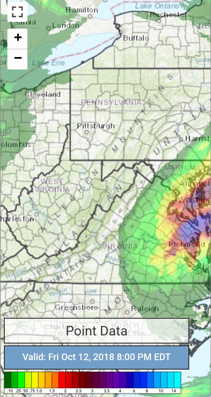
Radar with estimates 9pm-9pm, I didn’t get the graphic in, in time yesterday, so going with 48 hour totals vs the typical 24.. At Bittinger 2nw Valley coming in a .62
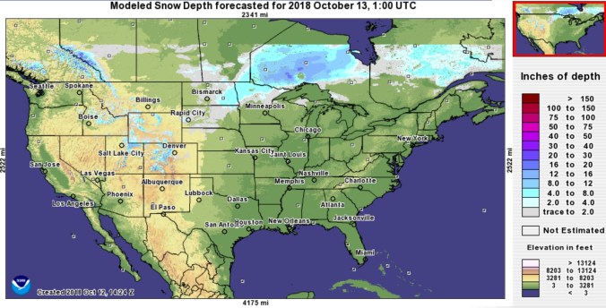
Snowfall
1.0″ at Bittinger 2nw Valley


Davis 3SE/Canaan Heights 2.3″
Snowshoe 3.0″
On Bald Knob, I’d estimate right around 3″.
Satellite
Flow
Surface features and 500mb height anomalies and flow


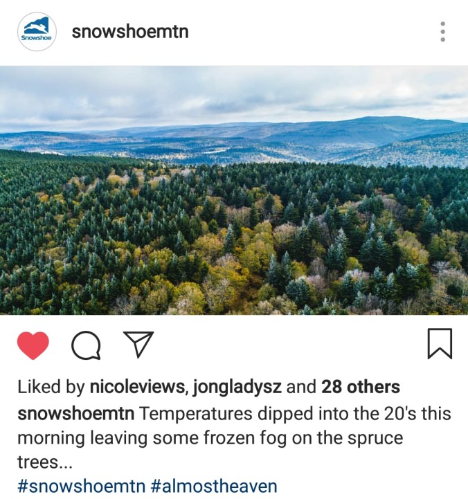
Pics today


Pics by Dave Perrine at Spruce Knob


Pics by Gerri Ann Atkinson at Gaudineer Knob


Pics by Walter Scriptunas II at the Cass Scenic Railroad to Bald Knob in Pocahontas County
Check out his photography work on his photography page on Facebook


Pics by Jonathan Gladysz at Red Spruce Knob


Pic by Rosanna Springston at the Highland Scenic Highway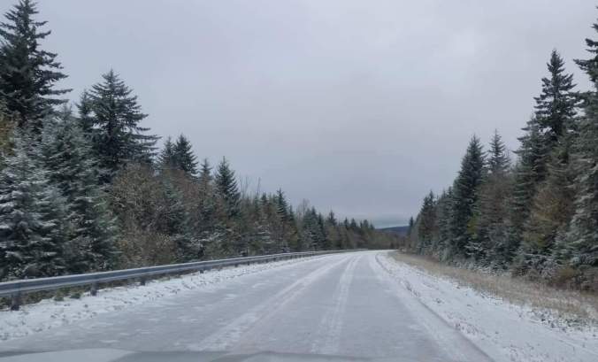
Pics by David Faunce at Pendleton Lake at Blackwater Falls State Park


Videos today
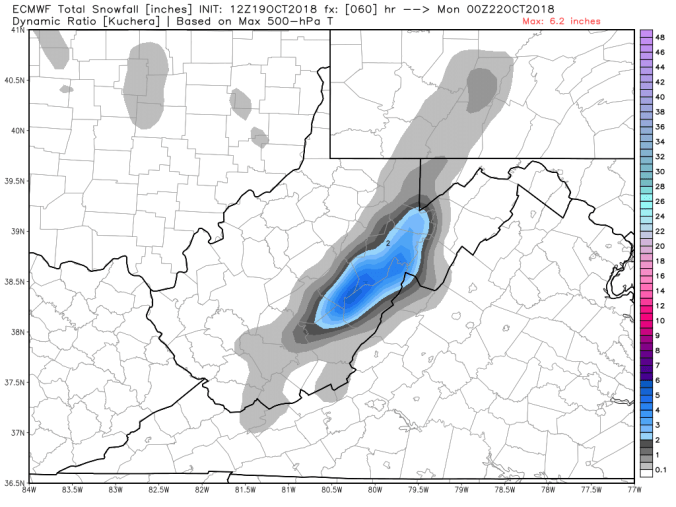
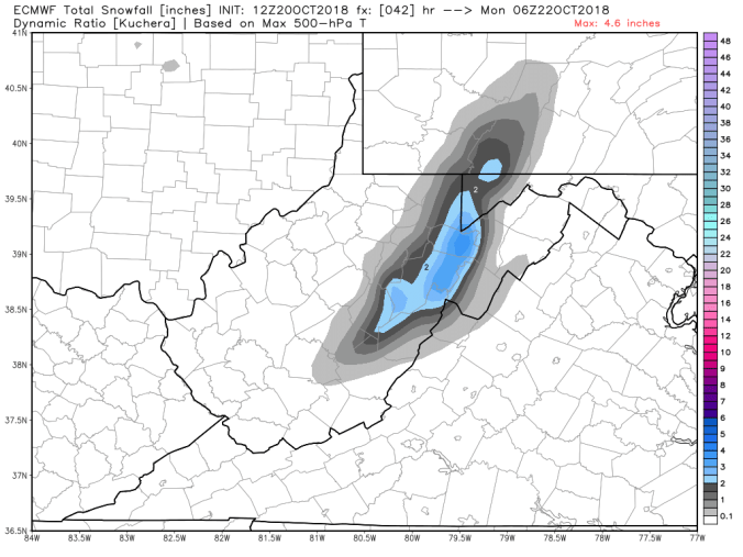
On the models
A semi tranquil, chilly week ahead. Then eyes turn to a system coming up from the south. Track, intensity, timing will have a impact on whether or not this sets up as a early season wet heavy snowfall for the Alleghenies. As of now, this is the ticket to watch.
12z ECMWF precip type next 240hrs
12z ECMWF 2m Temperatures


 No rain, nothing on radar past 24, straight to todays satellite