Nov 6(Tues) min. max. avg
Bitt 2nw valley 45.8 58.6 52.2
Garrett College 46.3 59.1 52.7
Can-Heights 42.9 54.8 48.8
CRN-Canaan 44.3 56.9 50.6
Cabin Mt 41.0 53.2 47.1
Cabin Mt north 42.6 56.7 49.6
Spruce Knob 39.0 50.5 44.7
Snowshoe 40.1 51.3 45.7
Can-Valley Floor 31.6 58.1 44.8
7Springs 44.1 56.4 50.2
Starting off with rain, wind, some areas with some storms….slowly gave way to breaking skies midday on.
Temp profile this afternoon


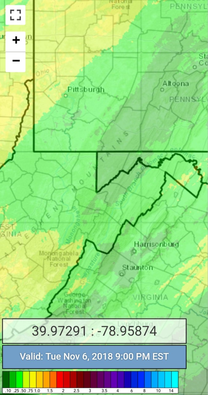
Radar with estimates 9pm-9pm Picked up .25 at Bittinger 2nw Valley
Satellite
Flow
Surface features and 500mb height anomalies and flow


On the models…..
Mini taste coming in Saturday with Friday/Friday night’s showers changing to snow showers. Continuing Saturday. Looks like coatings to a inch. That melts off Sunday and the focus goes to early to mid next week.(Looking like Tuesdau-Wednesday) Snowshowers, upslope snows, windy, cold and downright cold. We may have days mid next week with highs 18-23° for most and 12-18° for areas above 4000′ mins in the single digits, windchills 0 to 10 below during the coldest period with windchills in excess of -20 above 4000′. Late week, as high pressure moves in, with any snow cover, the coldest high valleys may see air temps dropping below 0. That’s on the table. That’s potentially what we are looking at. Really a taste of real winter weather. This upcoming period should be like hooking jumper cables up to dead battery for ski resorts that are looking to get a early start. Snowshoe, 7Springs are a lock for this, will anyone else follow suit? This is not to say we are locked into winter, but this should allow for a good base for areas wishing for the jump start.
12z ECMWF precip type next 240hrs
12z ECMWF 2m Temperatures
12z ECMWF windchills…keep in mind, this is a 9km model.. High ground can and does often beat these numbers
Too far out to throw in snow amounts. But, this far out plan to have snow covered roads, blowing snow and plowable snow. Those details will come as we get closer.
