Nov 17(Sat) min. max. avg
Bitt 2nw valley 19.7 32.5 26.1
Garrett College 23.2 31.8 27.5
Can-Heights 25.4 33.3 29.3
Cabin Mt. 24.1 34.6 29.4
Cabin Mt north 23.5 33.1 28.3
Spruce Knob 23.4 32.4 27.9
Snowshoe 24.8 33.4 29.1
Can-Valley Floor 18.0 36.3 27.1
7Springs 26.7 29.6 28.2
Windy, fog, mist temps in upper 20s last night left a glaze of ice. This continued to around daybreak. Today, skies remained cloudy the entire day Garrett County north, through midday Canaan, south of there. blue bird skies.
Temp profile this afternoon


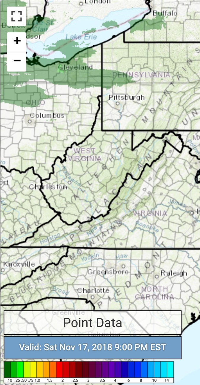
Radar with estimates 9pm-9pm.. Radar not picking up on the light low level moisture
Satellite
Flow
Surface features and 500mb height anomalies and flow


Pics today


Off the Canaan Cam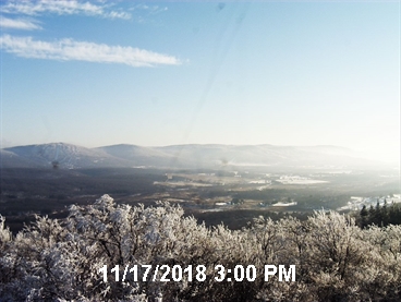
Snowshoe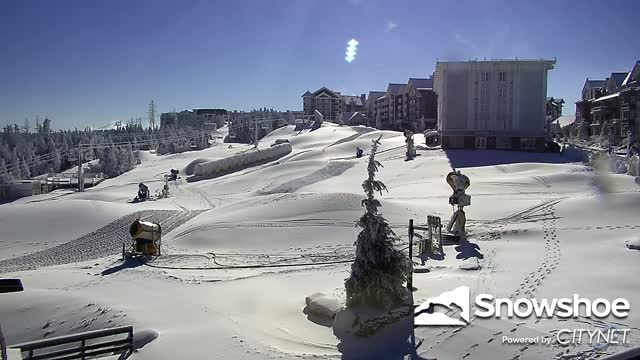
Beautiful photos by Zan Tewksbury today on Cabin Mt after the skies cleared


On the models….
Cold night ahead, followed by a milder next 2 days. Temps mid 30s to low to mid 40s holding into Tuesday morning before backsliding. This will be accompanied by some showers, changing to snow showers Tuesday. Minor if any accumulation. Then the question of, how far does the high push from the north, how long does the cold hold. As of now its looking like a chilly Wednesday and a cold Thanksgiving. If the high is stronger as the ECMWF suggest, highs 18-25, lows single digits. If it’s more progressive as the GFS suggest, highs 30s. The Canadian is in the cold camp. The ECMWF also holds just enough of a influence of the cold high for some possible ice next weekend. That’s a long ways off and highly subject to change.
12z ECMWF 2m Temperatures
12z ECMWF precip type next 240hrs
