Nov 19(Mon) min. max. avg
Bitt 2nw valley 28.4 50.2 39.3
Garrett College 40.5 49.9 45.2
Can-Heights 37.1 48.2 42.7
CRN-Canaan 37.7 48.7 43.2
Cabin Mt 36.1 44.1 40.1
Cabin Mt north 36.9 45.9 39.9
Spruce Knob 33.6 43.3 38.4
Snowshoe 35.6 45.1 40.3
Can-Valley Floor 34.2 49.8 42.0
7Springs 34.6 44.8 39.7
Cloudy start, to breaking skies, with sun into the afternoon, before clouds rolled back in and showers after dark.
Temp profile this afternoon


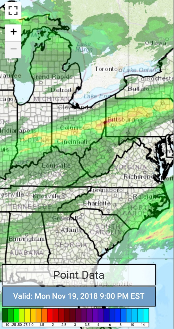
Radar with estimates 9pm-9pm
Satellite
Flow
Surface features and 500mb height anomalies and flow


Pics today


Sandhill Cranes
On the models..
Showers turning to snowshowers overnight into tomorrow. Coatings to 1 inch the rule. Isolated spots up to 2″. Falling temps tomorrow. Tomorrow afternoon through Friday looks like great snow making weather for resorts. Will Wisp try? Stay tuned. The cold high looks to rule for Thanksgiving. Outside shot, if we are calm Thanksgiving night, northern Alleghenies high valleys may make a run at 0.. Thanksgiving morning 10-15, windchills below 0. Southern Alleghenies slightly less harsh.
The cold high…does it holds or back away by the time precip arrives early Saturday a.m. The ECMWF holds it cold enough for some areas of freezing rain Saturday. Friday and Saturday may present a 20° swing from Savage Mt to Morgantown.
12z ECMWF 2m Temperatures
12z ECMWF precip type next 240hrs
California wildfire smoke
