Nov 29 (Thur) min. max. avg
Bitt 2nw valley 16.3 32.0 24.1
Garrett College 16.4 38.6 27.5
Can-Heights 11.4 33.7 22.5
CRN-Canaan 12.4 36.7 24.6
Cabin Mt 8.6 34.2 21.4
Cabin Mt north 9.9 33.3 21.4
Spruce Knob 6.8 31.6 19.2
Snowshoe 10.0 36.9 23.5
Can-Valley Floor 12.0 37.4 24.7
7Springs 14.2 36.6 25.4
Cloudy start, few fine flakes, high ground fog. This quickly eroding by mid morning for a sunny late morning, through mid afternoon period. Then clouds building, and spotty light precip after dark. Some pockets of freezing precip, mainly north.
Temp profile this afternoon


Radar
Snowfall- Picked up .1 after 6pm last night through 7am. new SD dropped to 4.5″. That’s 5.9″ event total, 14.1″ season total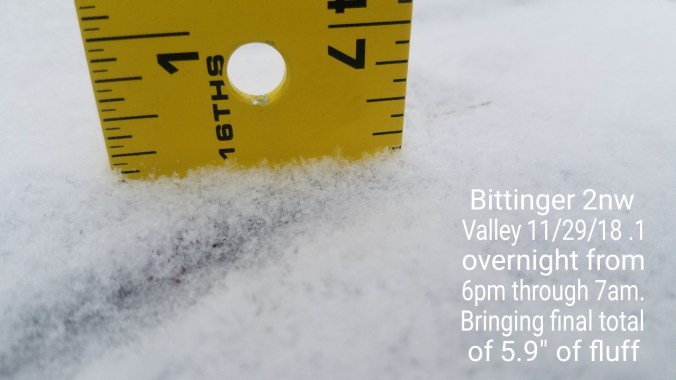
Satellite
Flow
Surface features and 500mb height anomalies and flow


Pics today


Pic by Vernon Patterson at Big Run Falls
Videos at Snowshoe and Canaan
On the models….
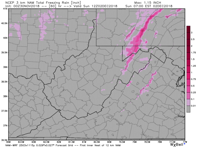
Spotty precip tonight, isolated pockets of freezing. Milder, low 40s tomorrow. Then, I have not seen any forecast remotely mention the threat of any spot seeing freezing rain Saturday. The NWS forecast for Garrett County didn’t mention temps in 30s even. I have said it before. I will live and die by the 3km Nam on this type of setup. 3km Nam is going with some light freezing rain in the same areas that got it last Saturday. Warmer Sunday, turning colder Monday, light snow threat Tuesday
0z 3km Nam 2m temperatures
A look closer at the model at 11am, 3pm and 6pm Saturday, areas +/- 32 all day


0z 3km Nam Simulated Radar
A look at the freezing rain areas on the model. Ignore amounts. This is a weak link in the model. Location, strong suit.