Nov 20(Tues) min. max. avg
Bitt 2nw valley 27.2 39.7 33.3
Garrett College 27.6 41.2 34.4
Can-Heights 24.2 38.8 31.5
CRN-Canaan 26.1 40.0 33.1
Cabin Mt 21.7 36.5 29.1
Cabin Mt north 22.1 37.2 29.6
Spruce Knob 20.8 36.0 28.4
Snowshoe 21.7 37.0 29.3
Can-Valley Floor 27.5 41.2 34.3
7Springs 23.2 35.4 29.3
Cloudy, light rain overnight changed to some light scattered snow. Some this morning. some late. Some light freezing drizzle in the evening as well. Some high ground fog.
Temp profile this afternoon


Radar with estimates. .1 liquid at Bittinger 2nw Valley. Radar doing poor for light snow . Really may discontinue showing it with snow events, especially upslope as it performs so poorly with the radar overshooting the precip.
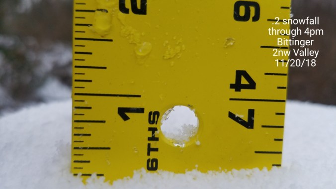
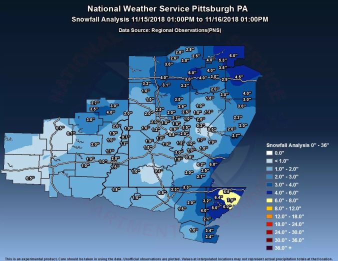
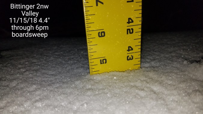
Snowfall- Picked up .2 at Bittinger 2nw Valley. 8.2″ on the season
Canaan Heights picked up .7, 7.9″ on the season
Satellite
Flow
Surface features and 500mb height anomalies and flow


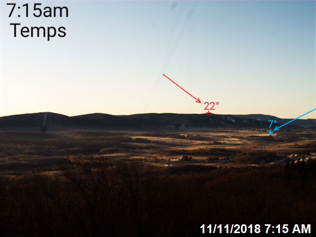
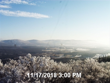
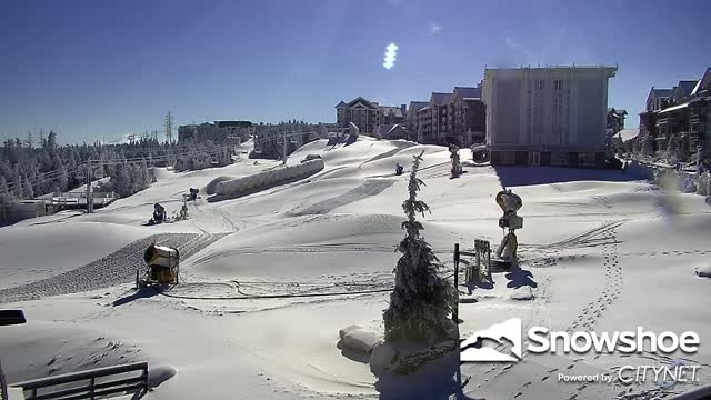
Pics today


On the models….
Colder air pressing in. Snow making weather is here. Squall line on artic boundary tomorrow may survive to the Mason Dixon line area or just south. That looks like it would occur in the evening and could quickly whiten roads if it occurs. Will update Facebook as models update tomorrow and radar. Temps into the teens from Tucker north tomorrow night, holding low to mid 20s Thanksgiving. 5-10 milder south of Tucker. Dry over Thanksgiving. Temps may make a run for 0 Thanksgiving night in the coldest high valley areas Tucker and north. Traditional cold east flow areas hold 25-30 Friday, setting up some mix Saturday a.m.
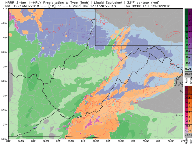
18Z HRRR simulated radar showing the potential squall like later tomorrow


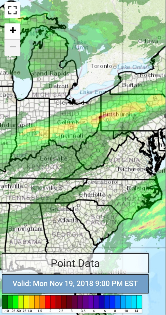


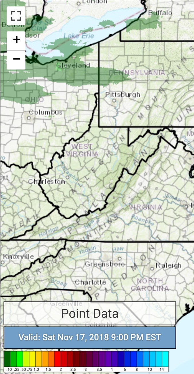


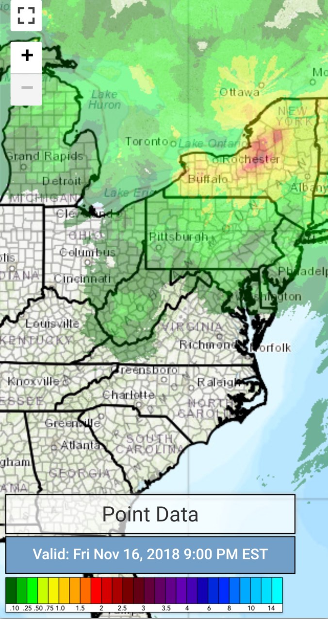


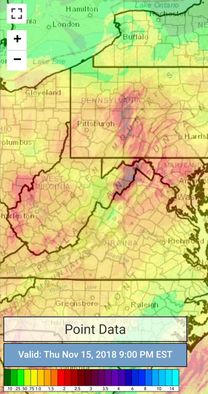


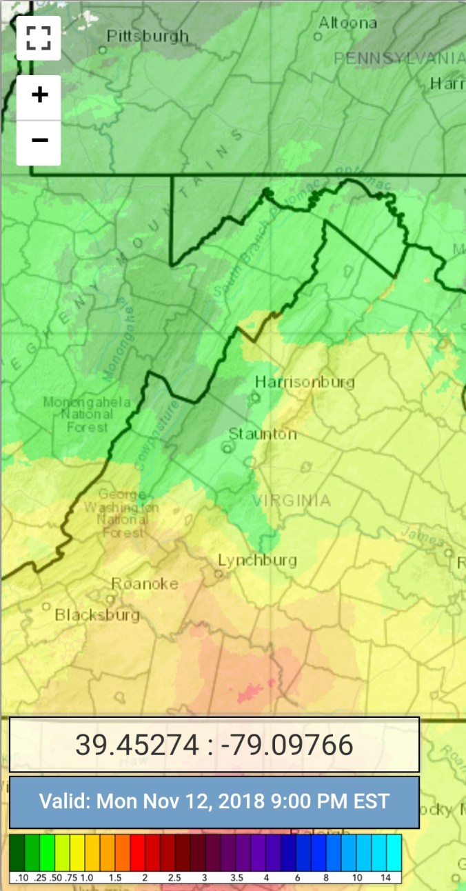
 estimates 9pm-9pm(Radar not picking up on the light Mt precip last night)