Dec 7(Fri) min. max. avg
Bitt 2nw valley 5.8 27.5 16.6
Garrett College 11.7 28.3 20.0
Can-Heights 12.8 24.4 18.6
Cabin Mt. 16.5 26.0 21.2
Cabin Mt north 15.2 22.6 18.9
Spruce Knob 13.6 20.1 16.9
Snowshoe 15.6 21.2 18.4
Can-Valley Floor -1.6 27.8 13.1
7Springs 16.6 24.8 20.7
Cloudy start, stray flurries early, turning into a partly cloudy day after the period of snow last night. Remaining cold.
Temp profile this afternoon


Radar
Snowfall- 1.3″ at Bittinger 2nw Valley overnight through 7am. Season total at 18.2″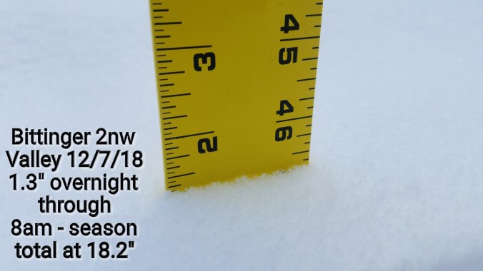
.7″ overnight at Canaan Heights. Season total 25.8″
Satellite
Flow
Surface features and 500mb height anomalies and flow


Pics today


Pics by Chip Chase at Whitegrass….get out there and ski it this weekend! 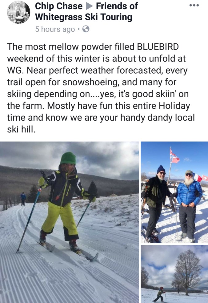
Video by Renee Morris on Cabin Mt
On the models….
With the short term storm passing by south and tranquil weather following, nothing in the short term looks terribly exciting, EXCEPT some valleys below 0 tonight. Overall the pattern looks to become more zonal, flooded with Pacific Air which will cut off any extreme cold next week, into mid month. That said, any warm surges look minimal and only based on storm track if any occurs. Temps look modified, and 20s, to low 40s range. Precip events likely of the rain to snow variety. Not any true cold storms, but any event with a favorable track could be cold enough for wet Mt. snow.
Overall the pattern begins to return more favorable as we go into the holiday stretch.
A look at the Euro weeklies
