Dec 8(Sat) min. max. avg
Bitt 2nw valley 4.9 24.0 14.4
Garrett College 11.0 24.3 17.6
Can-Heights 11.6 22.3 17.0
CRN-Canaan 14.1 22.6 18.4
Cabin Mt 9.9 21.6 15.7
Cabin Mt north 11.1 22.1 16.6
Spruce Knob 9.7 21.4 15.5
Snowshoe 12.9 26.1 19.4
Can-Valley Floor -1.6 24.6 11.5
7Springs 13.7 19.3 16.5
After a mostly clear night for the most part, that brought with it the coldest mins of the season. Just after midnight, temps then rose as light breezes kicked in area wide around 2-3am as well as a thin high cloud deck. A cold partly cloudy day, high thin cloud deck at times. The cloud deck was more dominant as you went south in the Alleghenies.
Temp profile this afternoon


Radar-void of precip
Satellite
Flow
Surface features and 500mb height anomalies and flow


Pics today


Coooold Valleys. The valley site along Timberline Rd dropped to -1.6 last night at midnight(that will give a below 0 reading for 2 days now) before a wind increase occured mixing out the coldest air with the air aloft. There is no anemometer at the Timerline site, but nearby to the north, you can see the temp and winds overnight at Garrett College.


On the models….
Short term, the southern App snow storm tonight through tomorrow. 15-24″ with pockets over that possible down there. Flakes may make it as far north as Canaan, light accumulation as far north as Pocahontas County. 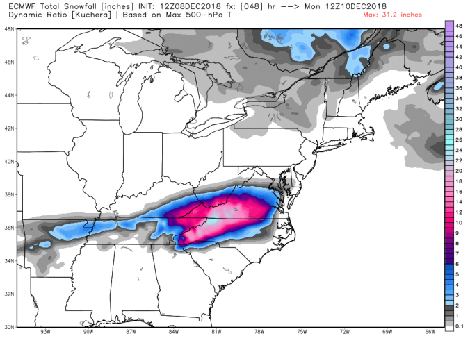 After this passes, the overall winter pattern look pretty “blah” for winter lovers leading up to the holiday season.
The pattern becomes dominated by modified Pacific Air. Lots of LP over the NE Pacific flooding in the Pacific flow and cutting off the tap into the artic air. It’s not terribly warm, its modified into the 25-45 range with most precip events drawing up mild up for wet vs white, with any white only occuring in the mountains as the system passes and winds shift N.W. 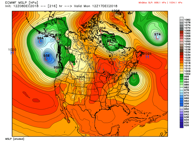
Lots of warmth in the NE Pacific. That feature becomes our best friend as we go into “real winter” and wave lengths shorten. Like back in 13-14, until then, it can leads to floods of Pacific Air across the nation and I’m surprised it took until mid December to occur. That SST setup is really a setup for a good winter. Primed for a – EPO, favorable MJO phases and a active southern jet. That cold pool 30N near the dateline, with warmth to the NE of that is a classic east cold signal. (A and B) Modiki Nino, active southern jet (C) and the cold pool in the eastern Indian Ocean, favors sinking air and convection being most active in phases 8, 1,2,3 which in winter are great for eastern cold. As the wave lengths tighten. 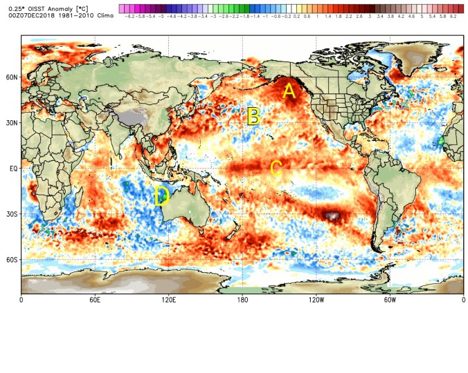 At present, +EPO, a MJO going into phase 3,4 another less than ideal sign for winter lovers over the coming period leading up to the holidays.


We can still see snow in this pattern in the Alleghenies. It’s a little more difficult, but a favorable track can lead to backside snows. Not all is lost, its just not one if you love winter you get overly excited about short term. Things look to reverse course as we go into the holiday period Christmas to New Year’s, pressures build across western Canada, EPO goes -, MJO into more favorable phases and we are back in business. The things that cause pain now, can lead to great things in the long term.
Current SST anomalies 
Previous winter SST anomalies with temp correlations
You’ll have trouble finding below anomalies at the dateline with warm NE Pacific, cold eastern Indian Ocean in a modiki Nino year giving the eastern U.S a mild winter.
