Dec 20(Thur) min. max avg
Bitt 2nw valley 21.7 41.4 31.5
Garrett College 25.9 47.2 36.5
Can-Heights 35.9 46.8 41.3
CRN-Canaan 29 48 39.5
Cabin Mt 36.0 46.1 41.0
Cabin Mt north x
Spruce Knob 36.0 42.1 39.0
Snowshoe 34.7 45.3 40.0
Can-Valley Floor 17.8 48.4 33.1
7Springs 34.0 43.7 38.8
Mainly clear start, fairly wide temp ranges overnight from valley to high ground. Clouds building in, rain in the afternoon. Temps into the 30-35 range in eastern Alleghenies. Weather Service with their grid forecast will never get this right apparently, despite it being modeled very well.
Temp profile this afternoon
Radar with estimates 9pm-9pm

Satellite
Flow
Surface features and 500mb height anomalies and flow
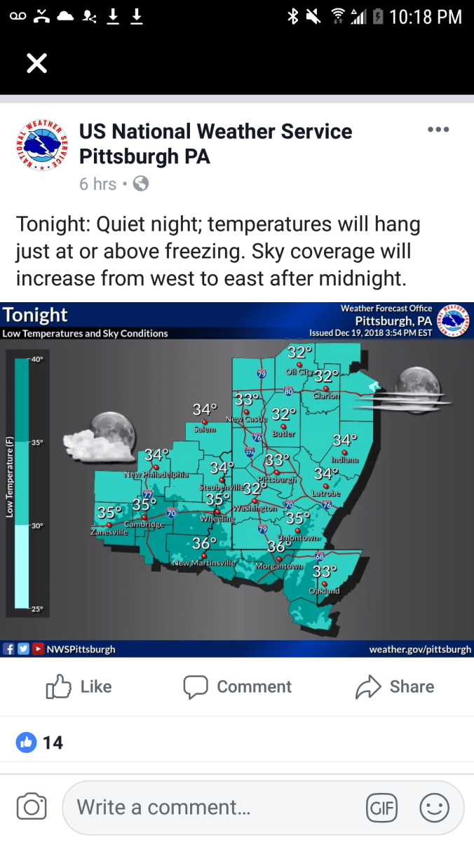
As much as I hate this, the NWS forecast grid, the repeatedly using of this grid to forecast temps in this setup is just plain awful. This is probably the 1000th time I’ve mentioned it over the years. Why on earth is this grid used, when there are high real models that do much better and have proven so, time and time again. No forecast mentioned 30s this afternoon, let alone near freezing. 3km Nam showed it clearly and the models track record in the setup is phenomenal. Let’s look… Temps, then NWS forecast beginning tonight.. You’ll see not only well off this evening, they flood the warmth back in way to fast tonight. Big consistent warm bias…
12z 3km Nam 2m temperatures from the morning
Now a look back to last night..
That was min forecast. That is airport grid based..That forecast done poor for most locations. High ground held near 36-40 most of the night. A lot of towns sit a little lower, a lot of people live in valleys, hollows, creek bottoms. Temps there ran mostly 20-27°. (Coldest pockets teens) Why would you not give a forecast for those 2 distinct areas vs a general 32° everyone near or above freezing…not even remotely near reality. The temps were off that not very long after that forecast was issued.


