Low thin clouds squeezing out every bit of moisture available with the very cold air. Windy, drifting snow. Skies clearing as the day progressed. Remaining cold.
Temp profile this afternoon
Radar
Snowfall , picked up 1.4″ from last evening through the shutoff late morning today. 45.9″ on the season . Snow depth at 8.5″ avg
Satellite
Flow
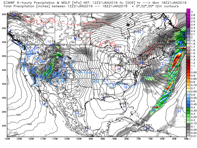
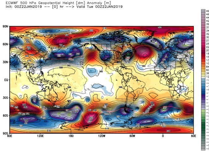
Surface features and 500mb height anomalies and flow
Cloudy, high ground fog. Snow pushing in, in the afternoon. Changed to sleet, freezing rain prior to nightfall
Temp profile this afternoon
Radar
Snowfall Picked up .2 from yesterday 3pm to today. Little of that last evening and beginning of today’s, then .9 more when snow changed to freezing rain.
Satellite
Flow
Surface features and 500mb height anomalies and flow
Cloudy, light snow, light drizzle at daybreak, temp just cracking freezing. Precip back to fine light snow at times today and plenty of fog across the high ground
Temp profile this afternoon
Radar
Snowfall-picked up 1.2″ overnight at Bittinger 2nw Valley at 6am. .2 additional by 3pm. No boardsweep at 6am with temp at 32.2, Some light snow falling, and temp getting ready to drop, I left it go so the falling snow at those temps would stick and did a boardsweep at 3pm. At 41.4″ on the season
Satellite
Flow
Surface features and 500mb height anomalies and flow
Cloudy, brief dimmed sun, very brief. First sun in days. Afternoon period of snow. Light SE winds.
Temp profile this afternoon
Radar
Snowfall- .1 at Bittinger 2nw Valley from 3pm yesterday through the overnight by 8am. 40.0″ on the season This afternoon snow will be included in the morning tally since it began shortly before evening with more to come.
Satellite
Flow
Surface features and 500mb height anomalies and flow
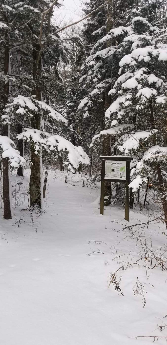
Pics today:
From the gut….
Speaking from the gut:. System moves in Saturday afternoon-Evening…I think the NWS snow map is high. Climatologically speaking, rare that these type of setup produce that much front end snow giving the warmth coming in aloft. Rare….. Do I hope I’m wrong, yes. Gladly would take their snow map….But, speaking from the gut, and it is still early, tweaks may be made, and may not. These systems often have boundaries that are so repetitive over and over. So, this may hold unless we get a big track shift south.— Snow lovers be praying. “As you may me down to sleep, when I awake please make the snow deep, amen.”
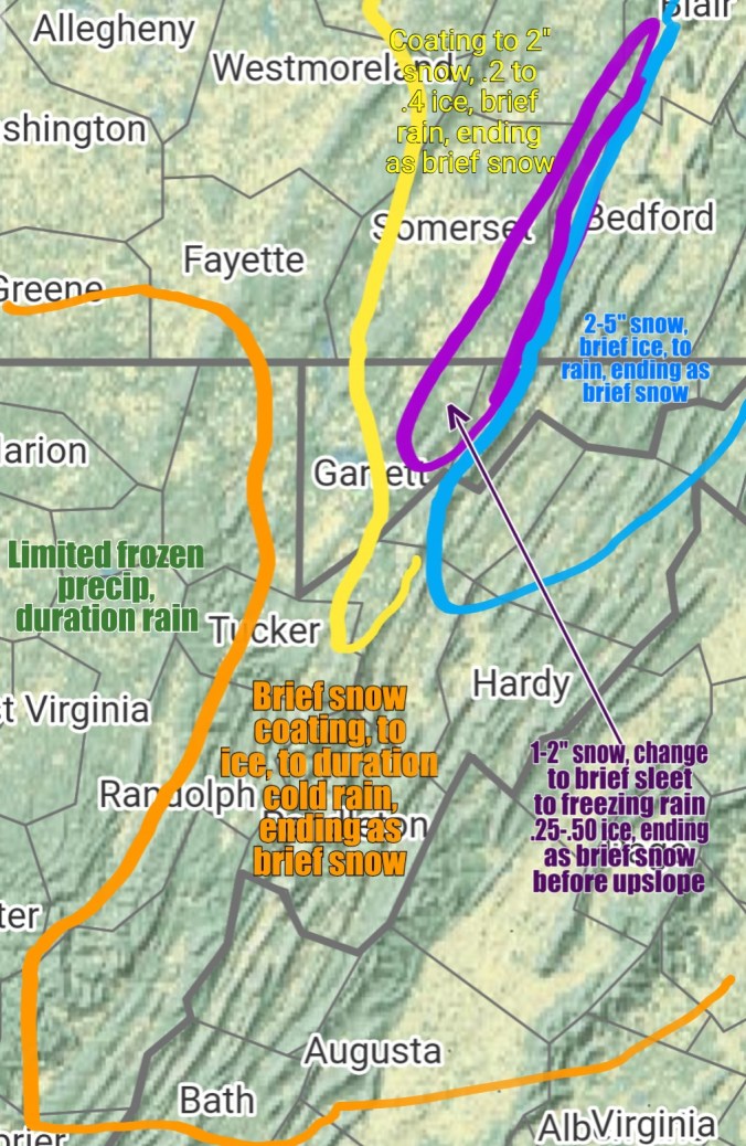
Right now, warm zone, west of the orange line. Primarily rain.
Orange zone, brief wintry precip at the onset .2-6 hours worth before plain cold miserable rain. That changes back to snow Sunday. Light accumulations. Coatings to 2″.
Yellow Zone- Brief quick snow thump, brief sleet, and a quick change then to freezing rain. Higher elevations in this zone .2-.4″ ice. Temps may creep above freezing 33-36° range before the rapid rumble Sunday. That’s a blessing if it occurs. As winds increase Sunday and Monday and if the ice remains on the trees, power issues possible. Rapid temp drop Sunday, coating to 2″ more.
Purple zone- Brief quick thump of snow, to sleet, to freezing rain. This is an area that stands a chance that it never goes +32°. Meadow Mt to Savage Mt. Elevation in this setup helps in this location helps, not hinders. Rapid temp drop Sunday and ends as brief snow coating to 2″ more.
Blue zone, Cold air at all level for longer here. Snow, a quick 2-5″ thump, brief icing, to some plain rain, I don’t think the cold stays locked in the low valleys with the Low location on this, then rapid temp drop Sunday, little if any accumulation.
Sunday night- Upslope zones. Western Alleghenies. Some upslope should form, a very high ratio, windblown snow. Maybe 30-50 to 1 ratios as temps fall -5 to +5. Maybe 1-3″/2-4″ of fluff in these areas and speaking of this seperate from the main storm. This 1-3″/2-4″ is not included in anything mentioned above. Temps from +5 to -10 Monday a.m. Coldest above 4000′ in Wv. Windchills -10 to -25 for most, -30 to -40 windchills above exposed 4000′ areas in Wv.
Be prepared….take steps to minimize issues that may occur with loss of electric, frozen water lines , etc.
Long range, the Euro weeklies are looking about as good as they can look… Really expect last several days of Jan, early Feb to go to the extreme in terms of cold and storm track is always a question.
Cloudy, high ground fog. Some extremely light freezing drizzle last night, and a touch this morning and some very fine light snow which was the moisture in the air freezing. A trace of snow fell from this. Trees all across the region are rimed up pretyy nice.
Temp profile this afternoon
Radar
Satellite (NWS call for partly sunny thos afternoon was a fail)
Flow
Surface features and 500mb height anomalies and flow
Pics today
My Facebook Ramble
Rambling thoughts on the good, bad ,ugly ahead…
-Pockets of black ice tomorrow morning, some fine light snow as well tomorrow. Light accumulations
– Thursday evening-night-Friday, Snow pushes in and I think some snows over the mountains of 2-4/3-5″ nature. Predawn hours of Friday, maybe some brief liquid mixes in with borderline temps but mainly a snow event for the high ground 2000’+north of Canaan, 3000’+ south of Canaan. East side of the mts, cold air depth is greater so you may get snow lower.
The weekend- Just sleep on Saturday, don’t look outside, wear earplugs so you don’t hear the rain on the roof. Rain looks to come in during the day, perhaps as a brief mix to start. This can change. That energy is yet off the southern California coast, and has to clear the Rockies, that the models can struggle with…. a shift of 50-100 miles on that Low position wouldn’t be unheard of. That said, models unfortunately have not budged off tracking the low into Wv, and southwest Pa. That’s dreadful. With this track somewhat “probable”, the possibility of extended icing(no Jim Odom, not the cake kind) does exist in the high ground in Garrett and high ground northeast. This setup really doesn’t trap the cold air east of the mountains like a classic CAD(cold air damming) event does. There isn’t cold air in place there and its a borderline temp event, so the northern Allegheny high ground from Garrett, Somerset look to have the best chance at ice for part of the storm before that goes to rain as well. A cold rain. “As track stands now”.
Following that into Sunday- rain to snow across the mountains, flash freeze, rapidly falling temperatures, all the way down to -5 to -15 by MONDAY a.m. The NWS tends to go to weak and adjust colder as we get closer. As this type of cold is a threat to property with water lines, maybe things need sealed up better, pets, livestock, I’d rather go to the extreme in saying what those temps can be vs waiting so those preps can be made. Snowfall after the changeover, 3-6″ of windblown fluff would be the initial call. That’s the extreme period. Monday holds bitter but begins to relax.
This is the first of multiple severe cold outbreaks. Now, the bugaboo, in the midst of these, and we experienced this in Jan 14′. Extreme cold with a poor storm track. Which initially features extreme cold and rapid mild ups before the pattern settled in. Midweek after the extreme cold, a system comes out of the South and throws what this far out looks to be another mixed event, to snow and back to the bitter cold scenario. We then look to shift the storm track more favorable in February. We had a pattern change Jan 9th, cold air is now more dominant, sure it sucks to have a storm cut west for snow lovers, but it’s at least far from a boring winter pattern ahead.
Plus factors to the extreme cold- 13/14, 14/15. Those cold extremes killed off a lot of the hemlock wooly adelgid in the area. Some areas that were infested, are yet adelgid free. Not the entire area. This extreme cold can go to great lengths to kill it back again.
– Main things, storm track sucks, extreme cold on the table, upslope snows will occur and better opportunity for snows going into Feb..
P.S- Excuse typos, typing from my phone and this autocorrect is a piece of shot and corrects the right word to the wrong one.
Cloudy, some early light snow , a lull, some afternoon light snow. Little rime early to 2750′ in Garrett.
Temp profile this afternoon
Radar
Snowfall – Through 7am picked up 4.4″ at Bittinger 2nw Valley, SD of 7.2″, with .7″ additional through the day for a event total of 5.1″ and season to date to 39.5″
Satellite
Flow
Surface features and 500mb height anomalies and flow
Pics today
B-52 Crash on Savage Mt. Buzz One Trailer
On the models…
Potential exist for a major winter storm next weekend. A lot needs to go right for this to occur. Models currently look good(for snow lovers) but bounce run to run